
12.7: Bent-Back Fronts and Sting Jets
- Page ID
- 10217

Fronts are intimately tied to mid-latitude cyclones. One approximation of this connection is called the Norwegian cyclone model, where the cold and warm fronts intersect (Figs. 12.30a & 12.31a) or where they pivot around a common low-pressure center (Fig. 12.1). The next chapter discussed extratropical cyclones in more detail.
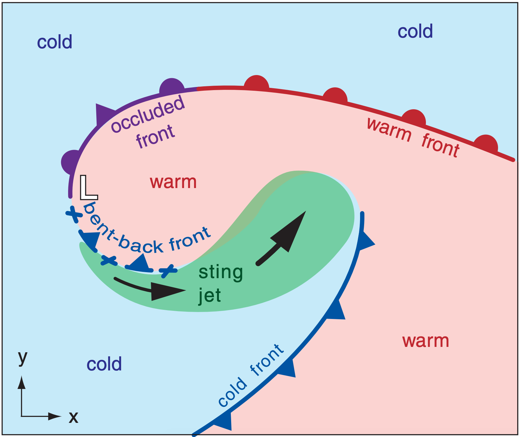
Another model, which has been found to describe some marine cyclones, is called the Shapiro-Keyser cyclone model (Fig. 12.33). In this model, the cold front is roughly perpendicular to, but does not intersect, the warm front.
Sometimes the warm/occluded front wraps around the low-center. The result is a bent-back front (Fig. 12.33) equatorward of the low. This portion of the front has cold air advancing poleward, and is identified as a weakening cold front.
Near the end of some bent-back fronts is a curved region of fast mid-tropospheric air that descends to the Earth’s surface causing a destructive windstorm called a sting jet. Its name is motivated by the curved poisonous tail (stinger) of a scorpion.