
25.3: The roots of the mountains
- Page ID
- 22795

Since the Taconian mountain range itself is long gone, we can consider the orogeny from two different perspectives: (1) that of the eroded roots of the mountains, and (2) that of the sedimentary basins “next door,” which received sloughed-off sediment eroded from the mountains.
Let’s first examine the roots of the mountains, which can be found in the Piedmont geologic province of Virginia, Maryland, Washington, D.C., Pennsylvania, New Jersey, and New York, as well as assorted provinces in New England [TKTKTKTK]. The rocks in question are the crushed, cooked remains of the Iapetus Ocean and the Taconian volcanic island arc.
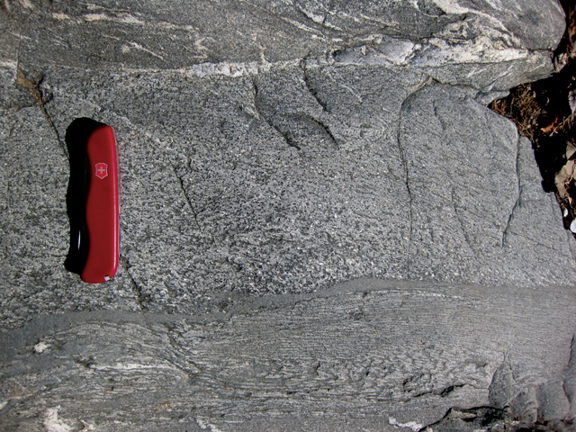
The rocks of the Piedmont have been metamorphosed to various degrees, from greenschist facies all the way up to partial melting. Their protoliths range from basalt and gabbro (oceanic crust) to mudstone, graywacke, and limestone (oceanic sediments), as well as the volcanic rocks of the volcanic island arc (both intrusive and extrusive, both mafic and felsic). In some cases, the subsequent metamorphic recrystallization had a light enough touch that primary structures are still preserved, both volcanic and sedimentary. Graded beds in meta-graywacke of the Mather Gorge Formation are a nice example of a primary sedimentary structure that speaks specifically of oceanic processes. These graded beds formed from deep submarine deposition of clastic sediment by turbidity currents in the Iapetus Ocean.
We can estimate the timing of the Taconian Orogeny by looking at metamorphic ages for these rocks (K/Ar, Ar/Ar, and Rb/Sr methods), as well as crystallization ages for the migmatites produced by partial melting (U/Pb). In both cases, the answer returned is ~460 Ma, a late Ordovician age. The Piedmont is also home to many plutons of felsic igneous rock like the Occoquan Granite, the Georgetown Intrusive Suite, and the Kensington Tonalite, and these all also yield isotopic ages in the 474 to 450 Ma range.
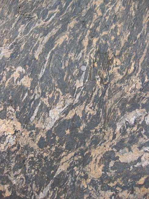
Explore this gigapixel panorama of a sample of migmatite from Orange County, Virginia, and search for pockets of speckled granite. These “leucosomes” represent the formerly-molten portion of this rock, which is otherwise a schist. Similar partial melting is occurring today beneath active modern mountain belts such as the Himalayas.
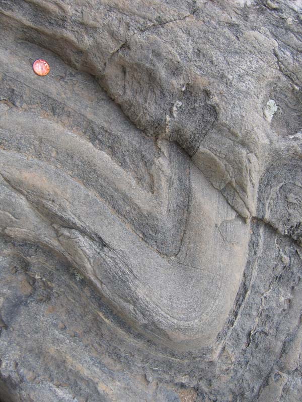
Deformation was another major signature of mountain-building in the Piedmont region. Primary structures were distorted by folds and disrupted by faults as the Taconian volcanic island arc docked with ancestral North America, compressing the Iapetan sediments caught in between.
In New England, Iapetus seafloor rocks including both oceanic lithosphere and overlying deepwater sedimentary deposits moved upward onto continental rocks, and westward for close to 5o km of distance. A major thrust fault allowed this relative motion. Today the trace of this fault is called “Cameron’s line,” after the geologist who first described it. Isolated klippen of the overthrust rocks remain in the eponymous region of the Taconic Mountains, but the trace of the fault also runs through New England and even through downtown New York City.
Did I Get It? - Quiz
Isotopic dating of metamorphic minerals and igneous plutons indicate that the Taconian Orogeny happened when?
a. ~200 Ma
b. ~1.2 Ga
c. ~460 Ma
d. ~840 Ma
e. ~500 Ma
f. ~330 Ma
- Answer
-
c. ~460 Ma
Pre-Taconian rocks that were heated up sufficiently to partially melt made __________.
a. limestone strata, including the microbial mat fossils called stromatolites
b. mafic lava flows called basalts, featuring cooling columns
c. granitic magma, which is preserved in small pockets in the rocks called migmatites
- Answer
-
c. granitic magma, which is preserved in small pockets in the rocks called migmatites
A signature of compressional forces that operated in the Taconian mountain belt is: ___________.
a. graded bedding
b. immature sedimentary deposits
c. granite
d. folding
- Answer
-
d. folding