
3: Crustal Deformation and Earthquakes
- Page ID
- 11206

\( \newcommand{\vecs}[1]{\overset { \scriptstyle \rightharpoonup} {\mathbf{#1}} } \)
\( \newcommand{\vecd}[1]{\overset{-\!-\!\rightharpoonup}{\vphantom{a}\smash {#1}}} \)
\( \newcommand{\dsum}{\displaystyle\sum\limits} \)
\( \newcommand{\dint}{\displaystyle\int\limits} \)
\( \newcommand{\dlim}{\displaystyle\lim\limits} \)
\( \newcommand{\id}{\mathrm{id}}\) \( \newcommand{\Span}{\mathrm{span}}\)
( \newcommand{\kernel}{\mathrm{null}\,}\) \( \newcommand{\range}{\mathrm{range}\,}\)
\( \newcommand{\RealPart}{\mathrm{Re}}\) \( \newcommand{\ImaginaryPart}{\mathrm{Im}}\)
\( \newcommand{\Argument}{\mathrm{Arg}}\) \( \newcommand{\norm}[1]{\| #1 \|}\)
\( \newcommand{\inner}[2]{\langle #1, #2 \rangle}\)
\( \newcommand{\Span}{\mathrm{span}}\)
\( \newcommand{\id}{\mathrm{id}}\)
\( \newcommand{\Span}{\mathrm{span}}\)
\( \newcommand{\kernel}{\mathrm{null}\,}\)
\( \newcommand{\range}{\mathrm{range}\,}\)
\( \newcommand{\RealPart}{\mathrm{Re}}\)
\( \newcommand{\ImaginaryPart}{\mathrm{Im}}\)
\( \newcommand{\Argument}{\mathrm{Arg}}\)
\( \newcommand{\norm}[1]{\| #1 \|}\)
\( \newcommand{\inner}[2]{\langle #1, #2 \rangle}\)
\( \newcommand{\Span}{\mathrm{span}}\) \( \newcommand{\AA}{\unicode[.8,0]{x212B}}\)
\( \newcommand{\vectorA}[1]{\vec{#1}} % arrow\)
\( \newcommand{\vectorAt}[1]{\vec{\text{#1}}} % arrow\)
\( \newcommand{\vectorB}[1]{\overset { \scriptstyle \rightharpoonup} {\mathbf{#1}} } \)
\( \newcommand{\vectorC}[1]{\textbf{#1}} \)
\( \newcommand{\vectorD}[1]{\overrightarrow{#1}} \)
\( \newcommand{\vectorDt}[1]{\overrightarrow{\text{#1}}} \)
\( \newcommand{\vectE}[1]{\overset{-\!-\!\rightharpoonup}{\vphantom{a}\smash{\mathbf {#1}}}} \)
\( \newcommand{\vecs}[1]{\overset { \scriptstyle \rightharpoonup} {\mathbf{#1}} } \)
\(\newcommand{\longvect}{\overrightarrow}\)
\( \newcommand{\vecd}[1]{\overset{-\!-\!\rightharpoonup}{\vphantom{a}\smash {#1}}} \)
\(\newcommand{\avec}{\mathbf a}\) \(\newcommand{\bvec}{\mathbf b}\) \(\newcommand{\cvec}{\mathbf c}\) \(\newcommand{\dvec}{\mathbf d}\) \(\newcommand{\dtil}{\widetilde{\mathbf d}}\) \(\newcommand{\evec}{\mathbf e}\) \(\newcommand{\fvec}{\mathbf f}\) \(\newcommand{\nvec}{\mathbf n}\) \(\newcommand{\pvec}{\mathbf p}\) \(\newcommand{\qvec}{\mathbf q}\) \(\newcommand{\svec}{\mathbf s}\) \(\newcommand{\tvec}{\mathbf t}\) \(\newcommand{\uvec}{\mathbf u}\) \(\newcommand{\vvec}{\mathbf v}\) \(\newcommand{\wvec}{\mathbf w}\) \(\newcommand{\xvec}{\mathbf x}\) \(\newcommand{\yvec}{\mathbf y}\) \(\newcommand{\zvec}{\mathbf z}\) \(\newcommand{\rvec}{\mathbf r}\) \(\newcommand{\mvec}{\mathbf m}\) \(\newcommand{\zerovec}{\mathbf 0}\) \(\newcommand{\onevec}{\mathbf 1}\) \(\newcommand{\real}{\mathbb R}\) \(\newcommand{\twovec}[2]{\left[\begin{array}{r}#1 \\ #2 \end{array}\right]}\) \(\newcommand{\ctwovec}[2]{\left[\begin{array}{c}#1 \\ #2 \end{array}\right]}\) \(\newcommand{\threevec}[3]{\left[\begin{array}{r}#1 \\ #2 \\ #3 \end{array}\right]}\) \(\newcommand{\cthreevec}[3]{\left[\begin{array}{c}#1 \\ #2 \\ #3 \end{array}\right]}\) \(\newcommand{\fourvec}[4]{\left[\begin{array}{r}#1 \\ #2 \\ #3 \\ #4 \end{array}\right]}\) \(\newcommand{\cfourvec}[4]{\left[\begin{array}{c}#1 \\ #2 \\ #3 \\ #4 \end{array}\right]}\) \(\newcommand{\fivevec}[5]{\left[\begin{array}{r}#1 \\ #2 \\ #3 \\ #4 \\ #5 \\ \end{array}\right]}\) \(\newcommand{\cfivevec}[5]{\left[\begin{array}{c}#1 \\ #2 \\ #3 \\ #4 \\ #5 \\ \end{array}\right]}\) \(\newcommand{\mattwo}[4]{\left[\begin{array}{rr}#1 \amp #2 \\ #3 \amp #4 \\ \end{array}\right]}\) \(\newcommand{\laspan}[1]{\text{Span}\{#1\}}\) \(\newcommand{\bcal}{\cal B}\) \(\newcommand{\ccal}{\cal C}\) \(\newcommand{\scal}{\cal S}\) \(\newcommand{\wcal}{\cal W}\) \(\newcommand{\ecal}{\cal E}\) \(\newcommand{\coords}[2]{\left\{#1\right\}_{#2}}\) \(\newcommand{\gray}[1]{\color{gray}{#1}}\) \(\newcommand{\lgray}[1]{\color{lightgray}{#1}}\) \(\newcommand{\rank}{\operatorname{rank}}\) \(\newcommand{\row}{\text{Row}}\) \(\newcommand{\col}{\text{Col}}\) \(\renewcommand{\row}{\text{Row}}\) \(\newcommand{\nul}{\text{Nul}}\) \(\newcommand{\var}{\text{Var}}\) \(\newcommand{\corr}{\text{corr}}\) \(\newcommand{\len}[1]{\left|#1\right|}\) \(\newcommand{\bbar}{\overline{\bvec}}\) \(\newcommand{\bhat}{\widehat{\bvec}}\) \(\newcommand{\bperp}{\bvec^\perp}\) \(\newcommand{\xhat}{\widehat{\xvec}}\) \(\newcommand{\vhat}{\widehat{\vvec}}\) \(\newcommand{\uhat}{\widehat{\uvec}}\) \(\newcommand{\what}{\widehat{\wvec}}\) \(\newcommand{\Sighat}{\widehat{\Sigma}}\) \(\newcommand{\lt}{<}\) \(\newcommand{\gt}{>}\) \(\newcommand{\amp}{&}\) \(\definecolor{fillinmathshade}{gray}{0.9}\)Learning Objectives
- Differentiate between stress and strain
- Identify the three major types of stress
- Differentiate between brittle, ductile, and elastic deformation
- Describe the geological map symbol used for strike and dip of strata
- Name and describe different fold types
- Differentiate the three major fault types and describe their associated movements
- Explain how elastic rebound relates to earthquakes
- Describe different seismic wave types and how they are measured
- Explain how humans can induce seismicity
- Describe how seismographs work to record earthquake waves
- From seismograph records, locate the epicenter of an earthquake
- Explain the difference between earthquake magnitude and intensity
- List earthquake factors that determine ground shaking and destruction
- Identify secondary earthquake hazards
- Describe notable historical earthquakes
Crustal deformation occurs when applied forces exceed the internal strength of rocks, physically changing their shapes. These forces are called stress, and the physical changes they create are called strain. Forces involved in tectonic processes as well as gravity and igneous pluton emplacement produce strains in rocks that include folds, fractures, and faults. When rock experiences large amounts of shear stress and breaks with rapid, brittle deformation, energy is released in the form of seismic waves, commonly known as an earthquake.
- 3.1: Stress and Strain
- Stress is the force exerted per unit area and strain is the physical change that results in response to that force. When the applied stress is greater than the internal strength of rock, strain results in the form of deformation of the rock caused by the stress. Strain in rocks can be represented as a change in rock volume and/or rock shape, as well as fracturing the rock. There are three types of stress: tensional, compressional, and shear.
- 3.2: Deformation
- When rocks are stressed, the resulting strain can be elastic, ductile, or brittle. This change is generally called deformation. Elastic deformation is a strain that is reversible after the stress is released. For example, when you stretch a rubber band, it elastically returns to its original shape after you release it. The type of deformation a rock undergoes depends on pore pressure, strain rate, rock strength, temperature, stress intensity, time, and confining pressure.
- 3.3: Geological Maps
- Geologic maps are two dimensional (2D) representations of geologic formations and structures at the Earth’s surface, including formations, faults, folds, inclined strata, and rock types. Formations are recognizable rock units. Geologists use geologic maps to represent where geologic formations, faults, folds, and inclined rock units are. Geologic formations are recognizable, mappable rock units.
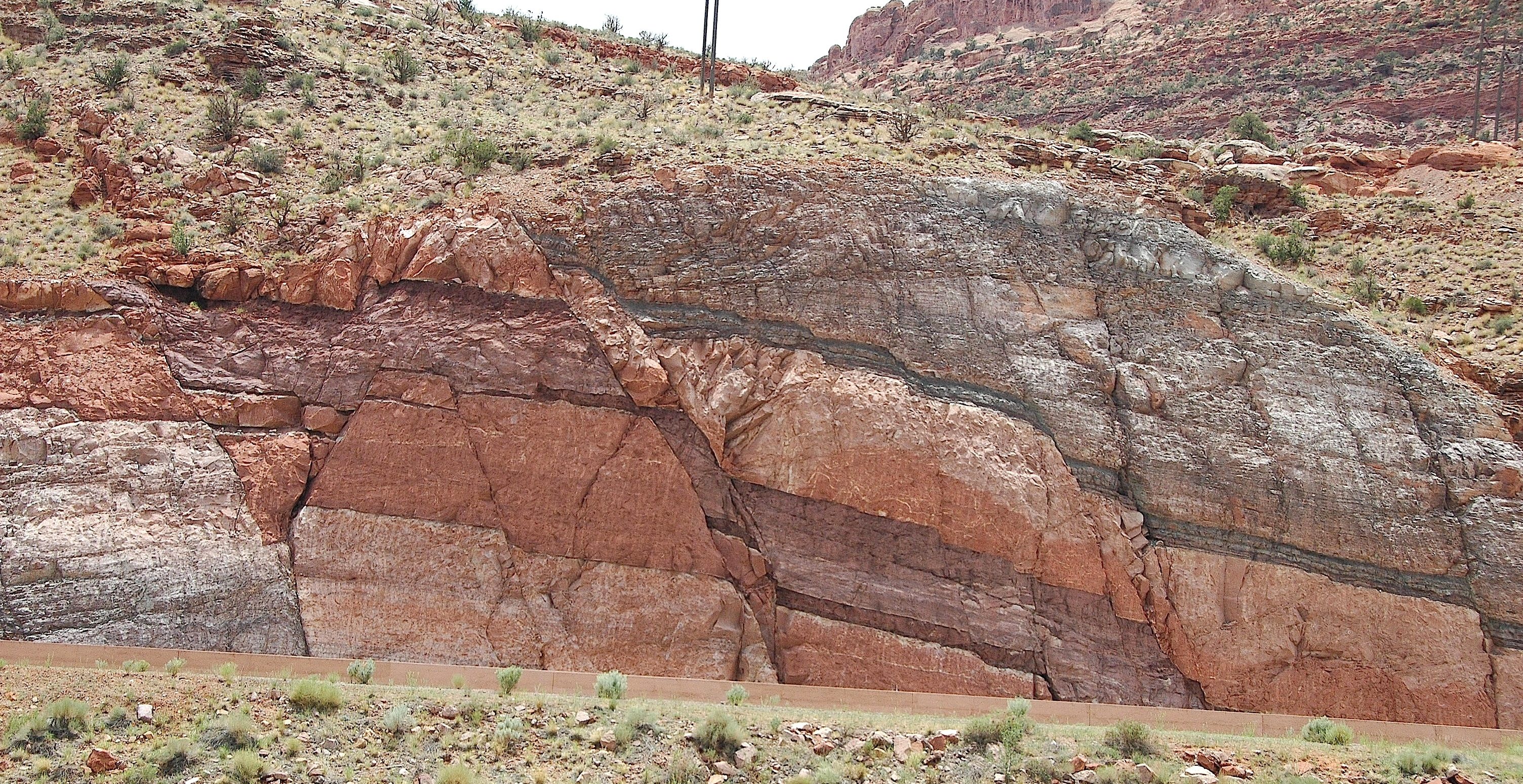
- 3.4: Folds
- Geologic folds are layers of rock that are curved or bent by ductile deformation. Folds are most commonly formed by compressional forces at depth, where hotter temperatures and higher confining pressures allow ductile deformation to occur. Folds are described by the orientation of their axes, axial planes, and limbs. There are many types of folds, including symmetrical folds, asymmetrical folds, overturned folds, recumbent folds, and plunging folds.
- 3.5: Faults
- Faults are the places in the crust where brittle deformation occurs as two blocks of rocks move relative to one another. Normal and reverse faults display vertical, also known as dip-slip, motion. Dip-slip motion consists of relative up-and-down movement along a dipping fault between two blocks, the hanging wall, and footwall. In a dip-slip system, the footwall is below the fault plane and the hanging wall is above the fault plane.
- 3.6: Earthquake Essentials
- Earthquakes are felt at the surface of the Earth when energy is released by blocks of rock sliding past each other, i.e. faulting has occurred. Seismic energy thus released travels through the Earth in the form of seismic waves. Most earthquakes occur along active plate boundaries. Intraplate earthquakes (not along plate boundaries) occur and are still poorly understood. The USGS Earthquakes Hazards Program has a real-time map showing the most recent earthquakes.
- 3.7: Measuring Earthquakes
- People feel approximately 1 million earthquakes a year, usually when they are close to the source and the earthquake registers at least moment magnitude 2.5. Major earthquakes of moment magnitude 7.0 and higher are extremely rare. The U. S. Geological Survey (USGS) Earthquakes Hazards Program real-time map shows the location and magnitude of recent earthquakes around the world.
- 3.8: Earthquake Risk
- Earthquake magnitude is an absolute value that measures pure energy release. Intensity, however, i.e. how much the ground shakes, is determined by several factors. In general, the larger the magnitude, the stronger the shaking and the longer the shaking will last. Shaking is more severe closer to the epicenter. The severity of shaking is influenced by the location of the observer relative to the epicenter, the direction of rupture propagation, and the path of greatest rupture.
- 3.9: Case Studies
- This section contains multiple case studies of major earthquakes in North America as well as historically important earthquakes in the whole world.
Thumbnail: Epicenter of the 2010 Chile earthquake with a collapsed building in Concepción. Image used with permission (CC-SA-BY; Claudio Núñez).
Summary
Geologic stress, applied force, comes in three types: tension, shear, and compression. Strain is produced by stress and produces three types of deformation: elastic, ductile, and brittle. Geological maps are two-dimensional representations of surface formations which are the surface expression of three-dimensional geologic structures in the subsurface. The map symbol called strike and dip or rock attitude indicates the orientation of rock strata with reference to north-south and horizontal. Folded rock layers are categorized by the orientation of their limbs, fold axes and axial planes. Faults result when stress forces exceed rock integrity and friction, leading to brittle deformation and breakage. The three major fault types are described by the movement of their fault blocks: normal, strike-slip, and reverse.
Earthquakes, or seismic activity, are caused by sudden brittle deformation accompanied by elastic rebound. The release of energy from an earthquake focus is generated as seismic waves. P and S waves travel through the Earth’s interior. When they strike the outer crust, they create surface waves. Human activities, such as mining and nuclear detonations, can also cause seismic activity. Seismographs measure the energy released by an earthquake using a logarithmic scale of magnitude units; the Moment Magnitude Scale has replaced the original Richter Scale. Earthquake intensity is the perceived effects of ground shaking and physical damage. The location of earthquake foci is determined from triangulation readings from multiple seismographs.
Earthquake rays passing through rocks of the Earth’s interior and measured at the seismographs of the worldwide Seismic Network allow 3-D imaging of buried rock masses as seismic tomographs.
Earthquakes are associated with plate tectonics. They usually occur around the active plate boundaries, including zones of subduction, collision, and transform and divergent boundaries. Areas of intraplate earthquakes also occur. The damage caused by earthquakes depends on a number of factors, including magnitude, location and direction, local conditions, building materials, intensity and duration, and resonance. In addition to damage directly caused by ground shaking, secondary earthquake hazards include liquefaction, tsunamis, landslides, seiches, and elevation changes.