
17.2: Clouds, Fog and Precipitation
- Page ID
- 32276

\( \newcommand{\vecs}[1]{\overset { \scriptstyle \rightharpoonup} {\mathbf{#1}} } \)
\( \newcommand{\vecd}[1]{\overset{-\!-\!\rightharpoonup}{\vphantom{a}\smash {#1}}} \)
\( \newcommand{\dsum}{\displaystyle\sum\limits} \)
\( \newcommand{\dint}{\displaystyle\int\limits} \)
\( \newcommand{\dlim}{\displaystyle\lim\limits} \)
\( \newcommand{\id}{\mathrm{id}}\) \( \newcommand{\Span}{\mathrm{span}}\)
( \newcommand{\kernel}{\mathrm{null}\,}\) \( \newcommand{\range}{\mathrm{range}\,}\)
\( \newcommand{\RealPart}{\mathrm{Re}}\) \( \newcommand{\ImaginaryPart}{\mathrm{Im}}\)
\( \newcommand{\Argument}{\mathrm{Arg}}\) \( \newcommand{\norm}[1]{\| #1 \|}\)
\( \newcommand{\inner}[2]{\langle #1, #2 \rangle}\)
\( \newcommand{\Span}{\mathrm{span}}\)
\( \newcommand{\id}{\mathrm{id}}\)
\( \newcommand{\Span}{\mathrm{span}}\)
\( \newcommand{\kernel}{\mathrm{null}\,}\)
\( \newcommand{\range}{\mathrm{range}\,}\)
\( \newcommand{\RealPart}{\mathrm{Re}}\)
\( \newcommand{\ImaginaryPart}{\mathrm{Im}}\)
\( \newcommand{\Argument}{\mathrm{Arg}}\)
\( \newcommand{\norm}[1]{\| #1 \|}\)
\( \newcommand{\inner}[2]{\langle #1, #2 \rangle}\)
\( \newcommand{\Span}{\mathrm{span}}\) \( \newcommand{\AA}{\unicode[.8,0]{x212B}}\)
\( \newcommand{\vectorA}[1]{\vec{#1}} % arrow\)
\( \newcommand{\vectorAt}[1]{\vec{\text{#1}}} % arrow\)
\( \newcommand{\vectorB}[1]{\overset { \scriptstyle \rightharpoonup} {\mathbf{#1}} } \)
\( \newcommand{\vectorC}[1]{\textbf{#1}} \)
\( \newcommand{\vectorD}[1]{\overrightarrow{#1}} \)
\( \newcommand{\vectorDt}[1]{\overrightarrow{\text{#1}}} \)
\( \newcommand{\vectE}[1]{\overset{-\!-\!\rightharpoonup}{\vphantom{a}\smash{\mathbf {#1}}}} \)
\( \newcommand{\vecs}[1]{\overset { \scriptstyle \rightharpoonup} {\mathbf{#1}} } \)
\(\newcommand{\longvect}{\overrightarrow}\)
\( \newcommand{\vecd}[1]{\overset{-\!-\!\rightharpoonup}{\vphantom{a}\smash {#1}}} \)
\(\newcommand{\avec}{\mathbf a}\) \(\newcommand{\bvec}{\mathbf b}\) \(\newcommand{\cvec}{\mathbf c}\) \(\newcommand{\dvec}{\mathbf d}\) \(\newcommand{\dtil}{\widetilde{\mathbf d}}\) \(\newcommand{\evec}{\mathbf e}\) \(\newcommand{\fvec}{\mathbf f}\) \(\newcommand{\nvec}{\mathbf n}\) \(\newcommand{\pvec}{\mathbf p}\) \(\newcommand{\qvec}{\mathbf q}\) \(\newcommand{\svec}{\mathbf s}\) \(\newcommand{\tvec}{\mathbf t}\) \(\newcommand{\uvec}{\mathbf u}\) \(\newcommand{\vvec}{\mathbf v}\) \(\newcommand{\wvec}{\mathbf w}\) \(\newcommand{\xvec}{\mathbf x}\) \(\newcommand{\yvec}{\mathbf y}\) \(\newcommand{\zvec}{\mathbf z}\) \(\newcommand{\rvec}{\mathbf r}\) \(\newcommand{\mvec}{\mathbf m}\) \(\newcommand{\zerovec}{\mathbf 0}\) \(\newcommand{\onevec}{\mathbf 1}\) \(\newcommand{\real}{\mathbb R}\) \(\newcommand{\twovec}[2]{\left[\begin{array}{r}#1 \\ #2 \end{array}\right]}\) \(\newcommand{\ctwovec}[2]{\left[\begin{array}{c}#1 \\ #2 \end{array}\right]}\) \(\newcommand{\threevec}[3]{\left[\begin{array}{r}#1 \\ #2 \\ #3 \end{array}\right]}\) \(\newcommand{\cthreevec}[3]{\left[\begin{array}{c}#1 \\ #2 \\ #3 \end{array}\right]}\) \(\newcommand{\fourvec}[4]{\left[\begin{array}{r}#1 \\ #2 \\ #3 \\ #4 \end{array}\right]}\) \(\newcommand{\cfourvec}[4]{\left[\begin{array}{c}#1 \\ #2 \\ #3 \\ #4 \end{array}\right]}\) \(\newcommand{\fivevec}[5]{\left[\begin{array}{r}#1 \\ #2 \\ #3 \\ #4 \\ #5 \\ \end{array}\right]}\) \(\newcommand{\cfivevec}[5]{\left[\begin{array}{c}#1 \\ #2 \\ #3 \\ #4 \\ #5 \\ \end{array}\right]}\) \(\newcommand{\mattwo}[4]{\left[\begin{array}{rr}#1 \amp #2 \\ #3 \amp #4 \\ \end{array}\right]}\) \(\newcommand{\laspan}[1]{\text{Span}\{#1\}}\) \(\newcommand{\bcal}{\cal B}\) \(\newcommand{\ccal}{\cal C}\) \(\newcommand{\scal}{\cal S}\) \(\newcommand{\wcal}{\cal W}\) \(\newcommand{\ecal}{\cal E}\) \(\newcommand{\coords}[2]{\left\{#1\right\}_{#2}}\) \(\newcommand{\gray}[1]{\color{gray}{#1}}\) \(\newcommand{\lgray}[1]{\color{lightgray}{#1}}\) \(\newcommand{\rank}{\operatorname{rank}}\) \(\newcommand{\row}{\text{Row}}\) \(\newcommand{\col}{\text{Col}}\) \(\renewcommand{\row}{\text{Row}}\) \(\newcommand{\nul}{\text{Nul}}\) \(\newcommand{\var}{\text{Var}}\) \(\newcommand{\corr}{\text{corr}}\) \(\newcommand{\len}[1]{\left|#1\right|}\) \(\newcommand{\bbar}{\overline{\bvec}}\) \(\newcommand{\bhat}{\widehat{\bvec}}\) \(\newcommand{\bperp}{\bvec^\perp}\) \(\newcommand{\xhat}{\widehat{\xvec}}\) \(\newcommand{\vhat}{\widehat{\vvec}}\) \(\newcommand{\uhat}{\widehat{\uvec}}\) \(\newcommand{\what}{\widehat{\wvec}}\) \(\newcommand{\Sighat}{\widehat{\Sigma}}\) \(\newcommand{\lt}{<}\) \(\newcommand{\gt}{>}\) \(\newcommand{\amp}{&}\) \(\definecolor{fillinmathshade}{gray}{0.9}\)Clouds
Clouds form by the condensation of water into extremely small droplets of liquid or ice. Clouds have a big influence on weather by preventing solar radiation from reaching the ground, absorbing warmth that is re-emitted from the ground, and as the source of precipitation. When there are no clouds, there is less insulation. As a result, cloudless days can be extremely hot, and cloudless nights can be very cold. For this reason, cloudy days tend to have a lower range of temperatures than clear days.

There are a variety of conditions needed for clouds to form. First, clouds form when air reaches its dew point. This can happen in two ways:
- Air temperature stays the same but humidity increases. This is common in locations that are warm and humid.
- Humidity can remain the same, but temperature decreases. When the air cools enough to reach 100% humidity, water droplets form. The air cools when it comes into contact with a cold surface or when it rises.
To have cloud formation, the air must be unstable. Stable air means air does not want to rise, cool, and condense. Thus, weather conditions tend to be clear skies with stable air. Unstable air means the air wants to rise, cool, and condense into clouds and potential storms. Rising air creates clouds when it has been warmed at or near the ground level and then is pushed up over a mountain or is thrust over a mass of cold, dense air. Water vapor is not visible unless it condenses to become a cloud. Water vapor condenses around a nucleus, such as dust, smoke, or a salt crystal. This forms a tiny liquid droplet. Billions of these water droplets together make a cloud.
Clouds are classified in several ways. The most common classification used today divides clouds into three separate cloud groups which are determined by their altitude and if precipitation is occurring or not. If they take on a layered appearance they are strati-form. If they show vertical development they are cumulo-form. To indicate they are precipitating, meteorologists apply the prefix nimbo- or suffix -nimbus to their name.
Low-level clouds are nearly all water droplets. Stratus, stratocumulus, and nimbostratus clouds are common low-level clouds. Stratus clouds appear as a uniform dark-gray layer of clouds covering the entire sky. Stratus clouds often form along warm fronts and can give way to nimbostratus as the front approaches your location. Stratus clouds may also form by the lifting of a fog bank. Stratocumulus clouds appear as lumpy, low lying clouds that cover much of the sky. They form patches or rows of clouds with some blue sky between the individual cloud units. Nimbostratus clouds are thick and dark clouds that produce precipitation. Cumulus clouds appear as small, cotton ball-like clouds that generally form by convection and exhibit vertical development. They are often flat at the bottom, where the condensation level is. Cumulus clouds are also called "fair-weather" clouds as pleasant conditions usually prevail while they are around. Cumulonimbus clouds have their bases at low altitudes and their tops at high or middle altitudes. Clouds grow vertically when strong unstable air currents are rising upward.
Middle-level clouds have the prefix 'alto-' attached to their name. They include altocumulus and altostratus clouds, and may be made of water droplets, ice crystals or both, depending on the air temperatures. Altocumulus clouds form as large masses in patches or rows that may or may not merge with one another. Individual clouds usually have a sharp outline as they are composed of water and not ice. Thick and broad altostratus clouds are gray or blue-gray. They often cover the entire sky and usually mean a large storm, bearing a lot of precipitation, is coming.
High-level clouds form from ice crystals where the air is extremely cold and can hold little water vapor. Cirrus, cirrostratus, and cirrocumulus are all names of high clouds. Cirrus clouds appear as wispy thin veils or detached filaments composed mostly of ice. Strong winds aloft often create the fibrous ice trails which tend to curl at their ends. Cirrus clouds are associated with an approaching warm front and may indicate that a storm is coming. Cirrostratus clouds are transparent, whitish veil of clouds that usually cover much of the sky. Sometimes cirrostratus clouds are so transparent that you can barely see them. They often create a halo around the sun or moon. Cirrostratus clouds thicken and grade into altostratus clouds with the approach of a warm front. Cirrocumulus clouds are small, white puffs that ripple across the sky, often in rows.

Fog
Fog is a cloud located at or near the ground. When humid air near the ground cools below its dew point, fog is formed. There are several types of fog that each form in a different way.
Advection fog forms when warm and moist air travels over a cool surface. Warm air overlying a cool surface, such as snow or cold water, creates a temperature gradient directed toward the surface. Heat is transferred from the air to the ground or water surface, thus cooling the air above the surface. If the air cools to the dew point temperature, condensation will result forming fog. Advection fogs are quite common. In the Midwest United States during the spring, warm, moist air from the Gulf of Mexico streams over the cooler, often snow-covered surface. As it does, it cools and the water vapor condenses into a fog. San Francisco, California is noted for its summertime fogs. Air masses from the Pacific travel over the cold California Current as they move toward the coast and form fog. Sea breezes bring the fog onshore.
.jpg?revision=1&size=bestfit&width=512&height=550)
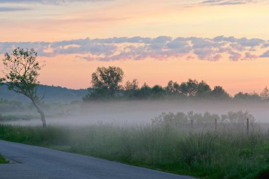
Radiation fog forms during the evening under cloudless skies with little to no wind when relative humidity is high. As the ground cools, the bottom layer of air will cool below its dew point, forming fog. The best condition to have radiation fog is when it had rained the previous night. This helps to moisten the soil and create higher dew points. This makes it easier for the air to become saturated and form fog. However, the winds must be less than 15 mph to prevent moisture and dry air from mixing. Valley fog, a form of radiation fog, forms in the valley when the soil is moist from previous rainfall. As the skies clear, solar energy exits Earth and allows the temperature to cool near or at the dew point. This forms deep fog, so dense it's sometimes called tule fog.
Steam fog appears in autumn when cool air moves over a warm lake. When the drier air lies above the moist surface, water evaporates from the lake surface and humidifies the air. Because the air's saturation point is low due to the cool temperature, the water vapor condenses, appearing like steam.
Upslope fog is generated when warm, humid air travels up a hillside and cools below its dew point. Such might be the situation when air moves out of the Gulf of Mexico traveling west up the Great Plains toward the east slope of the Rocky Mountains. As the air rises, it expands and cools. Once the air temperature reaches the dew point temperature the air becomes saturated, and condensation occurs to form the fog.
Precipitation
The word precipitation in chemistry refers to material falling out of suspension. The same definition can be applied when studying weather. Precipitation from a meteorological stand point is water in some form, falling out of the air, and settling on the surface of Earth. This allows us to distinguish between forms of condensation in the atmosphere and condensation that occurs at the surface. Dew is condensation at the surface and thus is not a form of precipitation. Rain, snow, hail, sleet, and freezing rain are all forms of precipitation. Convective precipitation forms when warm, moist air rises vertically in the atmosphere. It is generally more intense and of shorter duration than stratiform precipitation, which is relatively continuous and steady. Stratiform precipitation occurs when large air masses rise diagonally as larger-scale winds and atmospheric dynamics force them to move over each other.
For precipitation to occur, a variety of atmospheric conditions must occur. This includes a moisture source along with high and low pressure. Next, atmospheric instability needs to occur so that cloud formation may develop. Finally, moisture in the air needs to condense onto condensation nuclei so that the condensed moisture can become large enough to fall from the clouds in the form of precipitation. The atmosphere can produce a variety of precipitation types. The most common precipitation comes from clouds. Rain or snow droplets grow as they ride air currents in a cloud and collect other droplets. They fall when they become heavy enough to escape from the rising air currents that hold them up in the cloud. Millions of cloud droplets will combine to make only one raindrop. If temperatures are cold, the droplet will hit the ground as a snowflake.
Rain is liquid water falling from nimbostratus or cumulonimbus clouds. Many times, in the midlatitudes, precipitation will fall from clouds in the form of ice or snow, which then melts on its way down toward the ground.
Snow is precipitation in the form of ice crystals. The temperature the snow forms at will determine the size, shape, and concentration of snowflakes. When temperatures are freezing, snowflakes tend to be small and dry, which produces powdery snow. When the temperatures are warmer, the snowflakes are larger.
Sleet is precipitation that falls as ice pellets. It occurs when precipitation falls from the base of a cloud in the form of snow. As the snow falls, it enters a region of warm air and melts into rain. However, as the rain continues to fall, it enters a layer of cold air and refreezes in the form of ice pellets.
Freezing rain is similar to sleet except for the last step. As the rain falls, it enters a layer of cold air. However, the rain is not in this cold region long enough to freeze. Instead it stays as supercooled raindrops. However, once the supercooled raindrops reach the ground, they freeze instantly on any object they touch, coating the surface with a glaze of ice.
Hail is precipitation in the form of hard pellets of ice. It only forms in cumulonimbus clouds where the lower region of the cloud contains liquid water and is above freezing, while the upper region is below freezing. When an ice pellet falls within the cumulonimbus cloud, it enters the warm, liquid region and picks up moisture. Then the updrafts throw the ice pellet back up in the atmosphere where the temperature is below the freezing point, hardening the newly gathered water. The ice pellet will fall again to collect liquid water and is thrown back up to refreeze. This process will continue until the hailstone’s weight becomes too heavy for the updrafts to hold it up. Once the hail becomes too heavy, the hail will precipitate from the cloud. This occurs in severe thunderstorms where vertical up-and-down motions within the storm create concentric rings of ice around the hail stone.

The third type of precipitation is orographic precipitation. Orographic precipitation occurs when moist air is forced upwards over rising terrain, such as a mountain, cools to its dew point, resulting in precipitation by condensation on the slope of the mountain. The precipitation formed from chinook winds is an example of orographic precipitation, and results in the rainshadow effect on the leeward side of the mountain.
References
- 7.4.2: Clouds by Michael E. Ritter is licensed CC BY-SA 4.0. Original source: https://www.thephysicalenvironment.com.
- 7.4.1: Fog by Michael E. Ritter is licensed CC BY-SA 4.0. Original source: https://www.thephysicalenvironment.com.
- 7.4.3: Precipitation Process by Michael E. Ritter is licensed CC BY-SA 4.0. Original source: https://www.thephysicalenvironment.com.
- Cumulus clouds. Authored by: HarmonyCenter. Located at: https://pixabay.com/en/cumulus-clouds-dramatic-white-blue-499176/. License: CC0: No Rights Reserved
- Cloud types. Authored by: Valentin de Bruyn. Located at: https://commons.wikimedia.org/wiki/File:Cloud_types_en.svg. License: CC BY-SA 3.0.
- San Francisco in fog. Authored by: Brocken Inaglory. Located at: https://commons.wikimedia.org/wiki/File:San_francisco_in_fog_with_rays.jpg. License: CC BY-SA 3.0.
- Fog over meadows before sunrise. Authored by: Jakub Halun. Located at: https://commons.wikimedia.org/wiki/File:Mg%C5%82a_nad_%C5%82%C4%85kami_na_Pychowicach_przed_wschodem_s%C5%82o%C5%84ca,_20210610_0431_7096.jpg. License: CC BY-SA 4.0
- Perth hail size compared to hand. Authored by: FCB Excalibur. Located at: https://commons.wikimedia.org/wiki/File:Perth_hail_size_compared_to_hand.jpg. License: CC BY-SA 2.0.