14.2: Dumps and Landfills
- Page ID
- 25576
\( \newcommand{\vecs}[1]{\overset { \scriptstyle \rightharpoonup} {\mathbf{#1}} } \)
\( \newcommand{\vecd}[1]{\overset{-\!-\!\rightharpoonup}{\vphantom{a}\smash {#1}}} \)
\( \newcommand{\dsum}{\displaystyle\sum\limits} \)
\( \newcommand{\dint}{\displaystyle\int\limits} \)
\( \newcommand{\dlim}{\displaystyle\lim\limits} \)
\( \newcommand{\id}{\mathrm{id}}\) \( \newcommand{\Span}{\mathrm{span}}\)
( \newcommand{\kernel}{\mathrm{null}\,}\) \( \newcommand{\range}{\mathrm{range}\,}\)
\( \newcommand{\RealPart}{\mathrm{Re}}\) \( \newcommand{\ImaginaryPart}{\mathrm{Im}}\)
\( \newcommand{\Argument}{\mathrm{Arg}}\) \( \newcommand{\norm}[1]{\| #1 \|}\)
\( \newcommand{\inner}[2]{\langle #1, #2 \rangle}\)
\( \newcommand{\Span}{\mathrm{span}}\)
\( \newcommand{\id}{\mathrm{id}}\)
\( \newcommand{\Span}{\mathrm{span}}\)
\( \newcommand{\kernel}{\mathrm{null}\,}\)
\( \newcommand{\range}{\mathrm{range}\,}\)
\( \newcommand{\RealPart}{\mathrm{Re}}\)
\( \newcommand{\ImaginaryPart}{\mathrm{Im}}\)
\( \newcommand{\Argument}{\mathrm{Arg}}\)
\( \newcommand{\norm}[1]{\| #1 \|}\)
\( \newcommand{\inner}[2]{\langle #1, #2 \rangle}\)
\( \newcommand{\Span}{\mathrm{span}}\) \( \newcommand{\AA}{\unicode[.8,0]{x212B}}\)
\( \newcommand{\vectorA}[1]{\vec{#1}} % arrow\)
\( \newcommand{\vectorAt}[1]{\vec{\text{#1}}} % arrow\)
\( \newcommand{\vectorB}[1]{\overset { \scriptstyle \rightharpoonup} {\mathbf{#1}} } \)
\( \newcommand{\vectorC}[1]{\textbf{#1}} \)
\( \newcommand{\vectorD}[1]{\overrightarrow{#1}} \)
\( \newcommand{\vectorDt}[1]{\overrightarrow{\text{#1}}} \)
\( \newcommand{\vectE}[1]{\overset{-\!-\!\rightharpoonup}{\vphantom{a}\smash{\mathbf {#1}}}} \)
\( \newcommand{\vecs}[1]{\overset { \scriptstyle \rightharpoonup} {\mathbf{#1}} } \)
\(\newcommand{\longvect}{\overrightarrow}\)
\( \newcommand{\vecd}[1]{\overset{-\!-\!\rightharpoonup}{\vphantom{a}\smash {#1}}} \)
\(\newcommand{\avec}{\mathbf a}\) \(\newcommand{\bvec}{\mathbf b}\) \(\newcommand{\cvec}{\mathbf c}\) \(\newcommand{\dvec}{\mathbf d}\) \(\newcommand{\dtil}{\widetilde{\mathbf d}}\) \(\newcommand{\evec}{\mathbf e}\) \(\newcommand{\fvec}{\mathbf f}\) \(\newcommand{\nvec}{\mathbf n}\) \(\newcommand{\pvec}{\mathbf p}\) \(\newcommand{\qvec}{\mathbf q}\) \(\newcommand{\svec}{\mathbf s}\) \(\newcommand{\tvec}{\mathbf t}\) \(\newcommand{\uvec}{\mathbf u}\) \(\newcommand{\vvec}{\mathbf v}\) \(\newcommand{\wvec}{\mathbf w}\) \(\newcommand{\xvec}{\mathbf x}\) \(\newcommand{\yvec}{\mathbf y}\) \(\newcommand{\zvec}{\mathbf z}\) \(\newcommand{\rvec}{\mathbf r}\) \(\newcommand{\mvec}{\mathbf m}\) \(\newcommand{\zerovec}{\mathbf 0}\) \(\newcommand{\onevec}{\mathbf 1}\) \(\newcommand{\real}{\mathbb R}\) \(\newcommand{\twovec}[2]{\left[\begin{array}{r}#1 \\ #2 \end{array}\right]}\) \(\newcommand{\ctwovec}[2]{\left[\begin{array}{c}#1 \\ #2 \end{array}\right]}\) \(\newcommand{\threevec}[3]{\left[\begin{array}{r}#1 \\ #2 \\ #3 \end{array}\right]}\) \(\newcommand{\cthreevec}[3]{\left[\begin{array}{c}#1 \\ #2 \\ #3 \end{array}\right]}\) \(\newcommand{\fourvec}[4]{\left[\begin{array}{r}#1 \\ #2 \\ #3 \\ #4 \end{array}\right]}\) \(\newcommand{\cfourvec}[4]{\left[\begin{array}{c}#1 \\ #2 \\ #3 \\ #4 \end{array}\right]}\) \(\newcommand{\fivevec}[5]{\left[\begin{array}{r}#1 \\ #2 \\ #3 \\ #4 \\ #5 \\ \end{array}\right]}\) \(\newcommand{\cfivevec}[5]{\left[\begin{array}{c}#1 \\ #2 \\ #3 \\ #4 \\ #5 \\ \end{array}\right]}\) \(\newcommand{\mattwo}[4]{\left[\begin{array}{rr}#1 \amp #2 \\ #3 \amp #4 \\ \end{array}\right]}\) \(\newcommand{\laspan}[1]{\text{Span}\{#1\}}\) \(\newcommand{\bcal}{\cal B}\) \(\newcommand{\ccal}{\cal C}\) \(\newcommand{\scal}{\cal S}\) \(\newcommand{\wcal}{\cal W}\) \(\newcommand{\ecal}{\cal E}\) \(\newcommand{\coords}[2]{\left\{#1\right\}_{#2}}\) \(\newcommand{\gray}[1]{\color{gray}{#1}}\) \(\newcommand{\lgray}[1]{\color{lightgray}{#1}}\) \(\newcommand{\rank}{\operatorname{rank}}\) \(\newcommand{\row}{\text{Row}}\) \(\newcommand{\col}{\text{Col}}\) \(\renewcommand{\row}{\text{Row}}\) \(\newcommand{\nul}{\text{Nul}}\) \(\newcommand{\var}{\text{Var}}\) \(\newcommand{\corr}{\text{corr}}\) \(\newcommand{\len}[1]{\left|#1\right|}\) \(\newcommand{\bbar}{\overline{\bvec}}\) \(\newcommand{\bhat}{\widehat{\bvec}}\) \(\newcommand{\bperp}{\bvec^\perp}\) \(\newcommand{\xhat}{\widehat{\xvec}}\) \(\newcommand{\vhat}{\widehat{\vvec}}\) \(\newcommand{\uhat}{\widehat{\uvec}}\) \(\newcommand{\what}{\widehat{\wvec}}\) \(\newcommand{\Sighat}{\widehat{\Sigma}}\) \(\newcommand{\lt}{<}\) \(\newcommand{\gt}{>}\) \(\newcommand{\amp}{&}\) \(\definecolor{fillinmathshade}{gray}{0.9}\)A dump is a place where waste is literally dumped. There is little or no control over what is dumped, and by whom, and there are no mechanisms or procedures in place to ensure that the waste doesn’t contaminate the surrounding land, water and air. Waste in a dump is available to scavengers to consume or carry away, it can be scattered by the wind, or it can be washed away by water. Water that flows through the waste and becomes contaminated can drain off-site or seep into the ground. Gases generated by the waste are free to diffuse into the atmosphere. Dumps are often set on fire (Figure 14.0.1, Chapter 14 Introduction), and they may burn for years. Although many dumps still exist, it is no longer permissible to create new ones in most countries.
In contrast, a landfill is an engineered structure with barriers to contain the waste, mechanisms to capture and treat liquid and gaseous waste byproducts, and procedures in place to monitor the surrounding water and air. The important components of a typical landfill are illustrated on Figure 14.2.1.

The key feature of an engineered landfill is the impermeable barrier at the base (Figure 14.2.2). In most cases this is a heavy plastic liner (0.5 to 1.5 mm thick) with welded seams, although a thick compacted clay layer may achieve the same purpose. The impermeable layer is intended to contain all fluids within the landfill so that there is no risk (or at least a very low risk) that landfill liquids will be dispersed into the groundwater underneath or into the surrounding surface water.

The liner is normally covered with a layer of permeable fill (sand and gravel) within which pipes are installed to extract water (leachate) that has come in contact with the waste. That extracted leachate water may be sent to a dedicated processing plant, or to a sewage treatment plant, so that it can be detoxified prior to being released into the environment.
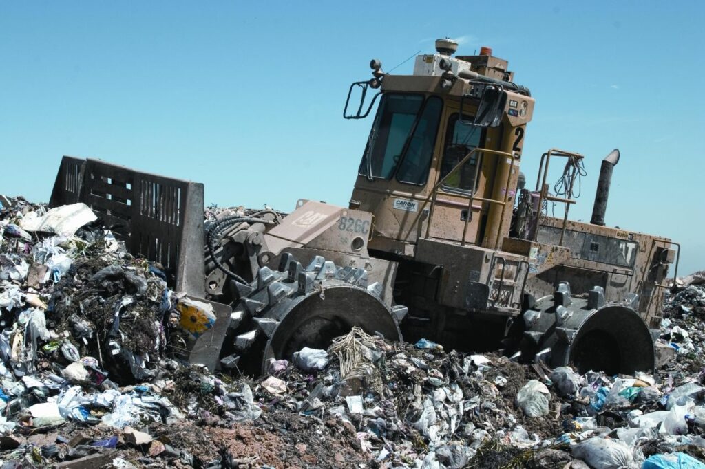
In a “completed” part of a landfill the waste is typically covered with another plastic membrane (or clay layer) to reduce the amount of water that can get in, and to prevent gases from escaping. The “working face” of the landfill is not covered in this way, but in most cases will be covered with a few centimetres of soil or some other material at the end of each day so as to prevent dispersal of the waste and access by birds, rodents and insects. An important part of the process at the working face is compaction of the waste, which is accomplished with heavy machines with studded metal wheels (Figure 14.2.3). That compaction allows for more waste to be stored within a specific volume. It also reduces the risk that there will be pockets of explosive gas within the waste.

As discussed below, the natural decomposition of landfill components results in generation of gases (mostly CO2 and CH4), and landfills are currently responsible for about 5% of global greenhouse gas emissions.[1]The key purpose of the landfill cover membrane is to contain these gases, so they are not released to the atmosphere. Another role is to contain all volatile emissions so that a landfill doesn’t smell as bad as it might otherwise.

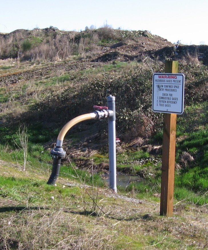
Landfill gases cannot be allowed to build up indefinitely, so they must be released in a controlled way through gas wells installed within the area of the covered waste, and extending down to a depth just above the level of the landfill water table (Figure 14.2.4). The extracted gas is then either flared to convert methane to carbon dioxide (CH4 + 2O2 -> CO2 + 2H2O) or is used to generate electricity.
Monitoring wells are constructed around, and sometimes within, a landfill in order to sample the groundwater and determine if any leachate is escaping. There may be several dozen such wells around a typical landfill. They are sampled regularly (e.g., quarterly, or at least annually) and the water is analyzed for a range of constituents that might be expected in leachate. The monitoring protocol might also include collecting water samples from nearby streams, and air samples from around the landfill.
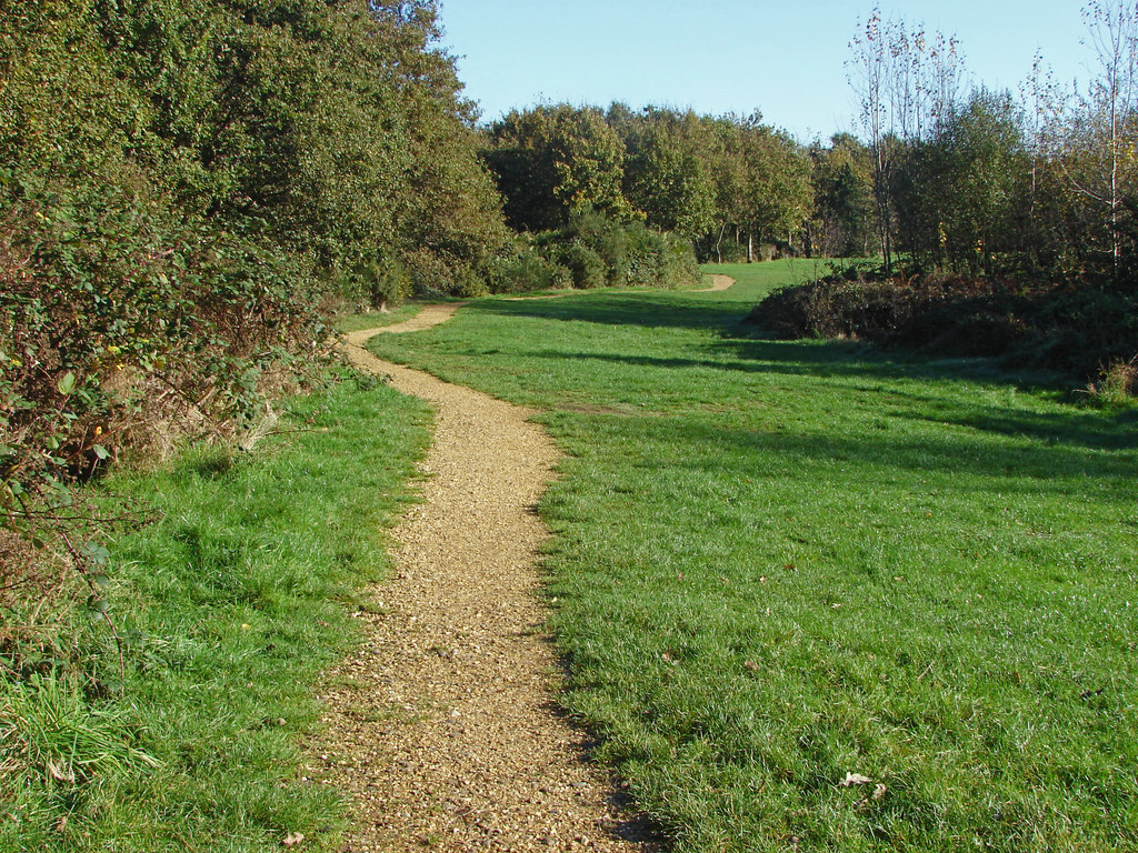
When a landfill is completely filled it can be covered with a thick layer of soil and adapted for other uses such as parks and playing fields (Figure 14.2.5).

Landfill Siting Criteria
Most jurisdictions have clear policies on siting landfills. Some of the siting criteria listed in the 2016 British Columbia document “Landfill Criteria for Municipal Solid Waste”[2] are as follows:
- At least 8 km from an airport (or at least 3.5 km if bird-control measures are in effect),[3]
- At least 500 m from a school or residential area,
- At least 500 m from a fault that has been active in the Holocene (11,650 y), or from a known risk of slope failure, or from an area with karst terrain,
- At least 300 m from a producing well and at least 1.5 m above the water table,
- At least 100 m from a surface water body (stream, pond, marsh, lake, ocean),
- At least 100 m from a park or archaeological site,
- Not within an existing topographic depression or on a river flood plain, and
- Not in an area at risk of tsunami, or within 1.5 m (vertical) of highest sea level.
Some other criteria that are important are the proximity to the source of the waste, the permeability of the material that underlies the site, and the proximity of material that can be used as cover.
Many of these criteria have geological implications. Obviously, we wouldn’t want to construct a landfill on a fault that may be active again, or in an area where there is a risk of slope failure. As described in Chapter 12, karst terrain is typically characterized by solutional opening of fractures and bedding planes and so could provide a conduit for significant dispersal of contaminated water.
In spite of all the measures taken to prevent it, there is always a risk that leachate will leak into the surroundings, and into surface water and groundwater. The 100 m buffer to the nearest body of surface water allows time for a surface leak to be detected before it gets there. The 300 m buffer to the nearest well allows for the longer period of time that it might take to detect dispersal within an aquifer. The stipulation that the deepest part of a landfill must be at least 1.5 m above the water table all but eliminates the construction of landfills in very wet regions where the water table may be within a few metres of surface, because most landfills are constructed by excavating to a depth of at least several metres.
Landfills must not be sited within existing topographic depressions or gullies (even dry ones) because those, along with river floodplains, are at risk of flooding under extreme conditions.
Exercise 14.2 Does Your Landfill Meet the Siting Criteria for British Columbia?
Most existing landfills were constructed before strict criteria like those listed above were established; yours may be an example (and of course the rules may be different in your area). Find out where the landfill (or other solid-waste handling facility) that accepts your waste is situated and, using an online mapping tool (e.g., Google maps), check to see if it meets the partial list of criteria below. You can still do this if you don’t live in British Columbia.
| Criterion | Yes/No? |
| At least 8 km from an airport | |
| At least 500 m from a school or residential area | |
| At least 100 m from a surface water body (stream, pond, marsh, lake, ocean)* | |
| At least 100 m from a park |
*Note that not all small streams, ponds or wetlands are marked on on-line mapping tools, so you might have to zoom in to see if any of those are closer than the 100 m limit.
Media Attributions
- Figure 14.2.1 Steven Earle, CC BY 4.0
- Figure 14.2.2Geomembrana by Ponchitos, 2006, CC BY-SA 3.0, via Wikimedia Commons, https://commons.wikimedia.org/wiki/F...mbrana_AGS.jpg
- Figure 14.2.3 Landfill Compactor by Ropable, 2006, public domain image, via Wikimedia Commons, https://commons.wikimedia.org/w/inde...p?curid=530271
- Figure 14.2.4 Photo by Steven Earle, CC BY 4.0
- Figure 14.2.5SU8969: Longhill Park, Bracknell by Alan Hunt, 2014, CC BY SA 2.0, https://www.geograph.org.uk/photo/4234266
- Stocker, T.F. et al. (2013). Technical summary. In Stocker, T.F et al. (Eds.), Climate change 2013: The physical science basis. Contribution of Working Group I to the Fifth Assessment Report of the Intergovernmental Panel on Climate Change IPCC (p. 159–254). Cambridge University Press. ↵
- Ministry of the Environment. (2016). Landfill criteria for municipal solid waste. BC Ministry of the Environment (accessed April 2021). https://www2.gov.bc.ca/assets/gov/en...l_criteria.pdf ↵
- Bird control measures include covering the waste as effectively as possible at the end of each working day, minimizing bird nesting and roosting habitat around the landfill, using sounds to scare birds away, and employing raptors (e.g., falcons or hawks) to intimidate birds such as gulls). ↵


