
2.4: Soils of Quebec
- Page ID
- 16616

\( \newcommand{\vecs}[1]{\overset { \scriptstyle \rightharpoonup} {\mathbf{#1}} } \)
\( \newcommand{\vecd}[1]{\overset{-\!-\!\rightharpoonup}{\vphantom{a}\smash {#1}}} \)
\( \newcommand{\id}{\mathrm{id}}\) \( \newcommand{\Span}{\mathrm{span}}\)
( \newcommand{\kernel}{\mathrm{null}\,}\) \( \newcommand{\range}{\mathrm{range}\,}\)
\( \newcommand{\RealPart}{\mathrm{Re}}\) \( \newcommand{\ImaginaryPart}{\mathrm{Im}}\)
\( \newcommand{\Argument}{\mathrm{Arg}}\) \( \newcommand{\norm}[1]{\| #1 \|}\)
\( \newcommand{\inner}[2]{\langle #1, #2 \rangle}\)
\( \newcommand{\Span}{\mathrm{span}}\)
\( \newcommand{\id}{\mathrm{id}}\)
\( \newcommand{\Span}{\mathrm{span}}\)
\( \newcommand{\kernel}{\mathrm{null}\,}\)
\( \newcommand{\range}{\mathrm{range}\,}\)
\( \newcommand{\RealPart}{\mathrm{Re}}\)
\( \newcommand{\ImaginaryPart}{\mathrm{Im}}\)
\( \newcommand{\Argument}{\mathrm{Arg}}\)
\( \newcommand{\norm}[1]{\| #1 \|}\)
\( \newcommand{\inner}[2]{\langle #1, #2 \rangle}\)
\( \newcommand{\Span}{\mathrm{span}}\) \( \newcommand{\AA}{\unicode[.8,0]{x212B}}\)
\( \newcommand{\vectorA}[1]{\vec{#1}} % arrow\)
\( \newcommand{\vectorAt}[1]{\vec{\text{#1}}} % arrow\)
\( \newcommand{\vectorB}[1]{\overset { \scriptstyle \rightharpoonup} {\mathbf{#1}} } \)
\( \newcommand{\vectorC}[1]{\textbf{#1}} \)
\( \newcommand{\vectorD}[1]{\overrightarrow{#1}} \)
\( \newcommand{\vectorDt}[1]{\overrightarrow{\text{#1}}} \)
\( \newcommand{\vectE}[1]{\overset{-\!-\!\rightharpoonup}{\vphantom{a}\smash{\mathbf {#1}}}} \)
\( \newcommand{\vecs}[1]{\overset { \scriptstyle \rightharpoonup} {\mathbf{#1}} } \)
\( \newcommand{\vecd}[1]{\overset{-\!-\!\rightharpoonup}{\vphantom{a}\smash {#1}}} \)
\(\newcommand{\avec}{\mathbf a}\) \(\newcommand{\bvec}{\mathbf b}\) \(\newcommand{\cvec}{\mathbf c}\) \(\newcommand{\dvec}{\mathbf d}\) \(\newcommand{\dtil}{\widetilde{\mathbf d}}\) \(\newcommand{\evec}{\mathbf e}\) \(\newcommand{\fvec}{\mathbf f}\) \(\newcommand{\nvec}{\mathbf n}\) \(\newcommand{\pvec}{\mathbf p}\) \(\newcommand{\qvec}{\mathbf q}\) \(\newcommand{\svec}{\mathbf s}\) \(\newcommand{\tvec}{\mathbf t}\) \(\newcommand{\uvec}{\mathbf u}\) \(\newcommand{\vvec}{\mathbf v}\) \(\newcommand{\wvec}{\mathbf w}\) \(\newcommand{\xvec}{\mathbf x}\) \(\newcommand{\yvec}{\mathbf y}\) \(\newcommand{\zvec}{\mathbf z}\) \(\newcommand{\rvec}{\mathbf r}\) \(\newcommand{\mvec}{\mathbf m}\) \(\newcommand{\zerovec}{\mathbf 0}\) \(\newcommand{\onevec}{\mathbf 1}\) \(\newcommand{\real}{\mathbb R}\) \(\newcommand{\twovec}[2]{\left[\begin{array}{r}#1 \\ #2 \end{array}\right]}\) \(\newcommand{\ctwovec}[2]{\left[\begin{array}{c}#1 \\ #2 \end{array}\right]}\) \(\newcommand{\threevec}[3]{\left[\begin{array}{r}#1 \\ #2 \\ #3 \end{array}\right]}\) \(\newcommand{\cthreevec}[3]{\left[\begin{array}{c}#1 \\ #2 \\ #3 \end{array}\right]}\) \(\newcommand{\fourvec}[4]{\left[\begin{array}{r}#1 \\ #2 \\ #3 \\ #4 \end{array}\right]}\) \(\newcommand{\cfourvec}[4]{\left[\begin{array}{c}#1 \\ #2 \\ #3 \\ #4 \end{array}\right]}\) \(\newcommand{\fivevec}[5]{\left[\begin{array}{r}#1 \\ #2 \\ #3 \\ #4 \\ #5 \\ \end{array}\right]}\) \(\newcommand{\cfivevec}[5]{\left[\begin{array}{c}#1 \\ #2 \\ #3 \\ #4 \\ #5 \\ \end{array}\right]}\) \(\newcommand{\mattwo}[4]{\left[\begin{array}{rr}#1 \amp #2 \\ #3 \amp #4 \\ \end{array}\right]}\) \(\newcommand{\laspan}[1]{\text{Span}\{#1\}}\) \(\newcommand{\bcal}{\cal B}\) \(\newcommand{\ccal}{\cal C}\) \(\newcommand{\scal}{\cal S}\) \(\newcommand{\wcal}{\cal W}\) \(\newcommand{\ecal}{\cal E}\) \(\newcommand{\coords}[2]{\left\{#1\right\}_{#2}}\) \(\newcommand{\gray}[1]{\color{gray}{#1}}\) \(\newcommand{\lgray}[1]{\color{lightgray}{#1}}\) \(\newcommand{\rank}{\operatorname{rank}}\) \(\newcommand{\row}{\text{Row}}\) \(\newcommand{\col}{\text{Col}}\) \(\renewcommand{\row}{\text{Row}}\) \(\newcommand{\nul}{\text{Nul}}\) \(\newcommand{\var}{\text{Var}}\) \(\newcommand{\corr}{\text{corr}}\) \(\newcommand{\len}[1]{\left|#1\right|}\) \(\newcommand{\bbar}{\overline{\bvec}}\) \(\newcommand{\bhat}{\widehat{\bvec}}\) \(\newcommand{\bperp}{\bvec^\perp}\) \(\newcommand{\xhat}{\widehat{\xvec}}\) \(\newcommand{\vhat}{\widehat{\vvec}}\) \(\newcommand{\uhat}{\widehat{\uvec}}\) \(\newcommand{\what}{\widehat{\wvec}}\) \(\newcommand{\Sighat}{\widehat{\Sigma}}\) \(\newcommand{\lt}{<}\) \(\newcommand{\gt}{>}\) \(\newcommand{\amp}{&}\) \(\definecolor{fillinmathshade}{gray}{0.9}\)Tim Moore
Learning Objectives
- Describe the factors responsible for the distribution of soils in Quebec
- Identify the diagnostic soil horizons associated with soil orders and great groups (according to the Canadian System of Soil Classification) of Quebec
- Describe the impact of human activities on the soils of the region, and relate the major land uses to the properties of the soil
INTRODUCTION
Quebec contains a great deal of environmental diversity, not surprising because it is the province with the largest area of land, 1.36 million km2, or 15 % of the Canadian total. A consequence of that diversity is the broad range of soils found in Quebec, spanning seven soil orders, ranging from fertile Brunisols and Gleysols in the south, to Podzols of the boreal forest, Brunisols in the subarctic and Cryosols in the north. This diversity reflects the range of soil forming factors and their control on soil forming processes (see Chapter 2).
SOIL FORMING FACTORS IN QUEBEC
The soil parent materials partially follow the underlying geology, varying from igneous and metamorphic rocks in the Canadian Shield to the metamorphic rocks in the Appalachian region to softer sedimentary rocks underlying the St. Lawrence valley (Bird 1980). However, the parent materials also reflect the emergence of Quebec from the last glaciation and the sediments laid down since then.
Quebec was covered by the Laurentide Ice Sheet until about 12,000 years ago when the southernmost part started to be freed by the ice sheet retreating northwards (Bird 1980; Richard and Occhietti 2005). With the land surface depressed by the mass of the ice, the sea rushed in to create the Champlain Sea in the St. Lawrence lowlands, depositing clay-rich marine sediments with a high initial salt content. As the land rose and emerged from the sea and glacial lakes, the clays were reworked and sandy deposits laid down, creating a rich mosaic of soil texture as rivers eroded downwards. The clay sediments laid down in the Champlain Sea were initially salt-rich and leaching of the salt and incision by rivers has created instability. This has resulted in over 700 landslides and earthflows in the St. Lawrence Lowlands, from Ottawa to Lac Saint-Jean, and some of which destroyed farmland and homes and killed people, such as at Nicolet in 1955 and at St. Jean Vianney in 1971 (Bird 1980; Carson 1978)
. Landslides continue to happen in Quebec and have had devastating consequences. Search the web for “Quebec landslides” for a number of images of the destruction associated with several of these events over the years. In northwestern Quebec, Lake Ojibway-Barlow formed, depositing fine sediments which now form the Clay Belt extending from Quebec into Ontario.
As the ice sheet continued to retreat northwards the land surface was covered with a thin layer of sandy/stony till. The last remnant of the ice sheet disappeared about 6,000 years ago in north central Quebec. Thus, Quebec soils have formed over the last 6,000 to 10,000 years, during which the climate has warmed and vegetation has moved northwards to occupy the glacial sediments.
The current climate varies from a mean annual temperature of 7°C around Montreal (45°N) to -5°C at Kuujjuaq in northern Quebec (58°N). Annual precipitation ranges from about 1000 mm in the south to about 550 mm in the north and the proportion of precipitation falling as rain varies from 80% in the south to 50% in the north. Runoff ranges from 400 mm in the south to 500 mm in the north, reflecting differences in evapotranspiration rates, and soils are not very moisture deficient, except for sandy, well-drained soils in the south.
Resulting from differences in climate, topography and parent material, the vegetation varies from deciduous forests in southwestern Quebec, mixed forests in the southern Appalachians and eastern Quebec through to dominantly coniferous forests in the Boreal Shield. In the north, the boreal forests give way to subarctic woodlands in the Taiga Shield, in which lichen forms an important ground cover and in northernmost Quebec into arctic tundra devoid of trees. Throughout Quebec, depressions collect water forming peatlands which contain plants adapted to wet conditions, such as sedges and mosses.
SOIL DISTRIBUTION IN QUEBEC
The soils of Quebec follow a classic ‘zonal’ distribution, from south to north (Figure 12.1), reflecting the dominating influence of climate and vegetation, but also the time for soil formation and the differences in parent material from south to north. Within these landscapes, topography becomes important, in producing shallow soils on steep slopes to poorly drained soils in depressions.

The dominant soil order in Quebec is Podzol, covering 39%, comprising mainly the Humo-Ferric great group and concentrated on the Boreal Shield and Taiga Shield terrestrial ecozones (Table 12.1). Podzols are characterized usually by a thick accumulation of organic matter at the surface, underlain by a leached, grey Ae horizon and then by a reddish brown B horizon showing the accumulation of iron and aluminum and/or organic matter, and defined by colour and chemical composition (see Chapter 8; Sanborn et al. 2011). Ferro-Humic and Humic great groups, with evidence of a larger translocation of organic matter within the soil profile than in the Ferric great group, cover 5% and occur primarily on the Canadian Shield along the North Shore in eastern Quebec, under a wetter climate.
Table 12.1. Coverage of soil Great Groups and Orders in Quebec
| Great group | Order | Area (km2) | Great Group (%) | Order (%) |
|---|---|---|---|---|
| Melanic Brunisol | Brunisol | 9,714 | 0.71 | 17.4 |
| Eutric Brunisol | Brunisol | 3,279 | 0.24 | |
| Sombric Brunisol | Brunisol | 153 | 0.01 | |
| Dystric Brunisol | Brunisol | 223,940 | 16.44 | |
| Turbic Cryosol | Cryosol | 79,867 | 5.86 | 5.9 |
| Organic Cryosol | Cryosol | 65 | 0 | |
| Static Cryosol | Cryosol | 172 | 0.01 | |
| Luvic Gleysol | Gleysol | 4,360 | 0.32 | 2.7 |
| Gleysol | Gleysol | 14,210 | 1.04 | |
| Humic Gleysol | Gleysol | 17,863 | 1.31 | |
| Gray Luvisol | Luvisol | 22,553 | 1.66 | 1.7 |
| Fibrisol | Organic | 7,668 | 0.56 | 8.1 |
| Humisol | Organic | 5,327 | 0.39 | |
| Mesisol | Organic | 96,848 | 7.11 | |
| Humic Podzol | Podzol | 1,894 | 0.14 | 38.8 |
| Humo-Ferric Podzol | Podzol | 463,518 | 34.03 | |
| Ferro-Humic Podzol | Podzol | 62,825 | 4.61 | |
| Regosol | Regosol | 41,044 | 3.01 | 3 |
| Undefined | 303,190 | 22.26 | 22.3 | |
| Total | 1,362,237 |
Second in coverage is the Brunisol order, covering 17% dominated by the Dystric great group, mainly in the Taiga and Boreal Shield Ecozones, where profile development is not strong enough for soils to fall into the Podzol order. Brunisols are characterized by the absence of a single, dominant pedogenic process and the formation of a brown Bm horizon, indicative of some weathering (see Chapter 8; Smith et al. 2011). Both the Podzols and the Dystric Brunisolic great group form in the thin, acidic coarse textured materials left during glacial retreat. Dystric Brunisols can transform into Podzols over several thousand years of soil formation, as occurs in sandy deposits exposed by relative sea level fall along the Quebec North Shore, resulting in the Bm horizon being replaced by sesquioxide-cemented Bfc horizons (Moore 1976). Soils of the Melanic Brunisol great group, caused by the incorporation of organic matter into the upper mineral layer by soil-dwelling organisms, occur where the parent material is calcareous with deciduous forest cover, mainly in southwestern Quebec and the Clay Belt.
Organic soils, defined by an accumulation of organic matter over 40 cm thick, cover 8%, The Organic soils are dominantly Mesisols, in which most of the soil profile shows an intermediate degree of decomposition of the original plant tissues, whereas Fibrisols and Humisols show less and greater decomposition, respectively (see Chapter 8; Kroetsch et al. 2011). Where the topography and climate conspire to produce waterlogged conditions, decomposition of plant litter is slowed, producing organic soils with up to 5 m of peat. In some peatlands, such as bogs, the inherent decomposability of the plant litter is slow such as is found in Sphagnum mosses which are essentially the peat formers. The peatlands can be found in depressions underlain by clays in the St. Lawrence lowlands, as acid bogs and more nutrient rich swamps, and in waterlogged sections of the Boreal Shield and the Clay Belt. The eastern coast of James Bay contains the extension of the Hudson Bay Lowlands, dominated by organic soils and covering 0.25 million km2.
Cryosols, underlain by permafrost, cover 6% in the northernmost part of the province, in the Southern and Northern Arctic Ecozones, and extend down the Hudson Bay coast (see Chapter 8). In a colder climate and north of the tree line, sporadic permafrost terrain develops, including palsa, which are ice cored mounds in peatlands and wetlands (Tarnocai and Bockheim 2011). North of about 58°N continuous permafrost covers the landscape with Turbic Cryosols, in which freeze-thaw activities turnover, or cryoturbate, the soil profile.
Gleysols cover 3% and are formed under poor drainage conditions in depressions or on heavy textured parent materials such as the glacio-marine sediments in the St. Lawrence Lowlands and the Clay Belt. The high water table creates morphologic features such as grey coloured matrices that can include brown or reddish mottles indicative of oxidation-reduction processes or gleying (see Chapter 8; Bedard-Haughn 2011). This arises from the depletion of oxygen beneath the water table resulting in the reduction of iron from the insoluble ferric (Fe3+) to soluble ferrous (Fe2+) state, which then leaves the soil profile, producing a grey colour, or relocates to microsites which retain oxidizing conditions producing the distinctive mottles.
Luvisols, mainly of Gray Luvisol great group, cover 2%, and occur mainly in the Clay Belt. Luvisols form on clay-rich sediments containing calcium and magnesium and are characterized by the translocation of clay from the upper to middle part of the soil profile, producing the Bt horizon enriched in clay (Lavkulich et al. 2011).
The remaining mapped area comprises Regosols (3%) which are soils which are weakly developed and do not contain a recognizable B horizon at least 5 cm thick (see Chapter 8). They form on recently exposed sediments, on steep slopes leading to erosion and mass movement or where the parent material is resistant to weathering, such as on the Canadian Shield (VandenBygaart 2011). Finally, 22% of the area remains undefined, primarily in northernmost Quebec.
HUMAN-SOIL INTERACTIONS IN QUEBEC
Human activities have had a profound effect on soils in Quebec. The Algonquin and Iroquois Indigenous peoples of southern Quebec occupied the soils of the St. Lawrence lowlands and developed agriculture on the most fertile soils, which reached a peak in the 16th century. Riley (2013) argues that the arrival of Europeans disturbed the delicate balance between soils and the environment under indigenous management, causing an initial decline in indigenous population and then the widespread forestry operations in the 19th century, leading to erosion and degradation of the soils. With European arrivals, there was more intensive use of land for agriculture, concentrated along St. Lawrence River and also extensive forest harvesting starting in early part of 19th century. The varying soil texture provides a variety of viable activities, with arable cultivation on the clay-rich soils, tobacco on sandy soils near Joliette and apple orchards on the gravelly soils around the Monteregian Hills.
The imprint of human occupation is not restricted to the soils of southern Quebec. In northern Quebec, extremely nomadic people fished and hunted over 3000 years ago, though archaeological evidence is hard to find with poor preservation of bones in acid soils. Nevertheless, the soils contain evidence of occupation, such as hearths which changed the morphology of the soil and chemical changes associated with disposal of bones of fish and caribou. The best indicator of the latter is the increase in the phosphorus concentration of the soil, compared to undisturbed conditions, and changes in the fractionation of the phosphorus, in particular an increase in the calcium phosphate fraction (Moore 1986; Moore and Denton 1988).
The introduction of the Dominion Drainage Act from the mid-19th century allowed more extensive use of the potentially fertile but wet soils of St. Lawrence Lowlands, and led to the colonization of northern locations, such the Clay Belt in northwestern Quebec and around Lac Saint-Jean, which have heavy-textured soils.
The introduction of worms to Quebec forests, through fishing and farming and, has also affected soils. The forest leaf litter layer on the soil surface can be consumed by earthworms, and lost to the atmosphere as carbon dioxide, mixed with the underlying mineral horizon, or, in the case of deep-living earthworms, being incorporated into the mineral subsoil layers (Wironen and Moore 2006).
Although Quebec soils cover over 1 million km2, soils of high agricultural potential cover a small area. The Canada Land Inventory identifies 600 km2 of Class 1 soils (those with no significant limitation for crops), 10,000 km2 of Class 2 soils (those that have moderate limitations) and 13,500 km2 of Class 3 soils with moderately severe limitations, mainly wetness and fertility (Table 12.2). These soil classes comprise only 0.2, 2.9 and 4.2%, respectively, of the area surveyed by the Land Inventory (essentially south of 49° N), being located mainly in the land around Montreal, with pockets along the St. Lawrence River and in the Lac Saint-Jean region, and small areas in the Clay Belt of northwestern Quebec. The Class 1 and 2 soils, especially when drained, have created the fertile ‘Corn Belt’ of agricultural land in the St. Lawrence Lowlands, now commonly in rotation with soya. Capability Class 1 to 3 soils are very restricted in area, and give an average of 0.28 ha (equivalent to a quarter of a football field) for each Quebecer, the smallest in any province in Canada and half the value in Ontario. Moreover, about 80% of the good quality soils (Classes 1 to 3) are covered by cropland, and this rises to 88% when pasture is included, a large percentage when compared to other parts of Canada. Thus, conservation of this limited area of good quality soils is important.
Table 12.2. The distribution of soils suitable for agriculture across Canada (Canada Land Inventory Capability Classes 1, 2 and 3*‡) by province or region and compared with population (estimated for 2019) and the area of cropland
| Region | CLI 1 | CLI 2 | CLI 3 | ΣCLI 1-3 | Population | ΣCLI 1-3 /population | Cropland† | Pasture† | Cropland /ΣCLI 1-3 |
|---|---|---|---|---|---|---|---|---|---|
| (thousands of km2) | (million) | (ha per person) | (thousands of km2) | ||||||
| Atlantic | 0 | 5.89 | 22.78 | 28.67 | 2.4 | 1.19 | 3.1 | 0.9 | 0.11 |
| QC | 0.6 | 9.54 | 13.63 | 23.77 | 8.4 | 0.28 | 18.7 | 2.2 | 0.785 |
| ON | 22.49 | 23.6 | 32.79 | 78.87 | 14.4 | 0.55 | 36.5 | 5.3 | 0.463 |
| MB | 1.83 | 25.56 | 25.61 | 53.01 | 1.4 | 3.79 | 46.7 | 17.4 | 0.88 |
| SK | 10.72 | 64.46 | 100.82 | 176.00 | 1.2 | 14.67 | 163.9 | 65.1 | 0.931 |
| AB | 7.08 | 38.97 | 62.88 | 108.93 | 4.3 | 2.53 | 102.2 | 86.1 | 0.938 |
| BC | 0.7 | 3.98 | 10 | 14.68 | 5 | 0.29 | 5.8 | 16.4 | 0.395 |
| *From the Canada Land Inventory http://sis.agr.gc.ca/cansis/publicat...agr/index.html ‡For descriptions of the Land Capability Classes, see https://sis.agr.gc.ca/cansis/nsdb/cli/classdesc.html †Cropland defined as ‘Land in crops’ and pasture as ‘tame or seeded pasture + natural land for pasture’ in Statistics Canada Land Use (2016); https://www150.statcan.gc.ca/t1/tbl1...ers%5B0%5D=1.1 |
|||||||||
Legislation was introduced by the provincial government in 1978 to preserve agricultural land and agricultural activities, particularly the very limited good quality soils in the province. This was enacted in the region around Montreal, to prevent widespread ‘suburban sprawl’ outcompeting agricultural activities for the best soils. The agricultural zone, to which the legislation applied, covered 64,000 km2 or only 12% of the land area of Quebec, further evidence of the paucity of good, agricultural soils. The legislation has been relaxed, so that suburban sprawl now occupies rich soils off the island of Montreal (see www.cptaq.gouv.qc.ca/fileadmin/en/publications/guides/Summary.pdf for an overview of the Act to preserve agricultural land and agricultural activities in Quebec). With climate change, the agricultural potential of soils in the Clay Belt and the Lac St. Jean region may improve.
Tree harvesting has occurred over the last three centuries in Quebec, initially on a small scale by indigenous communities, but more intensively with European settlement, so that few undisturbed forest stands remain. Tree harvesting occurred on a wide range of soils, mainly Podzols and Brunisols, but also Gleysols; unlike Finland, peatlands have not been drained to promote tree growth. Given the shallow nature of these soils and limited fertility, especially Podzols, tree harvesting may lead to exhaustion of nutrient supplies. Issue of exhaustion of nutrients through repeated harvesting operations poses a threat to the sustainability of forest operations on these soils. Thiffault et al. (2011) review the effects of whole-tree harvesting versus stem-only harvesting on soil properties in boreal and temperate forests. They show that, in general, whole-tree harvesting, as practiced in clearcutting, leads to larger reductions in soil carbon, nitrogen, phosphorus and base cations than stem-only harvesting, particularly on coarse-textured soils. However, there is great variability in the magnitude of the response arising from different forest types, climate and soil characteristics.
Extensive areas of bogs (Fibrisols and Mesisols, weakly and moderately decomposed peatlands, respectively) formed from slowly decomposing Sphagnum mosses and shrubs and trees, under acid, waterlogged conditions. They are of very limited value for agriculture, but substantial bog areas of Quebec, along with New Brunswick and Alberta, have been used to harvest horticultural peat moss. Flying along the St. Lawrence valley, one can see large bogs which have been drained, vegetation removed and the surface peat is dried and collected by giant vacuum cleaners. The peat is milled, dried and packaged for residential use (the bags of garden ‘peat moss’ bought in the spring), though the majority is used for horticultural purposes, such as a substrate for vegetables and flowers and, more recently, marijuana.
On the other hand, Mesisols and Humisols, peatlands formed from vegetation under higher nutrient conditions, and thus more decomposed, have been extensively drained in the St. Lawrence Lowlands for agriculture, particularly vegetables. Lowering the water table increases the rate at which the peat decomposes, releasing carbon dioxide, causes shrinkage of the peat as well as aeolian erosion, so that the peat surface is lowered by about 2 cm per year (Glenn et al. 1993; Parent et al. 1982). With soils originally between 1 and 1.5 m thick, these fertile soils have a limited lifespan.
Finally, ‘climate change’ is beginning to affect Quebec soil. This ranges from summer drought to mores spring flooding in the in the south to the thawing of Cryosol soils in the north, with resultant instability of transportation and housing sites.
REFERENCES
Bedard-Haughn, A. 2011. Gleysolic soils of Canada: Genesis, distribution and classification. Can. J. Soil Sci. 91: 763-779.
Bird, J.B. 1980. The Natural Landscapes of Canada. Second Edition, Wiley, Toronto.
VandenBygaart, A. J. 2011. Regosolic soils of Canada: Genesis, distribution and classification. Can. J. Soil Sci. 91: 881-887.
Carson, M.A. 1979. Le glissement de Rigaud (Québec) du 3 mai 1978 : une interprétation du mode de rupture d’après la morphologie de la cicatrice. Géographie physique et Quaternaire, 33: 63–92.
Glenn, S.M., Heyes, A., and Moore, T.R. 1993. Methane and carbon dioxide fluxes from drained peatland soils, southern Quebec. Global Biogeochemical Cycles 7: 247-257.
Kroetsch, D.J., Geng, X., Chang, S.X., and Saurette, D.D. 2011. Organic soils of Canada: Part 1. Wetland Organic soils. Can. J. Soil Sci. 91: 807-822.
Lavkulich, L.M. and Arocena, J.M. 2011. Luvisolic soils of Canada: Genesis, distribution and classification. Can. J. Soil Sci. 91: 781-806.
Moore, T. R. 1976. Sesquioxide-cemented soil horizons in northern Quebec: their distribution, properties and genesis. Can. J. Soil Sci. 56: 333-344.
Moore, T.R., 1986. The spatial variability of soil properties and its application to archaeology. Canadian Geographer 30: 80-82.
Moore, T.R., and Denton, D. 1988. The use of soils in archaeological investigations in northern Quebec. pp. 25-37 in J. Bintliff, D.A. Davidson and E.G. Grant (eds.) Conceptual Issues in Environmental Archaeology. Edinburgh University Press.
Parent, L.E., Millette, J.A., and Mehuys, G.R. 1982. Subsidence and erosion of a Histosol. Soil Sci. Soc. Am. J., 46: 404-408.
Richard, P.J.H., and Occhietti, S. 2005. 14C chronology for ice retreat and inception of Champlain Sea in the St. Lawrence Lowlands, Canada. Quaternary Research 63: 353-358.
Riley, J. 2013. The Once and Future Great Lakes Country: an Ecological History. McGill-Queen’s University Press.
Sanborn, P., Lamontagne, L., and Hendershot, P. 2011. Podzolic soils of Canada: Genesis, distribution and classification. Can. J. Soil Sci. 91: 843-880.
Smith, C.A.S., Webb, K.T., Kenney, E., Anderson, A., and Kroetsch, D. 2011. Brunisolic soils of Canada: Genesis, distribution and classification. Can. J. Soil Sci. 91: 695-717.
Soil Classification Working Group. 1998. The Canadian System of Soil Classification. Agric. And Agri-Food Canada. Publ. 1646 (Revised). 187 pp. Available at:
http://sis.agr.gc.ca/cansis/publications/manuals/1998-cssc-ed3/cssc3_manual.pdf
Tarnocai, C. and Bockheim, J.G. 2011. Cryosolic soils of Canada: Genesis, distribution and classification. Can. J. Soil Sci. 91: 749-762.
Wironen, M., and Moore, T.R. 2006. Exotic earthworm invasion of an old-growth forest in southern Quebec and effects on soil carbon and nitrogen. Can. J. For. Res. 36: 845-854.
Thiffault, E., Hannam, K.D., Paré, D., Titus, B.D., Hazlett, P.W., Maynard, D.G, and Brais, S. 2011. Effects of forest biomass harvesting on soil productivity in boreal and temperate forests – A review. Environ. Rev. 19: 278–309.
About the Author
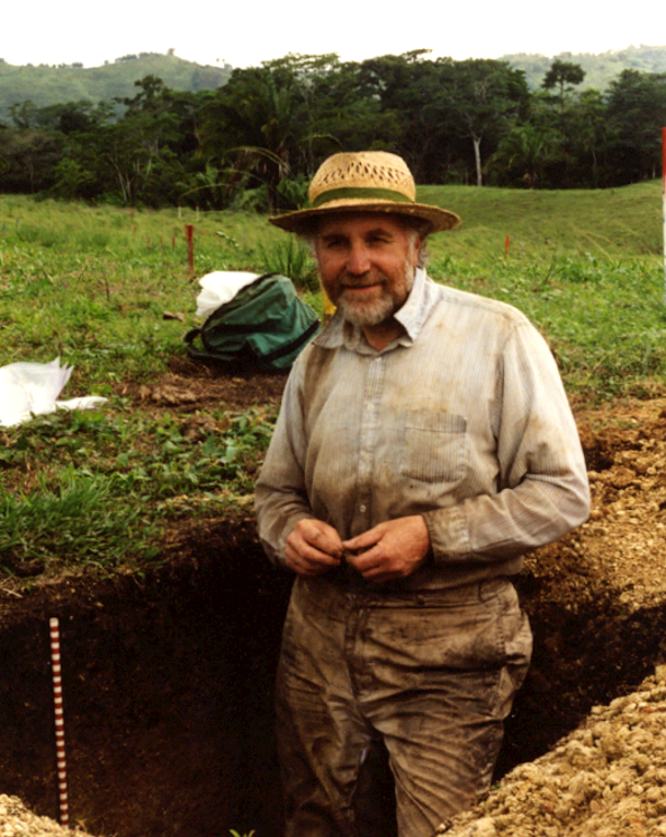
My mother’s family were market gardeners and she had a ‘green thumb’, so it is not surprising that I was exposed to soils early in life. I was professionally attracted to soils because they represent the interaction of many aspects of the environment and human activity. My research focuses on the relationships between soil and the environment, particularly the biogeochemical role of soils in the regulation of fluxes of gases, nutrients and elements between the soil and the atmosphere, the biosphere and the hydrosphere, and the impact of human activity on these fluxes. I am particularly interested in peatlands and wetlands and the controls on the cycling of carbon from these systems.