
12.2: Classifications of Coastlines and Shoreline Features
- Page ID
- 10333

Classifications of Coastlines and Shoreline Features
Three different classification schemes of coastlines include:
a. Primary or Secondary Coastlines
b. Active or Passive Margins
c. Emergent or Submergent Coasts
Note below that characteristics of each classification scheme overlap and complement each other.

Primary and Secondary Coastlines
Primary: Young coasts formed by terrestrial influences, not significantly altered by marine processes.
Secondary: Coasts that have been significantly changed by marine processes after sea level has stabilized.
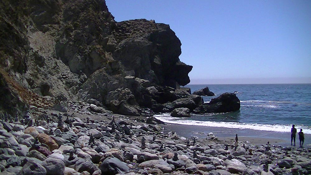
Figure 12.3. Jade Beach, CA
Primary Coasts - 5 Types
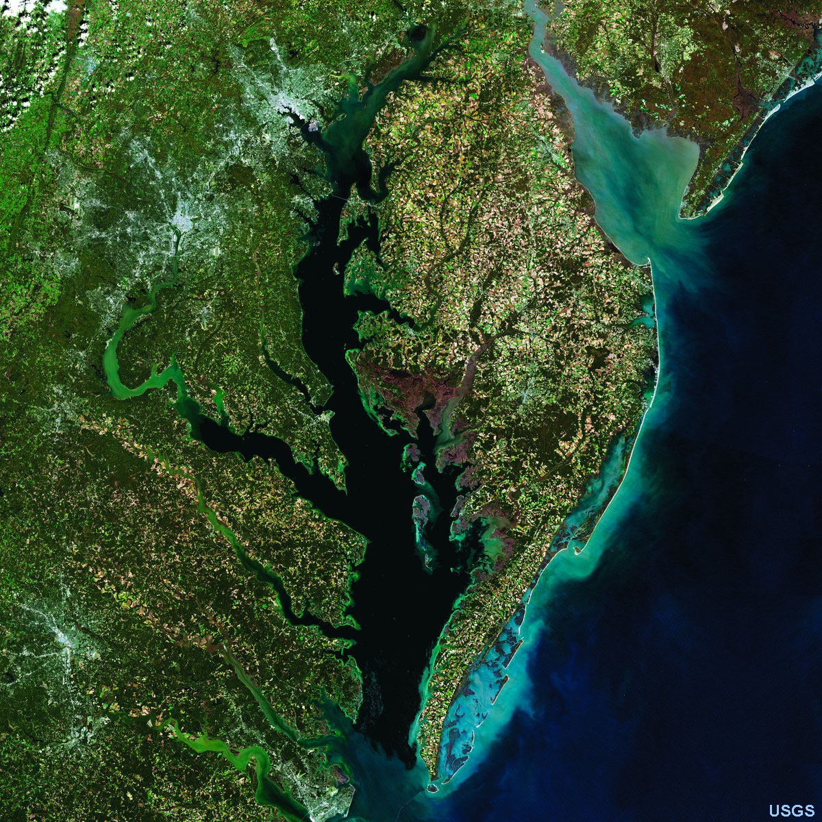
Ria Coasts: Drowned river valleys caused by a rise in sea level.
Examples: Chesapeake Bay (Figure 12.4).
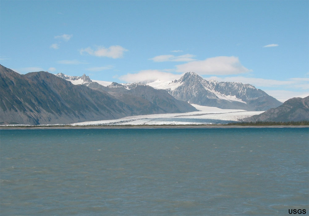
Glacial Coasts: Coastlines influenced by recent glacial activity such as glacial cut “U shaped” valleys called “fjords.” Examples: Norway, British Columbia, Alaska, Hudson Valley, New England region, Long Island (Figure 12.5).
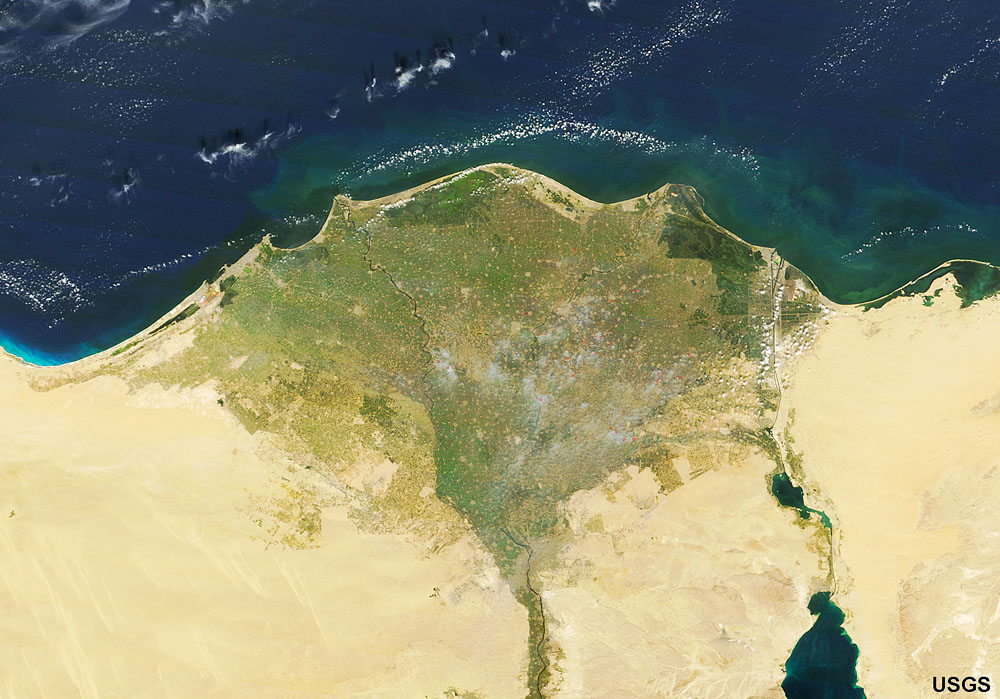
Deltaic Coasts: Coastlines associated with active river and delta systems.
Examples: Mississippi and Nile Rivers (Figure 12.6).
Volcanic Coasts: Coastlines associated with recent or active volcanoes (mostly basaltic or andesitic volcanoes).
Examples: Hawaii, Aleutian Islands, Japan, Philippines, Indonesia (Figure 12.7).
Fault/tectonic Coasts: Coastlines associated with major active fault systems along continental margins
Example: San Andreas fault going off shore at San Francisco (Figure 12.8).
 |
 |
 |
 |
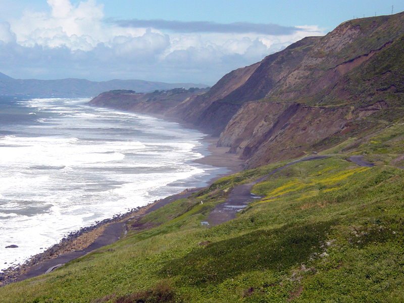 |
| Figure 12.4. Ria Coast: Chesapeake and Delaware Bays (estuaries), and the Delmarva Peninsula. Sea-level rise has back filled river valleys draining into the Atlantic Ocean. Ridges on land became peninsulas. | Figure 12.5. Glacial Coast: Kenai Fjords NP, Alaska | Figure 12.6. Deltaic Coast: Nile River Delta | Figure 12.7. Volcanic Coast: Hawaii Volcanoes NP | Figure 12.8. Tectonic Coast: Thornton SP, San Francisco |
Secondary Coasts
Secondary coasts are coastlines that have been significantly changed by marine processes after sea level has stabilized allowing erosional and/or depositional processes to dominate shaping of the landscape. However, to explain this better, we need to examine the other classifications of coastlines first.
Both primary and secondary coasts are influenced by whether they are active or passive continental margins (the second method of coast classification).
Both primary and secondary coasts are influenced by whether they are emergent or submergent coastlines (the third method of coast classification - discussed below). Passive margins tend to be submergent due to the ongoing rise in sea level (Figure 12.10). In contrast, active margins can be both emergent or submergent depending on local tectonic forces, such as caused by faulting.
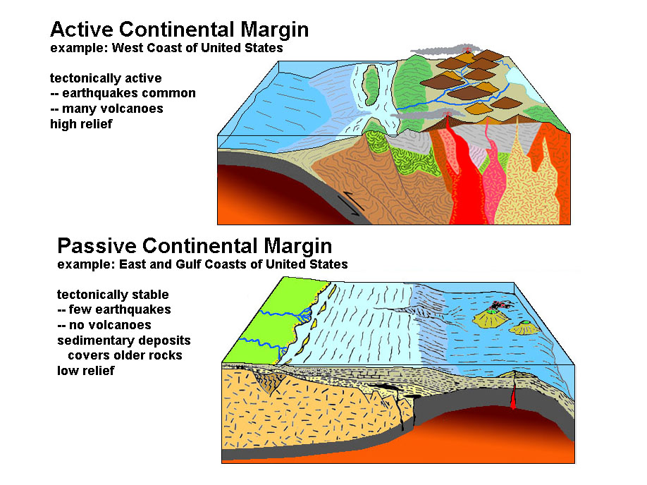 |
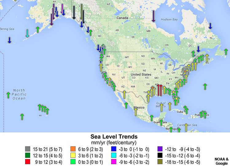 |
| Figure 12.9. Active versus passive continental margins. | Figure 12.10. Changing sea level trends around North America. |