
14.3: Lab Exercise (Part A)
- Page ID
- 5712

\( \newcommand{\vecs}[1]{\overset { \scriptstyle \rightharpoonup} {\mathbf{#1}} } \)
\( \newcommand{\vecd}[1]{\overset{-\!-\!\rightharpoonup}{\vphantom{a}\smash {#1}}} \)
\( \newcommand{\id}{\mathrm{id}}\) \( \newcommand{\Span}{\mathrm{span}}\)
( \newcommand{\kernel}{\mathrm{null}\,}\) \( \newcommand{\range}{\mathrm{range}\,}\)
\( \newcommand{\RealPart}{\mathrm{Re}}\) \( \newcommand{\ImaginaryPart}{\mathrm{Im}}\)
\( \newcommand{\Argument}{\mathrm{Arg}}\) \( \newcommand{\norm}[1]{\| #1 \|}\)
\( \newcommand{\inner}[2]{\langle #1, #2 \rangle}\)
\( \newcommand{\Span}{\mathrm{span}}\)
\( \newcommand{\id}{\mathrm{id}}\)
\( \newcommand{\Span}{\mathrm{span}}\)
\( \newcommand{\kernel}{\mathrm{null}\,}\)
\( \newcommand{\range}{\mathrm{range}\,}\)
\( \newcommand{\RealPart}{\mathrm{Re}}\)
\( \newcommand{\ImaginaryPart}{\mathrm{Im}}\)
\( \newcommand{\Argument}{\mathrm{Arg}}\)
\( \newcommand{\norm}[1]{\| #1 \|}\)
\( \newcommand{\inner}[2]{\langle #1, #2 \rangle}\)
\( \newcommand{\Span}{\mathrm{span}}\) \( \newcommand{\AA}{\unicode[.8,0]{x212B}}\)
\( \newcommand{\vectorA}[1]{\vec{#1}} % arrow\)
\( \newcommand{\vectorAt}[1]{\vec{\text{#1}}} % arrow\)
\( \newcommand{\vectorB}[1]{\overset { \scriptstyle \rightharpoonup} {\mathbf{#1}} } \)
\( \newcommand{\vectorC}[1]{\textbf{#1}} \)
\( \newcommand{\vectorD}[1]{\overrightarrow{#1}} \)
\( \newcommand{\vectorDt}[1]{\overrightarrow{\text{#1}}} \)
\( \newcommand{\vectE}[1]{\overset{-\!-\!\rightharpoonup}{\vphantom{a}\smash{\mathbf {#1}}}} \)
\( \newcommand{\vecs}[1]{\overset { \scriptstyle \rightharpoonup} {\mathbf{#1}} } \)
\( \newcommand{\vecd}[1]{\overset{-\!-\!\rightharpoonup}{\vphantom{a}\smash {#1}}} \)
\(\newcommand{\avec}{\mathbf a}\) \(\newcommand{\bvec}{\mathbf b}\) \(\newcommand{\cvec}{\mathbf c}\) \(\newcommand{\dvec}{\mathbf d}\) \(\newcommand{\dtil}{\widetilde{\mathbf d}}\) \(\newcommand{\evec}{\mathbf e}\) \(\newcommand{\fvec}{\mathbf f}\) \(\newcommand{\nvec}{\mathbf n}\) \(\newcommand{\pvec}{\mathbf p}\) \(\newcommand{\qvec}{\mathbf q}\) \(\newcommand{\svec}{\mathbf s}\) \(\newcommand{\tvec}{\mathbf t}\) \(\newcommand{\uvec}{\mathbf u}\) \(\newcommand{\vvec}{\mathbf v}\) \(\newcommand{\wvec}{\mathbf w}\) \(\newcommand{\xvec}{\mathbf x}\) \(\newcommand{\yvec}{\mathbf y}\) \(\newcommand{\zvec}{\mathbf z}\) \(\newcommand{\rvec}{\mathbf r}\) \(\newcommand{\mvec}{\mathbf m}\) \(\newcommand{\zerovec}{\mathbf 0}\) \(\newcommand{\onevec}{\mathbf 1}\) \(\newcommand{\real}{\mathbb R}\) \(\newcommand{\twovec}[2]{\left[\begin{array}{r}#1 \\ #2 \end{array}\right]}\) \(\newcommand{\ctwovec}[2]{\left[\begin{array}{c}#1 \\ #2 \end{array}\right]}\) \(\newcommand{\threevec}[3]{\left[\begin{array}{r}#1 \\ #2 \\ #3 \end{array}\right]}\) \(\newcommand{\cthreevec}[3]{\left[\begin{array}{c}#1 \\ #2 \\ #3 \end{array}\right]}\) \(\newcommand{\fourvec}[4]{\left[\begin{array}{r}#1 \\ #2 \\ #3 \\ #4 \end{array}\right]}\) \(\newcommand{\cfourvec}[4]{\left[\begin{array}{c}#1 \\ #2 \\ #3 \\ #4 \end{array}\right]}\) \(\newcommand{\fivevec}[5]{\left[\begin{array}{r}#1 \\ #2 \\ #3 \\ #4 \\ #5 \\ \end{array}\right]}\) \(\newcommand{\cfivevec}[5]{\left[\begin{array}{c}#1 \\ #2 \\ #3 \\ #4 \\ #5 \\ \end{array}\right]}\) \(\newcommand{\mattwo}[4]{\left[\begin{array}{rr}#1 \amp #2 \\ #3 \amp #4 \\ \end{array}\right]}\) \(\newcommand{\laspan}[1]{\text{Span}\{#1\}}\) \(\newcommand{\bcal}{\cal B}\) \(\newcommand{\ccal}{\cal C}\) \(\newcommand{\scal}{\cal S}\) \(\newcommand{\wcal}{\cal W}\) \(\newcommand{\ecal}{\cal E}\) \(\newcommand{\coords}[2]{\left\{#1\right\}_{#2}}\) \(\newcommand{\gray}[1]{\color{gray}{#1}}\) \(\newcommand{\lgray}[1]{\color{lightgray}{#1}}\) \(\newcommand{\rank}{\operatorname{rank}}\) \(\newcommand{\row}{\text{Row}}\) \(\newcommand{\col}{\text{Col}}\) \(\renewcommand{\row}{\text{Row}}\) \(\newcommand{\nul}{\text{Nul}}\) \(\newcommand{\var}{\text{Var}}\) \(\newcommand{\corr}{\text{corr}}\) \(\newcommand{\len}[1]{\left|#1\right|}\) \(\newcommand{\bbar}{\overline{\bvec}}\) \(\newcommand{\bhat}{\widehat{\bvec}}\) \(\newcommand{\bperp}{\bvec^\perp}\) \(\newcommand{\xhat}{\widehat{\xvec}}\) \(\newcommand{\vhat}{\widehat{\vvec}}\) \(\newcommand{\uhat}{\widehat{\uvec}}\) \(\newcommand{\what}{\widehat{\wvec}}\) \(\newcommand{\Sighat}{\widehat{\Sigma}}\) \(\newcommand{\lt}{<}\) \(\newcommand{\gt}{>}\) \(\newcommand{\amp}{&}\) \(\definecolor{fillinmathshade}{gray}{0.9}\)Materials
We will explore the various physiographic provinces of the United States of America by looking closely at the National Parks that showcase iconic geologic and topological features within each region. For each park, examine the area using Google Earth. To get a better view of the features, making sure to zoom in and out and also click on multiple photographs posted (make sure that photos are checked in the layers box). More information about these and other parks can be found at www.nps.gov.
This lab is also cumulative in that you may need to review the material presented in previous chapters to answer the following questions.
Part A – National Parks
Crater Lake National Park
Crater Lake National Park (Figure 14.7) is located in southern Oregon and was established as a National Park in 1902. The main attraction at this park is Crater Lake, which at almost 2,000 feet is one of the deepest lakes on Earth. Search for 42 56 33.15N 122 06 14.89W and zoom out to an eye altitude of 15 miles.
1. What type of volcano is Crater Lake?
a. Composite Volcano
b. Shield Volcano
c. Caldera
d. Cinder Cone
2. What is the origin of this volcano?
a. Subduction of an oceanic plate at a Convergent Boundary
b. Subduction of a continental plate at a Convergent Boundary
c. Development of a Hotspot d. Continental Rifting
3. Crater Lake National Park is located in which of the following physiographic provinces?
a. Rocky Mountains
b. Sierra Nevada
c. Cascades
d. Columbia Plateau
e. Colorado Plateau
f. Basin and Range
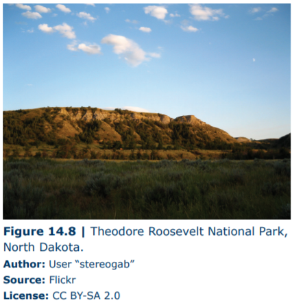
Theodore Roosevelt National Park
Theodore Roosevelt National Park (Figure 14.8) is located in North Dakota and was established as a National Park 1978. This park was named after Theodore Roosevelt in honor of his conservation policies that led to the establishment of the National Park System. Following the death of his wife, Roosevelt spent several years in the area that would ultimately become the park, during which time he wrote extensively about the lonely beauty of the surrounding landscape. Search for 46 58 52.55N 103 32 13.91W and zoom out to an eye altitude of 30,000 feet.
4. What is the prominent drainage pattern in this park?
a. Radial
b. Trellis
c. Rectangular
d. Dendritic
5. One of the main attractions at this park is a forest of large petrified trees. These trees were preserved by being replaced with silica from ash layers within the Triassic (Mesozoic) sandstones. Based on the geologic history and features of the area, which of the following statements about these sedimentary rocks is TRUE?
a. The clastic sand that forms these rocks was weathered and eroded from the Appalachian Mountains.
b. The ash was produced from volcanoes associated with the Yellowstone Hotspot.
c. The clastic sand that forms these rocks was weathered and eroded from the Rocky Mountains.
d. The clastic sand that forms these rocks was weathered and eroded from the Sierra Nevada Mountains.
6. Theodore Roosevelt National Park is located in which of the following physiographic provinces?
a. Rocky Mountains
b. Colorado Plateau
c. Interior Lowlands
d. Great Plains
e. Basin and Range
f. Columbia Plateau
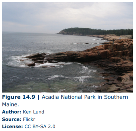
Acadia National Park
Acadia National Park (Figure 14.9) is located in Southern Maine and was preserved as a National Park in 1916. This was the first park established east of the Mississippi River and helped Maine gain the nickname “Vacationland”. Search for 44 21 09.94N 68 13 23.22W and zoom out to an eye altitude of 3,000 feet.
7. Based on the history of the region containing Acadia National Park and the color of the rocks, what type of igneous rock occur in this area?
a. Gabbro
b. Granite
c. Rhyolite
d. Andesite
e. Diorite
8. What type of igneous body does this structure represent?
a. Stock
b. Dike
c. Sill
9. Acadia National Park is located in which of the following physiographic provinces?
a. Interior Lowlands
b. Adirondacks
c. Great Plains
d. Appalachian Plateau
e. New England
f. Piedmont
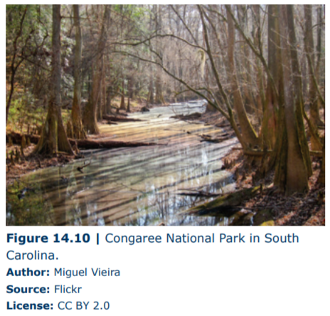
Congaree National Park Congaree National Park (Figure 14.10) is located in South Carolina and was recently established as a National Park in 2003. Unlike most National Parks, this area was preserved for reasons other than geology. Congaree contains the oldest tract of old-growth hardwood forest left in the United States. This lush ecosystem contains a diverse assemblage of animals, fungi, and plants. Search for 33 47 57.63N 80 47 49.79W and zoom out to an eye altitude of 35,000 feet.
10. What is the maturity of the river in this area?
a. Youthful
b. Mature
c. Old Age
11. Zoom out to an eye altitude of 500 miles to see the source of the sediment that is accumulating in this area. This sediment is __________ and if lithified would be called _________.
a. Immature, Conglomerate
b. Intermediate, Sandstone
c. Mature, Shale
12. Congaree National Park is located in which of the following physiographic provinces?
a. Interior Lowlands
b. Blue Ridge
c. Piedmont
d. Coastal Plain
e. New England
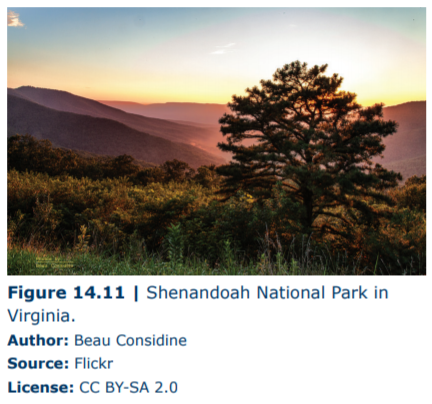
Shenandoah National Park Shenandoah National Park (Figure 14.11) is located in Virginia and was established as a National Park in 1935. This park, which is located close to Washington, D.C., is a favorite of hikers containing 101 miles of the Appalachian Trail, which runs from Northern Georgia to Maine. Search for 38 17 53.72N 78 40 26.42W and zoom out to an eye altitude of 25,000 feet.
13. Look over the region and examine the mountains, note their shape, ground cover, and height. Then Search for 43 48 25.03N 110 50 26.19W to examine Grand Tetons National Park. How do the Shenandoah Mountains compare to the Rocky Mountains?
a. The Shenandoah Mountains are shorter.
b. The Shenandoah Mountains are more rounded.
c. The Shenandoah Mountains have more vegetation.
d. All of the above.
14. Based on these observations, we can conclude that the mountains in Shenandoah National Park have undergone _________erosion and are _____________ the Rocky Mountains.
a. more, older than
b. less, younger than
c. the same amount of, the same age as
15. Shanandoah National Park is located in which of the following physiographic provinces?
a. Blue Ridge
b. Piedmont
c. Appalachian Plateau
d. Valley and Ridge
e. Adirondack
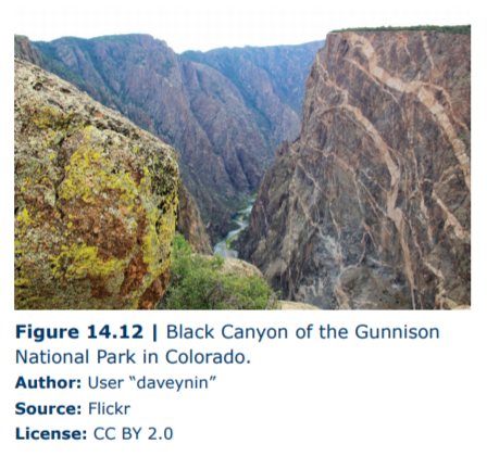
Black Canyon of the Gunnison National Park Black Canyon of the Gunnison National Park (Figure 14.12) is located in Western Colorado and was established as a National Park in 1999. This park is often overshadowed by the Grand Canyon but is striking in its own right. The Gunnison River has a high gradient, which has produced an incredibly steep canyon. In fact, it is called Black Canyon not because of the color of the rocks, but because of the dark shadows produced by the steep walls of the canyon. Search for 38 34 43.18N 107 43 43.74W and zoom out to an eye altitude of 30,000 feet.
16. What type of weathering is primarily responsible for the formation of this canyon?
a. Frost wedging
b. Chemical weathering
c. Mechanical weathering from air
d. Mechanical weathering from water
17. We can measure the rate of erosion in this canyon at about 0.01 inches/year. Based on this rate, when did the canyon start to erode? (Hint: Measure the difference in elevation from the bottom of the canyon at the latitude and longitude given above and the top, measured at the road on the edge of the canyon due south of the previous point. Then divide by the rate of erosion. Make sure to use the correct units.)
a. 750,000 years
b. 1,200,000 years
c. 2,700,000 years
d. 3,500,000 years
18. Black Canyon of the Gunnison National Park is located in which of the following physiographic provinces?
a. Blue Ridge
b. Colorado Plateau
c. Appalachian Plateau
d. Rocky Mountains
e. Basin and Range
f. Columbia Plateau