3.2.2: Bodega Head
- Page ID
- 705

Background
"One of our stops was Bodega Head. This beach is surrounded by large promontories, and is largely used recreationally by visitors. It lies just West of the San Andreas fault, and has coarse-sanded beaches with intrusive igneous parent material."
Walk down to the beach and observe the source material for the sands. The proximity to the San Andreas brought over the granitic rock of Bodega Bay, which differs from the Franciscan Complex on the mainland1. The fault actually shifted this area about 15 ft to the North as a result of the 1906 San Francisco earthquake. The Pacific Gas & Electric Company once tried to construct a nuclear power plant on Bodega Head in the 1950s2, but this plan was ultimately stopped when realizing the hazards associated with seismic activity in the area. The abandoned site, which has since become a pond, is called "Hole in the Head".
- U.S. Geological Survey Geographic Names Information System: Bodega Head
- Paula Garb. Critical Masses: Opposition to Nuclear Power in California, 1958-1978 (book review) Journal of Political Ecology, Vol 6, 1999.
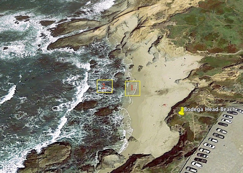
Photo taken from Google Earth and edited, there are cars for scale.
This is an area of Bay Head Beach. This photo shows the change in activity level throughout the beach. Medium energy waves can be observed in the swashzone at point 1. Higher energy waves can be observed at point 2.

This is side-view of Bodega Head Beach, those are people on the beach for scale. Our group collected two samples, one collected near point A and one from Point B. The samples show a difference in grain size, and sorting. Point A had well sorted grains while point B had very poorly sorted grains.
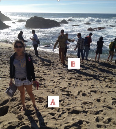
This image shows a rapid change of grain size and sorting observed in the transition from the swash zone to the breaker zone. Point B (Sample BH-1) grains are still course grained as high tide moves the breaker zone up to this point, though they are still more sorted and finer than sediment at point A (Sample BH-2).
Samples and Schematics

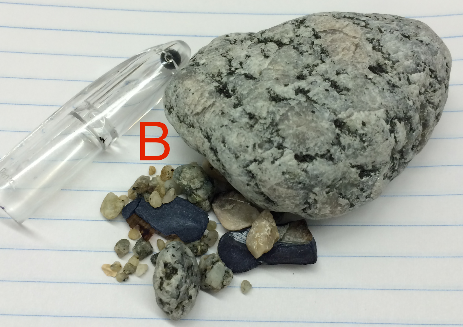
BH – 2:
Bodega Head
Sediment is local to igneous rock in the area.
- Collected: During high tides, it becomes the breaker zone. During low tides, it is the swash zone.
- Grain size: Coarse/Subangular – angular
- Sorting: Well sorted; however, the sorting declines if you go dig down a few decimeters.
- Interpreted energy: Medium – high energy
- Composition: 67% - Quartz, 30% - Lithics, 3% - Shells
- Facies - Fine
BH – 1
Bodega Head
Sediment is local to igneous rock in the area.
- Collected: Breaker zone
- Grain size: Very large pebble to granule
- Sorting: Very poorly sorted, subangular - subrounded
- Interpreted energy: Very high energy
- Composition: 40% - Lithics, 50% - Quartz, 7% - Shell Fragments, 3% - Feldspar
- Facies - Coarse
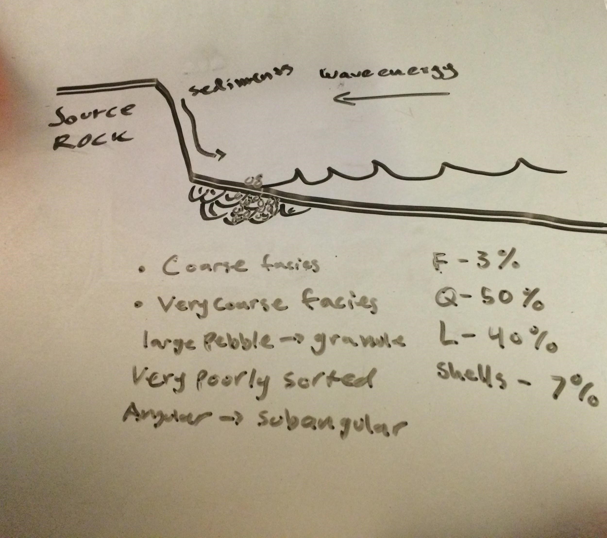
Bodega Head has a cliffside that is directly facing the ocean. The energy that brought by wave motion is thus high and is responsible for erosion of the source rock. Large grain sediments are found at the base of the cliff because they have been actively weathered out of the rock and have not traveled a long distance. In this environment, we observe the coarse facies from before and a new very coarse facies. In this new facies, we can expect to find large pebble to granule-sized sediments that are very poorly sorted and angular to subangular. The composition of the very coarse facies consists of mostly quartz then lithics followed by shells and feldspar.
Module D
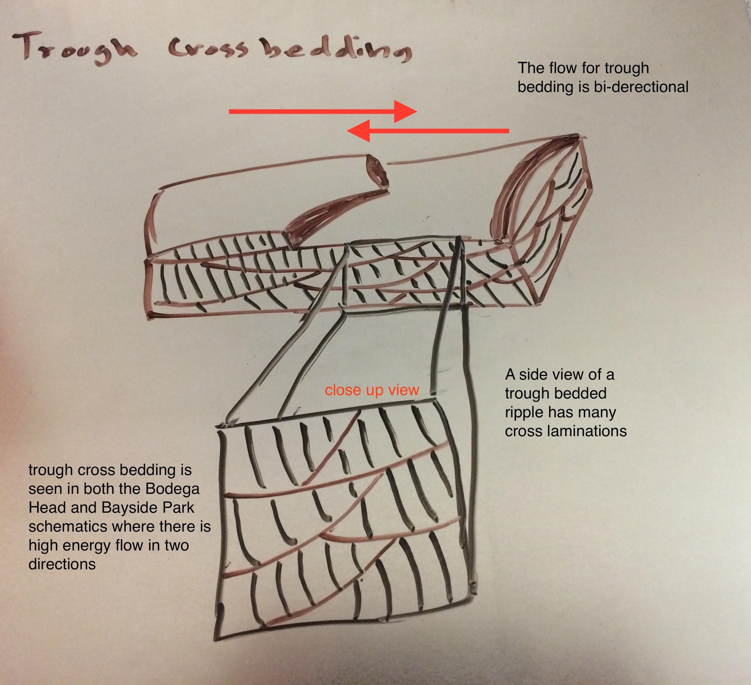
Ripple Schematics from Bay Head and Salmon Creek/Bayside Park: