11.7: Cyclones
- Page ID
- 12865
\( \newcommand{\vecs}[1]{\overset { \scriptstyle \rightharpoonup} {\mathbf{#1}} } \)
\( \newcommand{\vecd}[1]{\overset{-\!-\!\rightharpoonup}{\vphantom{a}\smash {#1}}} \)
\( \newcommand{\dsum}{\displaystyle\sum\limits} \)
\( \newcommand{\dint}{\displaystyle\int\limits} \)
\( \newcommand{\dlim}{\displaystyle\lim\limits} \)
\( \newcommand{\id}{\mathrm{id}}\) \( \newcommand{\Span}{\mathrm{span}}\)
( \newcommand{\kernel}{\mathrm{null}\,}\) \( \newcommand{\range}{\mathrm{range}\,}\)
\( \newcommand{\RealPart}{\mathrm{Re}}\) \( \newcommand{\ImaginaryPart}{\mathrm{Im}}\)
\( \newcommand{\Argument}{\mathrm{Arg}}\) \( \newcommand{\norm}[1]{\| #1 \|}\)
\( \newcommand{\inner}[2]{\langle #1, #2 \rangle}\)
\( \newcommand{\Span}{\mathrm{span}}\)
\( \newcommand{\id}{\mathrm{id}}\)
\( \newcommand{\Span}{\mathrm{span}}\)
\( \newcommand{\kernel}{\mathrm{null}\,}\)
\( \newcommand{\range}{\mathrm{range}\,}\)
\( \newcommand{\RealPart}{\mathrm{Re}}\)
\( \newcommand{\ImaginaryPart}{\mathrm{Im}}\)
\( \newcommand{\Argument}{\mathrm{Arg}}\)
\( \newcommand{\norm}[1]{\| #1 \|}\)
\( \newcommand{\inner}[2]{\langle #1, #2 \rangle}\)
\( \newcommand{\Span}{\mathrm{span}}\) \( \newcommand{\AA}{\unicode[.8,0]{x212B}}\)
\( \newcommand{\vectorA}[1]{\vec{#1}} % arrow\)
\( \newcommand{\vectorAt}[1]{\vec{\text{#1}}} % arrow\)
\( \newcommand{\vectorB}[1]{\overset { \scriptstyle \rightharpoonup} {\mathbf{#1}} } \)
\( \newcommand{\vectorC}[1]{\textbf{#1}} \)
\( \newcommand{\vectorD}[1]{\overrightarrow{#1}} \)
\( \newcommand{\vectorDt}[1]{\overrightarrow{\text{#1}}} \)
\( \newcommand{\vectE}[1]{\overset{-\!-\!\rightharpoonup}{\vphantom{a}\smash{\mathbf {#1}}}} \)
\( \newcommand{\vecs}[1]{\overset { \scriptstyle \rightharpoonup} {\mathbf{#1}} } \)
\(\newcommand{\longvect}{\overrightarrow}\)
\( \newcommand{\vecd}[1]{\overset{-\!-\!\rightharpoonup}{\vphantom{a}\smash {#1}}} \)
\(\newcommand{\avec}{\mathbf a}\) \(\newcommand{\bvec}{\mathbf b}\) \(\newcommand{\cvec}{\mathbf c}\) \(\newcommand{\dvec}{\mathbf d}\) \(\newcommand{\dtil}{\widetilde{\mathbf d}}\) \(\newcommand{\evec}{\mathbf e}\) \(\newcommand{\fvec}{\mathbf f}\) \(\newcommand{\nvec}{\mathbf n}\) \(\newcommand{\pvec}{\mathbf p}\) \(\newcommand{\qvec}{\mathbf q}\) \(\newcommand{\svec}{\mathbf s}\) \(\newcommand{\tvec}{\mathbf t}\) \(\newcommand{\uvec}{\mathbf u}\) \(\newcommand{\vvec}{\mathbf v}\) \(\newcommand{\wvec}{\mathbf w}\) \(\newcommand{\xvec}{\mathbf x}\) \(\newcommand{\yvec}{\mathbf y}\) \(\newcommand{\zvec}{\mathbf z}\) \(\newcommand{\rvec}{\mathbf r}\) \(\newcommand{\mvec}{\mathbf m}\) \(\newcommand{\zerovec}{\mathbf 0}\) \(\newcommand{\onevec}{\mathbf 1}\) \(\newcommand{\real}{\mathbb R}\) \(\newcommand{\twovec}[2]{\left[\begin{array}{r}#1 \\ #2 \end{array}\right]}\) \(\newcommand{\ctwovec}[2]{\left[\begin{array}{c}#1 \\ #2 \end{array}\right]}\) \(\newcommand{\threevec}[3]{\left[\begin{array}{r}#1 \\ #2 \\ #3 \end{array}\right]}\) \(\newcommand{\cthreevec}[3]{\left[\begin{array}{c}#1 \\ #2 \\ #3 \end{array}\right]}\) \(\newcommand{\fourvec}[4]{\left[\begin{array}{r}#1 \\ #2 \\ #3 \\ #4 \end{array}\right]}\) \(\newcommand{\cfourvec}[4]{\left[\begin{array}{c}#1 \\ #2 \\ #3 \\ #4 \end{array}\right]}\) \(\newcommand{\fivevec}[5]{\left[\begin{array}{r}#1 \\ #2 \\ #3 \\ #4 \\ #5 \\ \end{array}\right]}\) \(\newcommand{\cfivevec}[5]{\left[\begin{array}{c}#1 \\ #2 \\ #3 \\ #4 \\ #5 \\ \end{array}\right]}\) \(\newcommand{\mattwo}[4]{\left[\begin{array}{rr}#1 \amp #2 \\ #3 \amp #4 \\ \end{array}\right]}\) \(\newcommand{\laspan}[1]{\text{Span}\{#1\}}\) \(\newcommand{\bcal}{\cal B}\) \(\newcommand{\ccal}{\cal C}\) \(\newcommand{\scal}{\cal S}\) \(\newcommand{\wcal}{\cal W}\) \(\newcommand{\ecal}{\cal E}\) \(\newcommand{\coords}[2]{\left\{#1\right\}_{#2}}\) \(\newcommand{\gray}[1]{\color{gray}{#1}}\) \(\newcommand{\lgray}[1]{\color{lightgray}{#1}}\) \(\newcommand{\rank}{\operatorname{rank}}\) \(\newcommand{\row}{\text{Row}}\) \(\newcommand{\col}{\text{Col}}\) \(\renewcommand{\row}{\text{Row}}\) \(\newcommand{\nul}{\text{Nul}}\) \(\newcommand{\var}{\text{Var}}\) \(\newcommand{\corr}{\text{corr}}\) \(\newcommand{\len}[1]{\left|#1\right|}\) \(\newcommand{\bbar}{\overline{\bvec}}\) \(\newcommand{\bhat}{\widehat{\bvec}}\) \(\newcommand{\bperp}{\bvec^\perp}\) \(\newcommand{\xhat}{\widehat{\xvec}}\) \(\newcommand{\vhat}{\widehat{\vvec}}\) \(\newcommand{\uhat}{\widehat{\uvec}}\) \(\newcommand{\what}{\widehat{\wvec}}\) \(\newcommand{\Sighat}{\widehat{\Sigma}}\) \(\newcommand{\lt}{<}\) \(\newcommand{\gt}{>}\) \(\newcommand{\amp}{&}\) \(\definecolor{fillinmathshade}{gray}{0.9}\)
Cyclones can be the most intense storms on Earth. A cyclone is a system of winds rotating counterclockwise in the Northern Hemisphere around a low pressure center. The swirling air rises and cools, creating clouds and precipitation.
There are two types of cyclones: middle latitude (mid-latitude) cyclones and tropical cyclones. Mid-latitude cyclones are the main cause of winter storms in the middle latitudes. Tropical cyclones are also known as hurricanes.
An anticyclone is the opposite of a cyclone. An anticyclone’s winds rotate clockwise in the Northern Hemisphere around a center of high pressure. Air comes in from above and sinks to the ground. High pressure centers generally have fair weather.
Mid-Latitude Cyclones

Mid-latitude cyclones, sometimes called extratropical cyclones, form at the polar front when the temperature difference between two air masses is large. These air masses blow past each other in opposite directions. Coriolis Effect deflects winds to the right in the Northern Hemisphere, causing the winds to strike the polar front at an angle. Warm and cold fronts form next to each other. Most winter storms in the middle latitudes, including most of the United States and Europe, are caused by mid-latitude cyclones.The warm air at the cold front rises and creates a low pressure cell. Winds rush into the low pressure and create a rising column of air. The air twists, rotating counterclockwise in the Northern Hemisphere and clockwise in the Southern Hemisphere. Since the rising air is moist, rain or snow falls.
Mid-latitude cyclones form in winter in the mid-latitudes and move eastward with the westerly winds. These two- to five-day storms can reach 1,000 to 2,500 km (625 to 1,600 miles) in diameter and produce winds up to 125 km (75 miles) per hour. Like tropical cyclones, they can cause extensive beach erosion and flooding.Mid-latitude cyclones are especially fierce in the mid-Atlantic and New England states where they are called nor’easters, because they come from the northeast. About 30 nor’easters strike the region each year.
Hurricanes

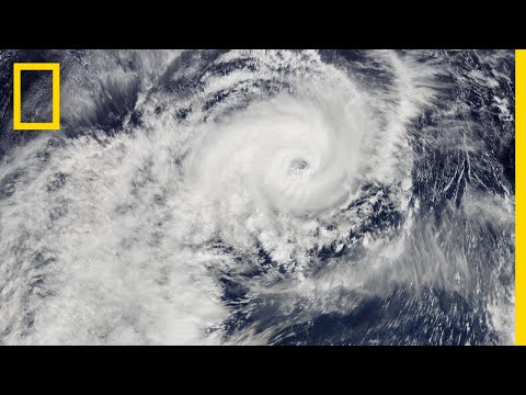
Tropical cyclones have many names. They are called hurricanes in the North Atlantic and eastern Pacific oceans, typhoons in the western Pacific Ocean, tropical cyclones in the Indian Ocean, and willi-willi’s in the waters near Australia. By any name, they are the most damaging storms on Earth. Hurricanes arise in the tropical latitudes (between 10 degrees and 25 degrees N) in summer and autumn when sea surface temperature are 28 degrees C (82 degrees F) or higher. The warm seas create a large humid air mass. The warm air rises and forms a low pressure cell, known as a tropical depression. Thunderstorms materialize around the tropical depression.If the temperature reaches or exceeds 28 degrees C (82 degrees F) the air begins to rotate around the low pressure (counterclockwise in the Northern Hemisphere and clockwise in the Southern Hemisphere).
As the air rises, water vapor condenses, releasing energy from latent heat. If wind shear is low, the storm builds into a hurricane within two to three days.Hurricanes are huge with high winds. The exception is the relatively calm eye of the storm where air is rising upward. Rainfall can be as high as 2.5 cm (1″) per hour, resulting in about 20 billion metric tons of water released daily in a hurricane. The release of latent heat generates enormous amounts of energy, nearly the total annual electrical power consumption of the United States from one storm. Hurricanes can also generate tornadoes.
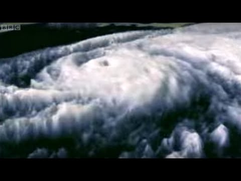
Hurricanes are huge with high winds. The exception is the relatively calm eye of the storm where air is rising upward. Rainfall can be as high as 2.5 cm (1 inch) per hour, resulting in about 20 billion metric tons of water released daily in a hurricane. The release of latent heat generates enormous amounts of energy, nearly the total annual electrical power consumption of the United States from one storm. Hurricanes can also generate tornadoes.Hurricanes are strange creatures because they are deadly monsters, yet have a gentle, but cold heart. The anatomy of a hurricane is fairly simple, though the processes involved are quite complex. As a low pressure disturbance forms, the warm, moist air rushes towards the low pressure in order to rise upward to form towering thunderstorms. Around the low pressure disturbance is a wall of clouds called an eye wall. Within the eye wall, the wind speeds are greatest, the clouds are the tallest, atmospheric pressure is at its lowest, and precipitation is most intense.
At the center or heart of the hurricane is called the eye. Within the eye of a hurricane, winds are light, precipitation is minimal, and occasionally the skies above are clear. It is the calm region of the tropical storm, but that is what makes it so dangerous. Many people tend to go outside as the eye moves overhead because they believe the storm is over. But what some don’t realize is that “round two” is coming from behind.
Moving away from the eye wall are organized, intense thunderstorms, called spiral rain bands, that rotate around and toward the storm’s eye wall. These rain bands are the first
Hurricanes are assigned to categories based on their wind speed. The categories are listed on the Saffir-Simpson Scale.
| Category | MPH | Estimated Damage |
|---|---|---|
| 1 (Weak) | 74–95 | Above normal; no read damage to structures |
| 2 (Moderate) | 96–110 | Some property damage; considerable damage to vegetation |
| 3 (Strong) | 111–130 | Some buildings damaged; mobile homes destroyed |
| 4 (Very strong) | 131–156 | Complete roof failure on small residences; major beach erosion of beach areas |
| 5 (Devastating) | Over 156 | Complete roof and some building failure on most residential and industrial buildings |
Hurricanes move with the prevailing winds. In the Northern Hemisphere, they originate in the trade winds and move to the west. When they reach the latitude of the westerlies, they switch direction and travel toward the north or northeast. Hurricanes may cover 800 km (500 miles) in one day.Damage from hurricanes comes from the high winds, rainfall, and storm surge. Storm surge occurs as the storm’s low pressure center comes onto land, causing the sea level to rise unusually high. A storm surge is often made worse by the hurricane’s high winds blowing seawater across the ocean onto the shoreline. Flooding can be devastating, especially along low-lying coastlines such as the Atlantic and Gulf Coasts. Hurricane Camille in 1969 had a 7.3 m (24 foot) storm surge that traveled 125 miles (200 km) inland.
Hurricanes typically last for 5 to 10 days. Over cooler water or land, the hurricane’s latent heat source shut downs and the storm weakens. When a hurricane disintegrates, it is replaced with intense rains and tornadoes.
There are about 100 hurricanes around the world each year, plus many smaller tropical storms and tropical depressions. As people develop coastal regions, property damage from storms continues to rise. However, scientists are becoming better at predicting the paths of these storms and fatalities are decreasing. There is, however, one major exception to the previous statement: Hurricane Katrina.
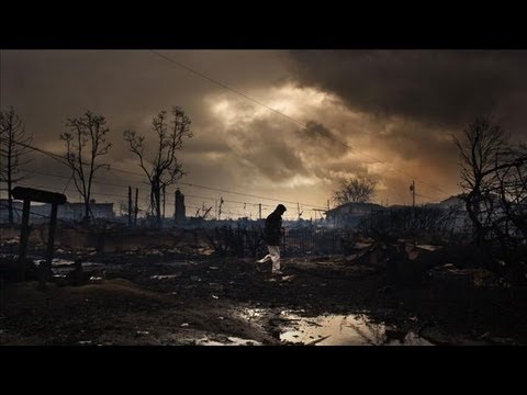
For over a decade, the conversation in the United States over hurricanes was directed toward Hurricane Katrina. But in late October 2012, a Category 3 hurricane called Hurricane Sandy, sometimes called Superstorm Sandy, struck the eastern coast of the United States. It is estimaged that the storm system caused $68 billion in damage and killed nearly 300 people.
What made Hurricane Sandy different from most tropical storms was how powerful it was so late in the hurricane season. The concern is that as the planet warms from anthropogenic (human-enhanced) climate change, the oceans will likely warm up allow hurricanes to become stronger, travel farther toward the poles, and the hurricane season last longer.
To view an interactive map on hurricanes created by the National Oceanic and Atmospheric Administration, click here.
Blizzards and Lake Effects
A blizzard is distinguished by certain conditions:
- Temperatures below –7 degrees C (20 degrees F); –12oC (10 degrees F) for a severe blizzard.
- Winds greater than 56 kmh (35 mph); 72 kmh (45 mph) for a severe blizzard.
- Snow so heavy that visibility is 2/5 km (1/4 mile) or less for at least three hours; near zero visibility for a severe blizzard.

Blizzards happen across the middle latitudes and toward the poles, usually as part of a mid-latitude cyclone. Blizzards are most common in winter, when the jet stream has traveled south and a cold, northern air mass comes into contact with a warmer, semitropical air mass. The very strong winds develop because of the pressure gradient between the low pressure storm and the higher pressure west of the storm. Snow produced by the storm gets caught in the winds and blows nearly horizontally. Blizzards can also produce sleet or freezing rain.
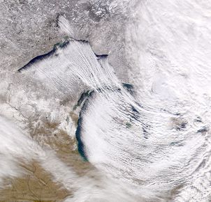
In winter, a continental polar air mass travels down from Canada. As the frigid air travels across one of the Great Lakes, it warms and absorbs moisture. When the air mass reaches the leeward side of the lake, it is very unstable and it drops tremendous amounts of snow. This lake-effect snow falls on the snowiest, metropolitan areas in the United States: Buffalo and Rochester, New York.
Heat Waves
Even more insidious are the deadliest weather phenomena, a heat wave. A heat wave is different for different locations; it is a long period of hot weather, at least 86 degrees F (30 degrees C) for at least three days in cooler locations but much more in hotter locations. Heat waves have increased in frequency and duration in recent years. What do you think caused the heat wave in the image below?

A high pressure zone kept the jet stream further north than normal for August.
- Dynamic Earth: Introduction to Physical Geography. Authored by: R. Adam Dastrup. Located at: http://www.opengeography.org/physical-geography.html. Project: Open Geography Education. License: CC BY-SA: Attribution-ShareAlike
- Hurricanes 101. Authored by: National Geographic. Located at: https://youtu.be/zP4rgvu4xDE. License: All Rights Reserved. License Terms: Standard YouTube License
- How a hurricane is born - The Science Of Superstorms. Authored by: BBCWorldwide. Located at: https://youtu.be/4f45jA5UxB0. License: All Rights Reserved. License Terms: Standard YouTube License
- Hurricane Sandy: As It Happened. Authored by: Wall Street Journal. Located at: https://youtu.be/KeaG1jRLIBw. License: All Rights Reserved. License Terms: Standard YouTube License
- Low pressure system over Iceland. Provided by: NASA. Located at: https://en.Wikipedia.org/wiki/File:Low_pressure_system_over_Iceland.jpg. License: Public Domain: No Known Copyright
- Mid-Latitude Cyclone over the United States. Provided by: NASA. Located at: https://earthobservatory.nasa.gov/NaturalHazards/view.php?id=52297. License: Public Domain: No Known Copyright
- Hurricane Floyd. Provided by: NOAA. Located at: https://commons.wikimedia.org/wiki/File:Hurricane_Floyd_1999-09-14.jpg. License: Public Domain: No Known Copyright
- Lake Effect Snow on Earth. Authored by: Robert Nemiroff (MTU) & Jerry Bonnell (USRA). Provided by: NASA. Located at: https://commons.wikimedia.org/wiki/File:Lake_Effect_Snow_on_Earth.jpg. License: Public Domain: No Known Copyright
- Heat Index. Provided by: NOAA. Located at: http://www.srh.noaa.gov/jetstream/global/hi.html. License: Public Domain: No Known Copyright


