

12.2: Eolian Processes and Erosional Landforms
- Page ID
- 42709

\( \newcommand{\vecs}[1]{\overset { \scriptstyle \rightharpoonup} {\mathbf{#1}} } \)
\( \newcommand{\vecd}[1]{\overset{-\!-\!\rightharpoonup}{\vphantom{a}\smash {#1}}} \)
\( \newcommand{\dsum}{\displaystyle\sum\limits} \)
\( \newcommand{\dint}{\displaystyle\int\limits} \)
\( \newcommand{\dlim}{\displaystyle\lim\limits} \)
\( \newcommand{\id}{\mathrm{id}}\) \( \newcommand{\Span}{\mathrm{span}}\)
( \newcommand{\kernel}{\mathrm{null}\,}\) \( \newcommand{\range}{\mathrm{range}\,}\)
\( \newcommand{\RealPart}{\mathrm{Re}}\) \( \newcommand{\ImaginaryPart}{\mathrm{Im}}\)
\( \newcommand{\Argument}{\mathrm{Arg}}\) \( \newcommand{\norm}[1]{\| #1 \|}\)
\( \newcommand{\inner}[2]{\langle #1, #2 \rangle}\)
\( \newcommand{\Span}{\mathrm{span}}\)
\( \newcommand{\id}{\mathrm{id}}\)
\( \newcommand{\Span}{\mathrm{span}}\)
\( \newcommand{\kernel}{\mathrm{null}\,}\)
\( \newcommand{\range}{\mathrm{range}\,}\)
\( \newcommand{\RealPart}{\mathrm{Re}}\)
\( \newcommand{\ImaginaryPart}{\mathrm{Im}}\)
\( \newcommand{\Argument}{\mathrm{Arg}}\)
\( \newcommand{\norm}[1]{\| #1 \|}\)
\( \newcommand{\inner}[2]{\langle #1, #2 \rangle}\)
\( \newcommand{\Span}{\mathrm{span}}\) \( \newcommand{\AA}{\unicode[.8,0]{x212B}}\)
\( \newcommand{\vectorA}[1]{\vec{#1}} % arrow\)
\( \newcommand{\vectorAt}[1]{\vec{\text{#1}}} % arrow\)
\( \newcommand{\vectorB}[1]{\overset { \scriptstyle \rightharpoonup} {\mathbf{#1}} } \)
\( \newcommand{\vectorC}[1]{\textbf{#1}} \)
\( \newcommand{\vectorD}[1]{\overrightarrow{#1}} \)
\( \newcommand{\vectorDt}[1]{\overrightarrow{\text{#1}}} \)
\( \newcommand{\vectE}[1]{\overset{-\!-\!\rightharpoonup}{\vphantom{a}\smash{\mathbf {#1}}}} \)
\( \newcommand{\vecs}[1]{\overset { \scriptstyle \rightharpoonup} {\mathbf{#1}} } \)
\(\newcommand{\longvect}{\overrightarrow}\)
\( \newcommand{\vecd}[1]{\overset{-\!-\!\rightharpoonup}{\vphantom{a}\smash {#1}}} \)
\(\newcommand{\ket}[1]{\left| #1 \right>}\)
\(\newcommand{\bra}[1]{\left< #1 \right|}\)
\(\newcommand{\braket}[2]{\left< #1 \vphantom{#2} \right| \left. #2 \vphantom{#1} \right>}\)
\(\newcommand{\braopket}[3]{\left< #1 \vphantom{#2}\vphantom{#3} \right| #2 \vphantom{#1}\vphantom{#3} \left| #3 \vphantom{#1}\vphantom{#2} \right>}\)
\(\newcommand{\qmvec}[1]{\mathbf{\vec{#1}}}\)
\(\newcommand{\op}[1]{\hat{\mathbf{#1}}}\)
\(\newcommand{\expect}[1]{\langle #1 \rangle}\)
\(\newcommand{\dfn}[1]{\emph{\textbf{#1}}}\)
Why Wind Activity Dominates Arid Deserts
Wind—technically referred to as an aeolian or eolian process—serves as the primary geomorphic force shaping desert landscapes. This dominance is driven by a distinct combination of atmospheric dynamics and surface conditions:
Convective Air Currents and Pressure Differentials
Wind is defined as air moving horizontally from zones of high pressure to zones of low pressure. During Summer months, the bare desert surface absorbs intense solar radiation and heats up rapidly. The air directly in contact with the ground absorbs this thermal energy, expands, becomes less dense, and ascends. This rapid upward movement generates a localized thermal low-pressure zone at the surface. Cooler, denser air from surrounding high-pressure systems quickly rushes inward to replace the rising air, creating strong, turbulent wind currents.
Soil Moisture Deficit
Arid regions are characterized by low annual precipitation along with high potential evaporation rates driven by intense heat. Consequently, desert soils remain severely dehydrated. Without water film to create surface tension and cohesive bonds between independent particles, loose minerals, sand grains, and rocks sit entirely unattached on the surface, making them highly vulnerable to wind displacement.
Absence of Frictional Obstructions and Anchors
The severely dry-environment naturally restricts plant growth, leaving landscapes largely devoid of vegetation. The absence of tall trees removes structural obstacles that would otherwise absorb kinetic energy and slow down wind velocity. Simultaneously, the lack of extensive plant root networks removes the physical matrix required to anchor the top layer of soil in place. Left completely unobstructed and unanchored, surface sediments are easily eroded, transported, and redistributed by the wind.
Processes of Wind Transportation
Much of our knowledge about sand transport dates back to the 1930's and 1940's when British Brigadier Ralph A. Bagnold conducted experiments while stationed in the desert of North Africa.
Suspension
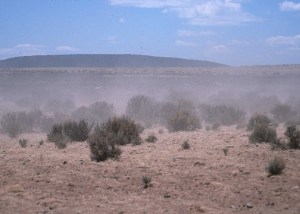
Light fine material are carried in suspension by the wind when it has a high level of energy. This material, carried by the wind in suspension, is used by the wind as tools for abrasion. Sometimes we can see the materials being carried by the wind when they are carried in high concentration. Dust storms are primarily composed of fine material that easily reduce visibilities to a few meters and can persist for hours. During a prolonged dry period, extraordinary amounts of valuable top soil was stripped from the Great Plains during the "Dust Bowl" period of the 1930's. Moister conditions returned and the application of soil conservation techniques have greatly reduced the erosive effects of wind. Sand storms are raging systems of blowing, stinging sand traveling a meter or two above the surface. Figure \(\PageIndex{1}\) is an astronaut photograph of a massive, swirling beige sandstorm completely blanketing the Qatar peninsula. The thick dust creates a sharp, curved front as it moves across the dark blue waters of the Persian Gulf toward the United Arab Emirates. Finer dust particles are lifted from the surface and suspended in the air at much greater heights than heavier sand grains.

Saltation
Some pebbles are carried by the wind in a hopping action where it carries the pebbles in suspension when its energy is high but since they are heavy the wind drops it as soon as its energy goes down. The hopping action of the pebbles is called saltation. Once airborne, sand grains travel downwind and then drop back to the surface several centimeters from their point of origin. With strong winds and turbulence, sand grains can be lifted as high as 2 meters and travel a distance of 10 meters or more. When a settling sand grain impacts the surface, it sends another grain of sand into the air to travel in the downwind direction. Watching this process in action makes sand appear to be bouncing along the surface. We call this process saltation which accounts for 75% to 80% of sand transport over sand dunes. Once saltation begins, transport can continue under somewhat lower wind speeds.
Creep
Heavy rocks and pebbles are often rolled by strong winds along the floor called creep. Sand generally begins to move when the wind achieves a velocity of about 4.5 m/sec. At first, sand exhibits a rolling motion called traction or surface creep. Approximately 20 to 25% of total sand transport during sand storms occurs by traction. As wind speed increases, grains are lifted into the air by wind gusts.
Wind Deposition
Wind deposits all the material that it is carrying with it as soon as its speed reduces making it difficult for it to carry materials. This can happen if there is an obstacle in its path. Topographic barriers or vegetation are commonly found obstacles. A landform commonly found as a result of wind deposition is a sand dune (Figure \(\PageIndex{2}\)).

Processes of Wind Erosion
The entire solid surface of the Earth is subject to wind erosion. It is the balance between the driving force of the wind and the resistance of the surface that ultimately determines whether surface materials are detached and transported away. Eolian processes have been enhanced by human activity over the past few centuries, especially in Asia and Africa. Overuse of soil and grazing land resources in semi-arid and arid and seasonally dry regions has led to extensive wind erosion and desertification. Wind shapes and breaks down the geography of the desert floor through three primary physical mechanisms:
Deflation
This process involves the direct lifting, scooping, and removal of loose, dry, unconsolidated fine-grained particles (such as clay, silt, and sand) from the ground by turbulent wind currents. The wind picks up these light materials and carries them away in turbulent suspension. Geomorphic environments highly vulnerable to deflation include dry desert basins, dry river courses (playas), coastal sand dunes, exposed agricultural farmlands, and loose glacial deposition zones. Over time, deflation sifts away the finer sediments, leaving behind excavated basins (deflation hollows) or concentrated surfaces of heavy pebbles too heavy for the wind to lift (desert pavements).
Abrasion
This mechanism is the mechanical wearing down of solid rock surfaces caused by the impact of windborne particles—functioning exactly like a natural sandblaster. As velocity drives the air current forward, suspended sand grains forcefully strike exposed bedrock formations, gradually chipping, scraping, and sculpting them away. Because heavier, highly abrasive quartz sand grains travel close to the ground via saltation (short bouncing leaps), the zone located 10 to 40 centimeters above the surface bears the overwhelming brunt of this impact, frequently undercutting the bases of standing rock structures.
Attrition
Unlike deflation and abrasion, which erode the stationary landscape, attrition is the wear and tear experienced directly by the moving sediments. As the wind transports sand grains and small pebbles across distances, the particles continuously collide, bump, and rub against one another mid-air and along the ground. This continuous kinetic friction breaks off sharp, angular corners, gradually smoothing and rounding the individual grains while systematically reducing their overall particle size over time.
Factors affecting wind erosion
The ability of the wind to erode the surface is determined by two factors, air density and wind velocity. The erosive power of the wind (E) is given as:
\[E\,=\,V^3\rho\]
where V = wind velocity, and \(\rho\) = air density. Density has relatively little impact on the power of the wind. The erosive force of the wind is primarily related to its velocity. Its importance is seen as erosive power varies with the third power of velocity. For instance, a doubling of the wind velocity increases the erosive power by 8 fold while a tripling of velocity produces a 27 fold increase.
The roughness length of the surface (z0), a parameter based on the size and distance between objects in a group, has a critical control over the velocity of the wind. Grass, shrubs, and trees, all impart a drag on the wind to reduce its erosive force. Vegetation also acts to bind soil particles to the surface. A surface without a cover of vegetation exposes soil to the direct force of the wind making erosion more effective. Thus, dry regions lacking a protective cover of vegetation display the effects of wind erosion more than humid climates.
|
Type of Surface |
zo(cm) |
|---|---|
|
Fir Forest |
283.0 |
|
Citrus Orchard |
198.0 |
|
Large City (Tokyo) |
165 |
|
Corn Field |
84.5 |
|
Wheat Field |
23.0 |
|
Grass |
10.0 |
|
Dry Lake Bed |
0.003 |
The roughness of a landscape shown in Table \(\PageIndex{1}\) —which tells us how much the ground slows down the wind—changes completely depending on what is covering the surface. A fir forest creates the most friction for the wind, measuring at 283.0 cm while a citrus orchard follows at 198.0 cm. Tall structures in a large city like Tokyo also create a lot of drag, coming in at 165 cm. Farm fields slow the wind down much less: a corn field measures at 84.5 cm, and a wheat field drops significantly to 23.0 cm. Shorter plants like regular grass have a low measurement of 10.0 cm, while a completely flat, wide-open dry lake bed offers almost zero resistance at a tiny 0.003 cm.
The cohesiveness of surface materials affects the resistance of the surface to erosion. Clay particles exhibit a greater degree of cohesiveness than sand. Clay-rich soils tend to resist erosion by wind more than less cohesive materials. Thus, clays require a much higher threshold velocity for detachment than one would expect. Cohesiveness may be provided by a cementing agent as well. Calcium carbonate and other salts common to desert regions deposited in inter-particle voids harden and bind particles together.
Features of wind erosion
In arid regions, weathering initiates the breakdown of rocks into sand. Processes like thermal expansion, freeze-thaw cycles, and exfoliation are highly active in these dry climates. Additionally, even the limited rainfall these areas receive triggers chemical reactions that weaken rock structures, leaving them highly vulnerable to wind erosion.
Desert Pavement
Landscapes formed by wind action are shaped either by the removal of fine particles or by the abrasive sculpting of moving material. Deflation specifically lifts and removes loose surface particles, leaving behind iconic features known as desert pavements or desert lag. These cobblestone-like layers develop when winds erode fine particles from mixed soils, leaving a protective blanket of larger stones across desert flats, alluvial fans, bajadas, and river terraces. The terminology for these terrains changes by region, with Saharan surfaces designated as regs or hammadas, and Australian interiors called gibber plains. Over millennia, exposure to the elements coats these interlocking stones in desert varnish, a dark, shiny glaze of iron and manganese oxides that forms an armor protecting the vulnerable, finer soils underneath from further erosion.
Geomorphologists attribute the development of these pavements to a combination of long-term eolian and hydraulic processes. The traditional explanation focuses on deflation and lag concentration, where wind strips away fine sand and silt while leaving behind the heavier pebbles and cobbles it cannot transport. However, infrequent but intense desert rainfall also plays a critical role by washing subsurface silt downward and later inducing rapid evaporation. This upward capillary action draws moisture back to the surface, precipitating mineral salts like calcium carbonate and gypsum that act as a natural cement to bind the stones into a durable conglomerate. Alternatively, modern science highlights dust accretion, a process where an initial layer of stones traps wind-blown atmospheric dust. Subsequent rains wash these fine particles beneath the rocks, creating an expanding soil bed that lifts the interlocking gravel pavement upward over time.
Once fully consolidated, this interlocking surface functions as a remarkably effective shield that halts erosion by locking the fine underlying dirt away from the wind. Because these pavements provide firm, stable terrain compared to shifting sand dunes, they historically served as favored caravan routes through regions like the Sahara. However, this geomorphic stability exists in a delicate ecological balance. The protective seal relies entirely on the uninterrupted tension of the stones, meaning that any disruption caused by human activity or vehicular traffic exposes the highly erodible subsurface sediments. Once broken, the exposed fine silt can easily be lifted by the wind, re-triggering severe erosion and generating hazardous dust storms.

Deflation Hollow
Deflation can result in blowout depressions, which are basins ranging in size from less than a meter to many meters deep. This process begins when the chemical weathering of cementing materials loosens particle cohesiveness, enabling wind erosion. The wind then picks up the loose soil through deflation; meanwhile, heavier materials may be rolled along the ground and deposited miles away, creating the hollow. This continuous deflation lowers the land surface down to the water table. The depth of the depression is strictly restricted to the level of the water table because, below this point, the soil becomes wet and difficult for the wind to carry. Some extremely large depressions, like the Qattara Depression in the Western Desert of Egypt (shown in Figure \(\PageIndex{5}\)), are partially a result of deflation.

When these deflation hollows reach down to the water table, they create an oasis. Once the basin floor intersects this saturated zone, water begins to seep or spring out, forming a permanent or semi-permanent lake or pond within the depression. This reliable water source allows vegetation, such as date palms and grasses, to flourish, creating an oasis in an otherwise dry landscape. Siwa Oasis (shown in Figure \(\PageIndex{6}\)) in Egypt is an example of an oasis formed in this manner.

Ventifacts
Ventifacts (shown in Figure \(\PageIndex{7}\)) are smooth, faceted rocks with distinctively polished surfaces formed by wind-driven sand abrasion. The number of flat, sharp-edged faces a ventifact develops depends entirely on shifting wind directions, which dictate which sides of the rock are exposed to sandblasting over time. Geologists classify these rocks based on the number of abraded faces they display, using specific German-derived terms:
Einkanter: A ventifact with one faceted surface
Zweikanter: A ventifact with two wind-faceted surfaces.
Dreikanter: The most common variety, featuring three distinct, wind-carved faces.
Vierkanter: A rarer variety boasting four wind-faceted surfaces.

Mushroom Rock
Rock pedestals are pillars of rock formed by differential erosion, where wind and water wear away softer rock layers faster than harder, resistant layers. While they can take many shapes, a specific type known as a mushroom rock (illustrated in Figure \(\PageIndex{8}\)) forms when wind abrasion is concentrated heavily at the base. Because wind carries heavier, abrasive sediments close to the ground, the bottom wears away into a narrow stalk, leaving a wide capstone. In the Sahara, these mushroom-shaped variations are called gour.

Zeugen
Zeugen, shown in Figure \(\PageIndex{9}\), form a ridge and furrow landscape where rocks are arranged in alternating horizontal bands of hard and soft layers. The process begins when weathering opens up the top rocks, exposing their joints to blowing wind and leaving them vulnerable to wind erosion. As the wind blows through these joints, abrasion erodes the rocks further, eventually opening up the cracks and making them bigger. Once the erosion reaches the underlying softer rocks, it wears them away much faster, creating a landscape where the zeugen ridges generally stand 10 to 100 feet above the sunken valleys. Windy Point in the Mojave Desert in California serves as an example of a zeugen.

Figure \(\PageIndex{9}\) illustrates the four stages of zeugen formation. In the initial stage, a resistant layer of hard rock overlies a softer rock layer, and vertical joints are present in the hard cap rock. During weathering, the joints widen and deepen, increasing weaknesses in the rock. In the third stage, wind abrasion and deflation erode the softer rock more rapidly than the hard rock, creating troughs and undercutting the cap rock. In the final stage, long parallel ridges of resistant rock, called zeugen, remain separated by deep valleys or corridors eroded into the softer rock. The ridges become aligned with the prevailing wind direction, producing a streamlined landscape shaped by differential erosion.
Yardang
Yardangs are ridge and furrow landscapes that develop where hard and soft rocks are present in alternating vertical bands (as shown in Figure \(\PageIndex{10}\)). Through wind erosion, the soft rocks are carved out to create valleys, leaving the resistant hard rocks standing tall as ridges. These eroded bands of softer rock form long, narrow corridors that separate the steep-sided, overhanging ridges of hard rock. These distinct formations can be found in the Lut Desert of Iran.

Figure \(\PageIndex{10}\) illustrates three stages of yardang formation. In Stage 1, alternating layers of resistant hard rock and weaker soft rock are exposed to prevailing winds. In Stage 2, wind erosion removes the softer rock more quickly, creating parallel corridors and leaving the harder rock standing as ridges. In Stage 3, continued erosion deepens the corridors and streamlines the remaining ridges into elongated landforms called yardangs. The resulting landscape consists of parallel hard-rock ridges separated by broad erosional troughs aligned with the prevailing wind direction.
Mesas and Buttes
A mesa, which gets its name from the Spanish word meaning table, is a flat, table-like land mass characterized by a very resistant horizontal top layer and very steep sides. Because the hard stratum on the surface resists denudation by both wind and water, it protects the underlying layers of rocks from being eroded away. Mesas can form on fault blocks, such as Table Mountain of Cape Town, South Africa, or in canyon regions like Arizona, where many of them in arid countries are separated by deep gorges or canyons. Through the ages, continued denudation may reduce a mesa in area until it becomes an isolated, flat-topped hill called a butte.

Inselberg
Inselberg is a German word which means island mountain. They are isolated wind sculpted hills of resistant rocks like granite or gneiss or remains for a plateau that has been eroded away. These inselbergs are characterized by steep slopes found in arid and semi arid regions. Figure \(\PageIndex{12}\) shows a photograph of Ayers Rock or Uluru in Australia, which is an example of an inselberg.
