

11.2: Coastal Landforms and Processes
- Page ID
- 42714

\( \newcommand{\vecs}[1]{\overset { \scriptstyle \rightharpoonup} {\mathbf{#1}} } \)
\( \newcommand{\vecd}[1]{\overset{-\!-\!\rightharpoonup}{\vphantom{a}\smash {#1}}} \)
\( \newcommand{\dsum}{\displaystyle\sum\limits} \)
\( \newcommand{\dint}{\displaystyle\int\limits} \)
\( \newcommand{\dlim}{\displaystyle\lim\limits} \)
\( \newcommand{\id}{\mathrm{id}}\) \( \newcommand{\Span}{\mathrm{span}}\)
( \newcommand{\kernel}{\mathrm{null}\,}\) \( \newcommand{\range}{\mathrm{range}\,}\)
\( \newcommand{\RealPart}{\mathrm{Re}}\) \( \newcommand{\ImaginaryPart}{\mathrm{Im}}\)
\( \newcommand{\Argument}{\mathrm{Arg}}\) \( \newcommand{\norm}[1]{\| #1 \|}\)
\( \newcommand{\inner}[2]{\langle #1, #2 \rangle}\)
\( \newcommand{\Span}{\mathrm{span}}\)
\( \newcommand{\id}{\mathrm{id}}\)
\( \newcommand{\Span}{\mathrm{span}}\)
\( \newcommand{\kernel}{\mathrm{null}\,}\)
\( \newcommand{\range}{\mathrm{range}\,}\)
\( \newcommand{\RealPart}{\mathrm{Re}}\)
\( \newcommand{\ImaginaryPart}{\mathrm{Im}}\)
\( \newcommand{\Argument}{\mathrm{Arg}}\)
\( \newcommand{\norm}[1]{\| #1 \|}\)
\( \newcommand{\inner}[2]{\langle #1, #2 \rangle}\)
\( \newcommand{\Span}{\mathrm{span}}\) \( \newcommand{\AA}{\unicode[.8,0]{x212B}}\)
\( \newcommand{\vectorA}[1]{\vec{#1}} % arrow\)
\( \newcommand{\vectorAt}[1]{\vec{\text{#1}}} % arrow\)
\( \newcommand{\vectorB}[1]{\overset { \scriptstyle \rightharpoonup} {\mathbf{#1}} } \)
\( \newcommand{\vectorC}[1]{\textbf{#1}} \)
\( \newcommand{\vectorD}[1]{\overrightarrow{#1}} \)
\( \newcommand{\vectorDt}[1]{\overrightarrow{\text{#1}}} \)
\( \newcommand{\vectE}[1]{\overset{-\!-\!\rightharpoonup}{\vphantom{a}\smash{\mathbf {#1}}}} \)
\( \newcommand{\vecs}[1]{\overset { \scriptstyle \rightharpoonup} {\mathbf{#1}} } \)
\(\newcommand{\longvect}{\overrightarrow}\)
\( \newcommand{\vecd}[1]{\overset{-\!-\!\rightharpoonup}{\vphantom{a}\smash {#1}}} \)
\(\newcommand{\ket}[1]{\left| #1 \right>}\)
\(\newcommand{\bra}[1]{\left< #1 \right|}\)
\(\newcommand{\braket}[2]{\left< #1 \vphantom{#2} \right| \left. #2 \vphantom{#1} \right>}\)
\(\newcommand{\braopket}[3]{\left< #1 \vphantom{#2}\vphantom{#3} \right| #2 \vphantom{#1}\vphantom{#3} \left| #3 \vphantom{#1}\vphantom{#2} \right>}\)
\(\newcommand{\qmvec}[1]{\mathbf{\vec{#1}}}\)
\(\newcommand{\op}[1]{\hat{\mathbf{#1}}}\)
\(\newcommand{\expect}[1]{\langle #1 \rangle}\)
\(\newcommand{\dfn}[1]{\emph{\textbf{#1}}}\)
Shaping the Coastline
A coast or the coastal zone is a dynamic region where land is sculpted and shaped by wave action and currents. Barring the effects of tectonic uplift and sea level change, erosion is the dominate geomorphic process acting on coasts. Coastal sediments are subject to multiple episodes of erosion, transportation and deposition, though a net seaward transport takes place on a global scale. The deep ocean floor becomes the resting place for terrestrial sediment eroded from the land.
The combined effect of waves, currents and tides result in a variety of gradational processes acting in the coastal zone. Marine erosion reshapes coastal landscapes through four primary processes:
- Abrasion: Waves weaponize rock fragments of various shapes and dimensions, hurling them dynamically against the base of coastal cliffs. This relentless bombardment undercuts and wears back the cliff faces. Tidal currents then sweep the resulting loose debris out to sea, clearing the shoreline for subsequent wave actions.
- Attrition: The constant movement of waves causes transported beach materials—including large boulders, pebbles, shingles, and fine sand grit—to repeatedly collide with one another. This mutual friction progressively breaks the fragments down into smaller, rounded particles. This continuous grinding action is the primary source of the fine sand that characterizes typical seaside resort beaches.
- Hydraulic Action: As powerful waves surge forward against a rocky coast, they trap and violently compress air inside the rock's structural joints, cracks, and crevices. When the waves recede, this highly compressed air expands with sudden, explosive force. Over time, this repeated cycle of compression and expansion forces the cracks to widen, loosening and prying rock fragments apart.
- Corrosion: On coastlines composed of soluble rocks like limestone, seawater exerts a chemical solvent action on calcium carbonate. This initiates chemical changes that dissolve the rock matrix, leading to its complete disintegration. This specific erosional process is entirely restricted to limestone coastlines.

Figure \(\PageIndex{1}\) compares constructive waves and destructive waves. Constructive waves are low-energy waves with low wave heights, long wavelengths, and lower frequencies. They have a strong swash that carries sediment up the beach and a weak backwash that leaves much of the sediment in place. Over time, this process deposits material and builds wide, gently sloping beaches.
Destructive waves are high-energy waves with greater wave heights, shorter wavelengths, and higher frequencies, often associated with storms. They have a weak swash and a strong backwash that removes sand, gravel, and other sediment from the shore. This process erodes the coastline and creates steeper beach profiles.
The key difference is that constructive waves result in net deposition and beach growth, while destructive waves result in net erosion and the removal of sediment from the shoreline
The characteristic landforms shaped along a shoreline are heavily influenced by the prevailing wave action, which is divided into constructive and destructive waves (Figure \(\PageIndex{1}\)). Constructive waves are low-frequency, low-amplitude waves with a powerful swash and a weak backwash, allowing them to deposit sediment and build up wide, gentle beaches. Conversely, destructive waves are high-frequency, short-wavelength waves generated by storms. Because their backwash is significantly stronger than their swash, these waves rapidly erode the coastline by stripping sediment away from the shore.

Figure \(\PageIndex{2}\) explains how longshore currents transport sand and sediment along a coastline. Waves approach the shore at an angle due to prevailing winds. As waves break, the swash carries water and sediment up the beach at the same angle. The backwash then flows straight down the slope toward the ocean under the influence of gravity.
Because each incoming wave approaches at an angle, sediment is repeatedly moved up the beach by swash and back down by backwash. This creates a zig-zag pattern of movement known as beach drift. At the same time, water in the surf zone flows parallel to the shoreline, forming a longshore current.
Together, beach drift and longshore currents transport sand and other sediment along the coast. The net result is the gradual movement of sediment parallel to the shoreline in the direction of the prevailing waves and current.
The water level in the surf zone increases as waves approach shore at an angle. The rising water moves parallel to the shore as a longshore current (Figure \(\PageIndex{2}\)). Beach drifting transports sand grains along the beach as waves strike the shore at an oblique angle. Sediment is carried landward when water rushes across the beach as swash. Sediment is carried back toward the ocean as backwash. The continual up rush and backwash carries sand in a zig-zag like movement along the shore.
Erosional Landforms
The rate of marine erosion depends on the type of waves (constructive or destructive), resistant or non resistant rocks, extent of rocks exposed to the sea, orientation and alignment of the rocks, effects of tides and currents, and human interference. Sometimes events like earthquakes, volcanoes, glaciation, tectonic activities also impact coastal vulnerability.
Sea Cliff
Coastal cliffs are prominent landforms carved out by marine erosion, characterized by steep or near-vertical walls of rock facing the sea. When powerful waves consistently strike an elevated coastline, they concentrate their energy at the base of the rock face. Through a process known as hydraulic plucking, the sheer force of the water tears away pieces of rock, gradually carving out a hollow groove called a wave-cut notch.
As this notch grows deeper over time, it undermines the structural integrity of the entire cliff face. Eventually, the heavy, unsupported rock overhanging the notch collapses under its own weight, sliding down into the ocean through mass wasting. This fallen debris accumulates at the foot of the cliff. As this cycle of undercutting and collapse repeats, the cliff face is forced to retreat farther inland, leaving behind a wide, flat rocky shelf at the base known as a wave-cut platform.
The speed and vulnerability of this erosion depend heavily on the geological structure of the coast. If the natural cracks and joints within the rock layers tilt toward the ocean, the cliff is much more unstable and prone to collapse. Conversely, if the joints tilt inland toward the land, the rock structure is more stable and better able to resist the impact of the waves. A classic real-world example of these dramatic coastal cliffs can be seen along the Big Sur coastline in California.

Capes and Bays
The coastline is made up of resistant and non resistant rocks so the coastlines are differentially eroded. The soft rocks like sand and clay are eroded more to inlets of water called bays while hard resistant rocks like granites and limestones form headlands or capes. Example : San Francisco Bay in California.

Sea Cave and Blowout
Sea caves (Figure \(\PageIndex{5}\)) are hollow spaces or rooms carved into cliffs by the power of the ocean. Instead of wearing away a whole cliff evenly, waves look for weak spots in the stone. These weak areas can be cracks, broken rock zones, or layers of softer rock trapped between harder rock layers. The process starts when waves push into a small crack in the cliff. As the water rushes in, it traps air inside the crack and squeezes it tightly. When the wave pulls back, this trapped air expands quickly with explosive force. This repeated squeezing and expanding, along with the scratching of sand and pebbles carried by the water, scrapes away the inside of the rock. Over time, this constant scraping hollows out a cave that goes deep into the cliff.

A blowhole (Figure \(\PageIndex{6}\)) is an opening that looks like a chimney on top of a cliff. It happens when a sea cave wears away upwards until it breaks through the ceiling to the open air. As waves keep wearing away the cave from the inside, the ceiling gets thin or cracks along a weak line until the water pressure finally forces an opening through the top.

Figure \(\PageIndex{6}\) shows how waves erode coastal cliffs to form sea caves, sea arches, and blowholes. Waves repeatedly attack cracks and weaker layers of rock through hydraulic action, abrasion, and chemical solution. Over time, these cracks widen and deepen, forming a sea cave. Continued erosion enlarges the cave and may extend it farther into the cliff. If caves erode through a headland from opposite sides and connect, a sea arch forms.
The infographic also shows how blowholes develop. Waves enter cracks or joints in a rocky shoreline and enlarge them into a sea cave. If erosion extends upward through a weakness in the rock, a vertical shaft forms from the cave to the surface. As waves force water and air into the cave, pressure pushes water up the shaft. When water is expelled through the opening, a blowhole is created.
The key concept is that waves exploit weaknesses in coastal rock. Continued erosion can transform small cracks into sea caves, sea arches, and blowholes.
Once this chimney is open, a blowhole shoots out water under specific conditions (Figure \(\PageIndex{6}\)):
- In the first style, a large wave rushes into the cave and completely blocks the main entrance. With the entrance closed, the water has nowhere to go, so it tightly squeezes the air inside the cave. This high pressure forces a large blast of water and air to shoot straight up out of the hole in the ceiling like a geyser.
- In the second style, the main entrance of the cave gets covered by a high wave. The squeezed air inside the cave then blasts water out of the top hole just as the wave begins to drop and uncover the entrance again.

Sea Arch, Stack and Stump
When there are waves wearing away a protruded headland from both sides, a sea arch will form (example: Mud arch in the Natural Bridges State Park in Santa Cruz, California). After more and more erosion by the waves, the arch will become bigger and bigger and eventually the top wall of the the arch collapses and pillars are left standing in the water (Figure \(\PageIndex{9}\)). These pillars are called stacks and with more erosion of the stacks, their height reduces and stumps form. In Figure \(\PageIndex{7}\), and Figure \(\PageIndex{8}\) we see spectacular evidence of the formation of sea arch, stacks and stumps by waves in the Algarve region of Portugal.
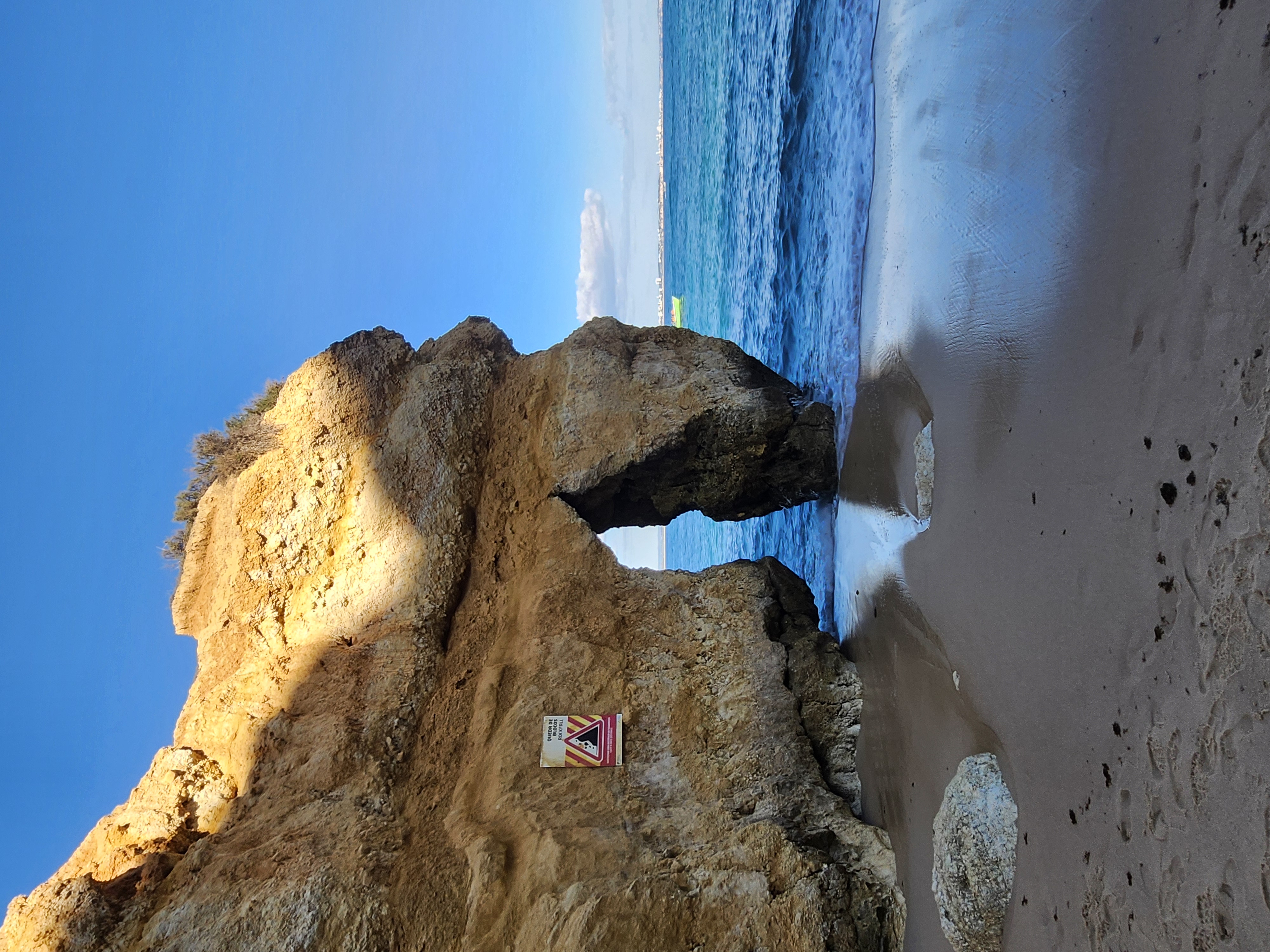


Figure \(\PageIndex{10}\) illustrates the sequential formation of several coastal erosional landforms. Waves attack cracks and weaknesses in a coastal cliff through hydraulic action, abrasion, and solution, enlarging them into a sea cave. Continued erosion widens the cave until it breaks through the headland, forming a sea arch. As wave action and weathering continue, the roof of the arch becomes unstable and collapses, leaving an isolated pillar of rock called a sea stack. Ongoing erosion gradually wears down the stack until only a low remnant, known as a sea stump, remains. The diagram emphasizes that coastal erosion can transform a cliff through a predictable sequence of landforms: sea cave, sea arch, sea stack, and sea stump.
Depositional Landforms
Beaches
A beach is an accumulation of loose sediment that forms alongside a body of water. While most people associate beaches with sand, they actually showcase an incredible variety of sediment sizes across the globe, ranging from massive boulders to fine silt. The physical characteristics of a beach are heavily shaped by wave energy: areas with intense wave action tend to have larger rock particles and steeper shorelines, whereas sheltered locations with gentle wave action are defined by fine sediment and flat, gradual slopes. Depending on the specific minerals and rocks being eroded nearby, beach sand can appear in a striking array of colors, including white, yellow, red, brown, black, green, pink, or even purple.
The creation of these coastal features represents the primary constructive role of the ocean, as waves deposit sands and gravels that have been stripped away from the land. This eroded material is moved along the coast through a few key mechanisms. Longshore drift, which strikes the shoreline at an angle, pushes debris sideways in the direction of the prevailing wind. Simultaneously, the retreating backwash pulls a portion of the material back out to sea along the ocean floor, settling it onto the offshore terrace. In highly sheltered coastal areas where the water is calm, the finest materials, such as mud and silt, finally settle into the shallow water.
This continuous wave movement naturally organizes the shoreline deposits into a clearly sorted pattern. The waves drop the heaviest, coarsest materials—like cobbles and large boulders—at the very top of the beach. Meanwhile, the finer particles, including smaller pebbles and sand grains, are dragged down the slope by the backwash and deposited closer to the water's edge. Because of this, geography plays a major role in where beaches form. Along smooth, low-lying coastal plains, beaches can stretch uninterrupted for hundreds of kilometers, as seen along the eastern coast of Peninsular Malaysia. In contrast, mountainous regions where steep highlands plunge directly into the ocean, such as the coast of Chile, completely lack these long, continuous beaches.

Spits and Bars
A sand spit (Figure \(\PageIndex{12}\)) is a frequent coastal feature characterized by a narrow, elongated ridge of sediment that remains connected to the shoreline at one side while extending out into open water. When waves hit a changing coastline at an angle, longshore drift transports sand parallel to the beach. If the shoreline bends suddenly, wave trajectories spread out, causing the wave energy to drop and the water to lose its capacity to carry sediment, which then accumulates. This building process by wind and waves typically occurs in the calmer waters of a bay where wave refraction lowers energy levels.
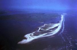
These spits can stretch across the opening of a bay, though active wave currents usually flush some sand out to sea or drop it within the inlet. Depending on local forces, the ridge may bend inward into a hook shape, known as a recurved spit. If the deposit continues to build directly across a bay or river mouth to attach to the opposite shoreline, it creates a bay-mouth bar. Once a bar completely shuts off a bay from the open ocean, it traps the water to form a marshy coastal body known as a lagoon. On the Baltic coastlines of Germany and Poland, these long bars are called nehrungs, and the resulting lagoons are referred to as haffs. Chesil Beach in Dorset, England, is a striking example of a bar that runs for over 26 kilometers to link the Isle of Portland to the mainland, trapping a lagoon called the Fleet behind it.
Wave energy is also lessened in the sheltered water directly behind large sea stacks or islands. When wave refraction bends waves around both sides of an island, it sweeps sediment from two opposite directions and deposits it into a narrow strip of land called a tombolo. A historical example of this feature is Adam's Bridge, which once spanned the 33-mile wide Palk Strait to connect India with Sri Lanka. Other notable real-world examples of spits and bars include Calshot Spit in Southampton Water, England, as well as the spits found along the coast of Kelantan.

Figure \(\PageIndex{13}\) illustrates several depositional coastal landforms formed by the movement and accumulation of sediment. A beach forms where waves deposit sediment along the shoreline. A spit is a narrow ridge of sand or pebbles attached to land at one end and extending into the water, created when longshore currents transport and deposit sediment. A bar is a ridge of sediment that forms offshore and may become exposed at low tide.
A tombolo is a ridge of deposited sediment that connects an island to the mainland. A lagoon forms when a spit, bar, or tombolo partially or completely separates a body of water from the open sea. A barrier bar, or offshore bar, is a long ridge of sand or pebbles that forms parallel to the coast farther offshore and can help protect the shoreline from wave action.
The infographic emphasizes that waves, tides, and longshore currents move sediment along the coast. When water slows and loses energy, sediment is deposited, creating a variety of coastal depositional landforms.
Barrier Islands
Coastlines paralleled by offshore narrow strips of sand dunes, salt marshes and beaches are known as barrier islands. Barrier island complexes stretch along the southeastern coast of North America from Long Island, New York to the Gulf coast of Texas. Many believe barrier islands originated as offshore bars built by waves breaking on a shallow shore. When waves begin to feel the tug of the ocean floor, they push sand toward shore as they break. The return undertow sweeps sand back to settle on the developing bar. These offshore bars were later exposed when the continent rebounded after ice age glaciers melted.
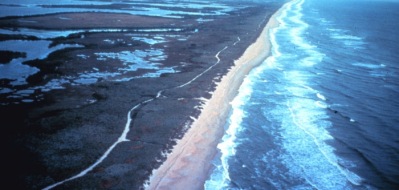
Larger barrier islands have been sought as "ideal" places to build vacation homes. Such scenic places are susceptible to the destructive forces of nature such as hurricanes, however. In 1989 Hurricane Hugo hit the U.S. mainland just north of Charleston, South Carolina, with sustained winds of 215 kilometers per hour and a storm surge of more than 6 meters. The barrier islands along the South Carolina coast are generally less than 3 meters above sea level. Most islands were inundated with water and in many places, beaches were severely eroded and dunes were leveled. Much of the sand eroded from the beach was over washed landward or carried offshore. South Carolina suffered $5.9 billion in damage and 29 people died.
Sand Dunes
Coastal dunes form just behind the beach where there is a steady supply of sand, and while wind is the main force that physically shapes them, sea waves are critical to their lifecycle. Waves act as a conveyor belt by moving sand from underwater onto the shore through normal, gentle wave action. Once this sand dries on the beach face, the wind can easily pick it up and blow it landward to build the initial dune structures. There is a continuous exchange loop here, as offshore winds blow sand back into the ocean, where marine waves and currents capture it, rework it, and push it right back onto the beach to keep the sediment supply alive.
However, waves are also the primary force responsible for eroding and destroying these dunes. During severe storm events or coastal flooding, large, high-energy waves slam directly into the shoreline. These powerful waves erode the beach face and chew away at the base of the foredunes, causing the sand structures to collapse and creating open pathways through the dunes. The sand that waves strip away during these storms is dragged out into deeper water or deposited on offshore terraces, resetting the coastline until gentler waves can start the process of pushing sediment back to the shore to rebuild.
