

4.4.2: Clouds
- Page ID
- 40049

\( \newcommand{\vecs}[1]{\overset { \scriptstyle \rightharpoonup} {\mathbf{#1}} } \)
\( \newcommand{\vecd}[1]{\overset{-\!-\!\rightharpoonup}{\vphantom{a}\smash {#1}}} \)
\( \newcommand{\dsum}{\displaystyle\sum\limits} \)
\( \newcommand{\dint}{\displaystyle\int\limits} \)
\( \newcommand{\dlim}{\displaystyle\lim\limits} \)
\( \newcommand{\id}{\mathrm{id}}\) \( \newcommand{\Span}{\mathrm{span}}\)
( \newcommand{\kernel}{\mathrm{null}\,}\) \( \newcommand{\range}{\mathrm{range}\,}\)
\( \newcommand{\RealPart}{\mathrm{Re}}\) \( \newcommand{\ImaginaryPart}{\mathrm{Im}}\)
\( \newcommand{\Argument}{\mathrm{Arg}}\) \( \newcommand{\norm}[1]{\| #1 \|}\)
\( \newcommand{\inner}[2]{\langle #1, #2 \rangle}\)
\( \newcommand{\Span}{\mathrm{span}}\)
\( \newcommand{\id}{\mathrm{id}}\)
\( \newcommand{\Span}{\mathrm{span}}\)
\( \newcommand{\kernel}{\mathrm{null}\,}\)
\( \newcommand{\range}{\mathrm{range}\,}\)
\( \newcommand{\RealPart}{\mathrm{Re}}\)
\( \newcommand{\ImaginaryPart}{\mathrm{Im}}\)
\( \newcommand{\Argument}{\mathrm{Arg}}\)
\( \newcommand{\norm}[1]{\| #1 \|}\)
\( \newcommand{\inner}[2]{\langle #1, #2 \rangle}\)
\( \newcommand{\Span}{\mathrm{span}}\) \( \newcommand{\AA}{\unicode[.8,0]{x212B}}\)
\( \newcommand{\vectorA}[1]{\vec{#1}} % arrow\)
\( \newcommand{\vectorAt}[1]{\vec{\text{#1}}} % arrow\)
\( \newcommand{\vectorB}[1]{\overset { \scriptstyle \rightharpoonup} {\mathbf{#1}} } \)
\( \newcommand{\vectorC}[1]{\textbf{#1}} \)
\( \newcommand{\vectorD}[1]{\overrightarrow{#1}} \)
\( \newcommand{\vectorDt}[1]{\overrightarrow{\text{#1}}} \)
\( \newcommand{\vectE}[1]{\overset{-\!-\!\rightharpoonup}{\vphantom{a}\smash{\mathbf {#1}}}} \)
\( \newcommand{\vecs}[1]{\overset { \scriptstyle \rightharpoonup} {\mathbf{#1}} } \)
\(\newcommand{\longvect}{\overrightarrow}\)
\( \newcommand{\vecd}[1]{\overset{-\!-\!\rightharpoonup}{\vphantom{a}\smash {#1}}} \)
\(\newcommand{\ket}[1]{\left| #1 \right>}\)
\(\newcommand{\bra}[1]{\left< #1 \right|}\)
\(\newcommand{\braket}[2]{\left< #1 \vphantom{#2} \right| \left. #2 \vphantom{#1} \right>}\)
\(\newcommand{\braopket}[3]{\left< #1 \vphantom{#2}\vphantom{#3} \right| #2 \vphantom{#1}\vphantom{#3} \left| #3 \vphantom{#1}\vphantom{#2} \right>}\)
\(\newcommand{\qmvec}[1]{\mathbf{\vec{#1}}}\)
\(\newcommand{\op}[1]{\hat{\mathbf{#1}}}\)
\(\newcommand{\expect}[1]{\langle #1 \rangle}\)
\(\newcommand{\dfn}[1]{\emph{\textbf{#1}}}\)
How Clouds Are Classified
Clouds are visible collections of tiny water droplets or ice crystals that form when water vapor undergoes condensation. Scientists categorize these formations primarily based on two factors: the altitude where they appear and their overall physical shape.
When looking at altitude, clouds are divided into three main levels. High-level clouds develop above 7,000 meters and consist almost entirely of ice. These are known as cirro-form clouds. Middle-level clouds occupy the space between 2,000 and 7,000 meters and are identified by the prefix alto. Low-level clouds are those that form from the earth's surface up to an altitude of 2,000 meters. Figure \(\PageIndex{1}\) shows a panoramic chart showing various cloud types at different altitudes, ranging from low stratus to high cirrus.
The physical structure of a cloud provides further classification. Clouds that appear in wide, flat layers are described as strati-form, while those that grow upward with a heaped or puffy appearance are called cumulo-form. To specify that a cloud is producing rain or snow, meteorologists add the term nimbo or nimbus to its name. While many specialized terms exist to describe more complex cloud shapes, these core categories represent the fundamental system used in meteorology.

Figure \(\PageIndex{1}\) classifies common cloud types by altitude and shape. A vertical scale runs from the surface at 0 kilometers up to about 12 kilometers, showing the height ranges where different clouds typically form.
High-level clouds : High clouds appear above about 7 kilometers. These include cirrus, shown as thin and wispy clouds, and cirrocumulus, shown as small clustered patches. These clouds form in very cold air and are made mostly of ice crystals.
Middle-level clouds : Middle clouds form between about 2 and 7 kilometers. These include altocumulus, shown as rounded or patchy cloud groups. The middle layer may also overlap with some stratified cloud forms in the diagram. These clouds form where both liquid droplets and ice crystals may be present.
Low-level clouds : Low clouds form from the surface up to about 2 kilometers. These include stratus, shown as a broad uniform layer, and nimbostratus, shown as a thicker layer associated with precipitation. These clouds are often linked to overcast skies and steady rain or snow.
Vertically developed clouds : Some clouds grow vertically through more than one altitude zone. Cumulus clouds have puffy vertical development. Cumulonimbus clouds grow from low levels to high altitudes and may span nearly the full height of the diagram. These tall storm clouds form through strong convection and can produce heavy precipitation and storms.
Overall, the diagram shows that clouds can be grouped by the height at which they form and by whether they appear as layers, patches, wisps, or vertically growing towers.
High clouds
High clouds, technically known as cirro-form clouds, typically develop at altitudes exceeding 7,000 meters and consist primarily of ice crystals. This category includes three specific types: cirrus, cirrostratus, and cirrocumulus.
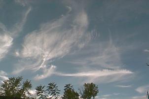
Cirrus clouds are identified as delicate, detached filaments or thin, wispy veils. High-altitude winds frequently shape these ice fibers into curved trails known as mare's tails. Their appearance in the sky often serves as an early indicator of an advancing warm front.

Cirrostratus clouds form a pale, transparent layer that can blanket a large portion of the sky. These clouds are sometimes so thin they are nearly invisible, yet they are responsible for creating the distinct halo effect seen around the sun or moon. As a warm front draws closer, these formations typically become denser and transition into mid-level altostratus clouds.

Cirrocumulus clouds consist of small, white ripples or patches arranged in organized patterns. Because the small cloud units resemble the scales of a fish, this formation is frequently referred to as a mackerel sky.
Middle Clouds
Mid-level clouds, situated within the central layer of the troposphere, are designated by the prefix "alto." This classification includes two primary forms: altocumulus and altostratus.

Altocumulus clouds typically manifest as organized rows or patchy sheets of rounded masses. Due to their composition of liquid water droplets rather than ice crystals, these clouds generally possess distinct, well-defined perimeters. While they may be confused with other cumuliform clouds, they are differentiated by their apparent size relative to the observer's perspective:
Altocumulus elements typically subtend an angle of 1 to 5 degrees, roughly equivalent to the width of a thumb at arm's length.
Cirrocumulus (high-level) is characterized by smaller, less dense individual grains.
Stratocumulus (low-level) consists of significantly larger elements, generally exceeding 5 degrees in apparent width.
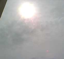
Altostratus clouds appear as a vast, uniform layer of grayish or bluish cloud cover that often obscures the majority of the sky. They possess a higher density than the higher-altitude cirrostratus. A distinguishing characteristic of altostratus is the "watery sun" effect, in which the sun is visible as a diffused, blurry disk. Unlike cirrostratus, which allow enough light to pass through to create shadows on the ground, altostratus layers are sufficiently opaque to prevent shadow formation. In the event of an approaching warm front, these clouds typically thicken and descend, transitioning into nimbostratus.
Low Clouds
Low-level clouds develop between the Earth's surface and an altitude of approximately 2,000 meters. This category contains three primary types: stratus, stratocumulus, and nimbostratus.
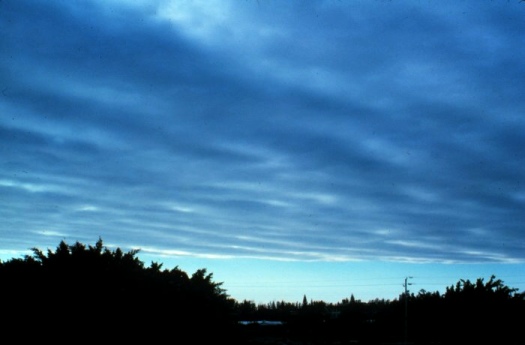
Stratus clouds present as a consistent, dark gray blanket that typically obscures the whole sky. These clouds frequently develop in association with warm fronts and may evolve into nimbostratus as the front moves closer. Additionally, they can be created when a layer of fog is lifted from the ground.
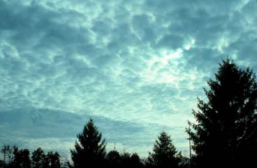
Stratocumulus clouds are identified by their uneven, lumpy appearance and low elevation. While they often cover a significant portion of the sky, they are arranged in distinct rows or patches, which allows for visible sections of blue sky between the individual cloud masses.
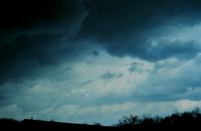
Nimbostratus clouds are dark-gray layers of clouds that cover the entire sky. The prefix "nimbo" indicates that these clouds are precipitating. Nimbostratus clouds are typically found along a warm front, producing low-intensity precipitation that lasts for several hours.
Vertically Developed Clouds
Cumulus-type clouds are those that primarily exhibit vertical development. Two of the more common types are the cumulus and cumulonimbus.
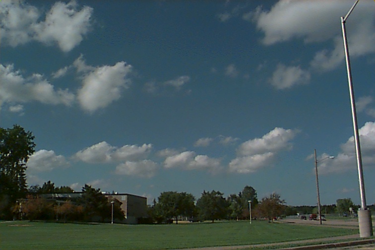
Cumulus clouds appear as small, cotton ball-like clouds that generally form by convection. Cumulus are also called "fair-weather" clouds as pleasant conditions usually prevail while they are around.
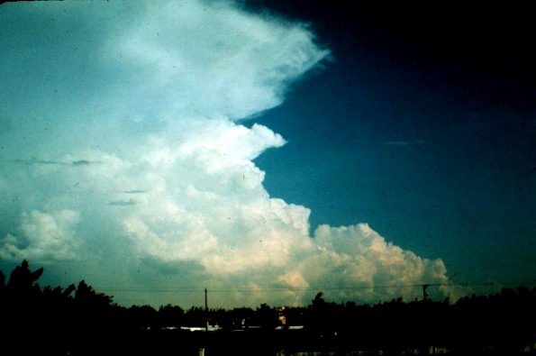
Cumulonimbus clouds form during very unstable conditions. They are the tallest clouds, and can reach to the stratosphere. Cumulonimbus clouds are associated with thunderstorms capable of generating locally high winds, hail, lightning, and torrential down pours.