
3.1.1: Gale Crater and Bagnold dunes
- Page ID
- 2796

Gale Crater, Mars, is ~150 km in diameter and has a high central peak that formed during the impact that created the crater (Figure \(\PageIndex{1}\)). The central peak (formally named Aeolis Mons and informally called Mount Sharp) is flanked by sedimentary rocks. These rocks have been partially eroded away. However, there is no fluvial outflow channel from the crater, so the debris from erosion must have been removed from Gale Crater by wind. Wind still actively moves sediment in the crater: the black areas in the crater consist of basaltic sand with active dunes.
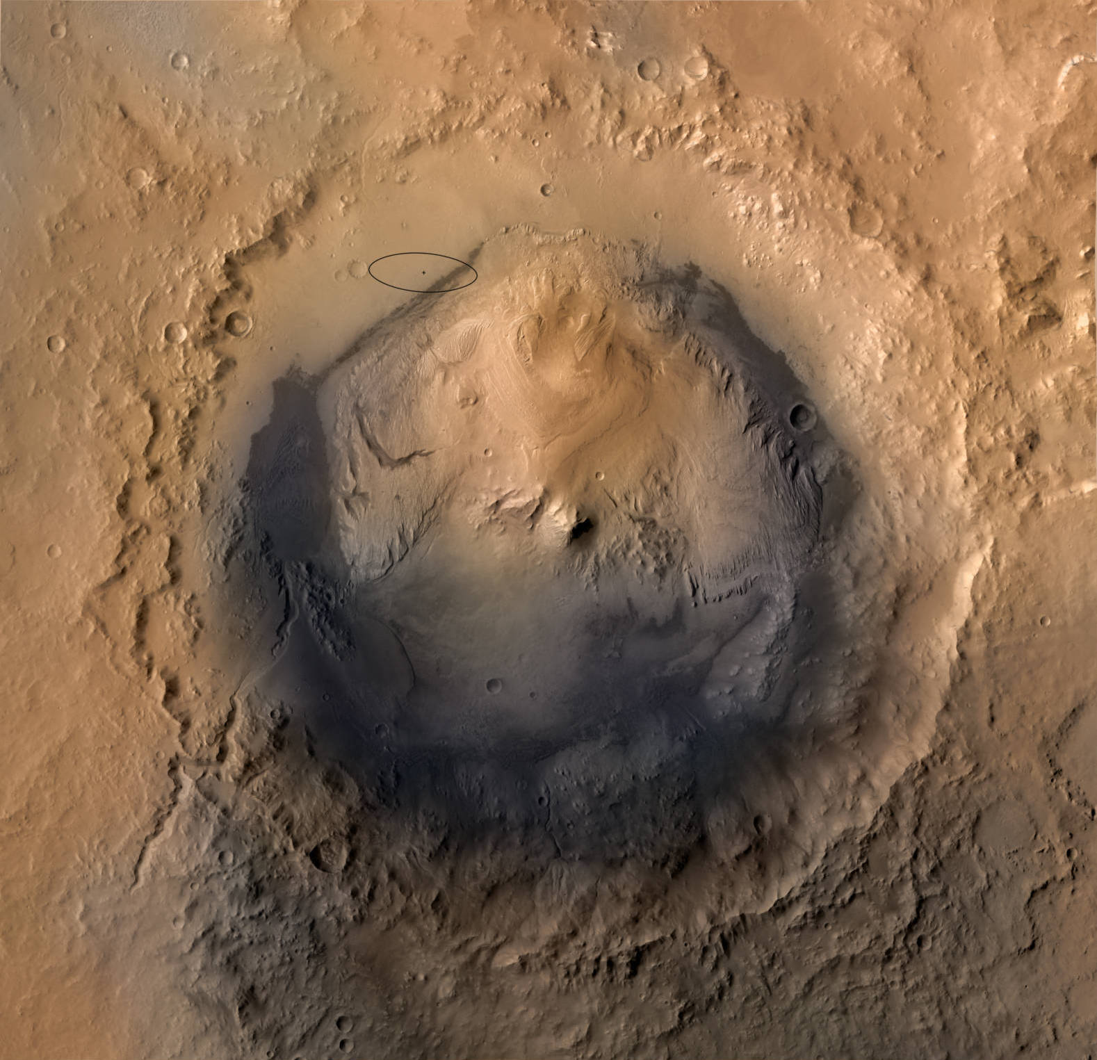
Figure \(\PageIndex{1}\): A satellite image of Gale Crater, Mars. The central peak, which we’ll call Mount Sharp, is in the middle of the crater, and the ejecta from the impact surrounds the crater. The topography is lower in the northern half of the crater due to more extensive wind erosion north of Mount Sharp. The black areas consist of basaltic sand in modern eolian dunes. The ellipse represents the Curiosity rover landing target. Image credit: NASA/JPL-Caltech/ESA/DLR/FU Berlin/MSSS
The dunes surround Mount Sharp with the main transport of sand from north to south around the mountain. The dunes that cut across the landing ellipse (Figure \(\PageIndex{1}\)) are informally named Bagnold dunes. They mostly consist of linear dunes, with some barchan dunes, particularly along the northern edge of the dune field (Figure \(\PageIndex{2}\)).
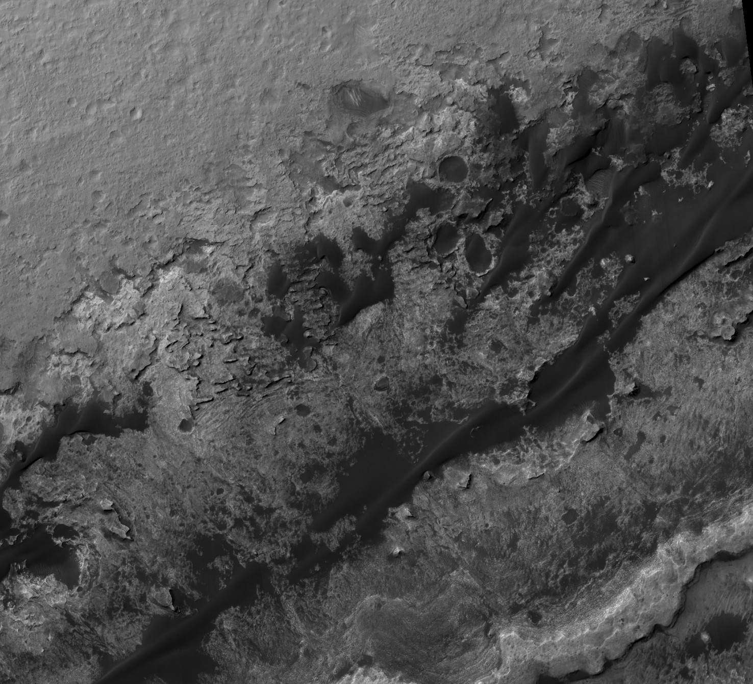
Figure \(\PageIndex{2}\): Image of part of Bagnold dunes. The actively transported sand is black and the bedrock is lighter colored. The northwest corner of the image consists of hummocky plains underlain by ancient fluvial deposits. The patches near the center of the image with parallel, linear ridges consists of cemented eolian sandstones of the Stimson formation. The rest of the bedrock consists of the mostly lacustrine Murray formation. The eolian Stimson formation unconformably overlies the Murray formation and has a similar distribution to the modern sand dunes. Image credit: NASA/JPL/University of Arizona
NASA’s Curiosity rover landed just east of the center of the landing ellipse (Figure \(\PageIndex{1}\)) on August 6, 2012. To better understand active sand transport on Mars, the Mars Science Laboratory (MSL) team chose to use Curiosity to investigate Bagnold dunes at two sites, one with barchan dunes (Phase 1) and one with linear dunes (Phase 2) (Figure \(\PageIndex{3}\)).
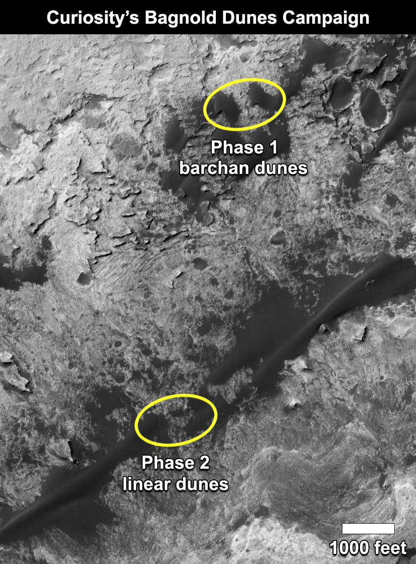
Figure \(\PageIndex{3}\): Areas where Curiosity investigated Bagnold dunes. Image credit: NASA/JPL-Caltech/University of Arizona
The main goals of the investigations were to (Lapotre et al., 2018): 1) develop an understanding of the mechanisms of eolian transport on Mars by directly observing eolian structures and their dynamics; and 2) characterize the physical properties and mineralogy of the sand in Bagnold dunes. To answer these questions, the MSL team planned observations for the Curiosity rover to image sedimentary structures and bedforms in enough detail to interpret bedform migration dynamics. They also performed experiments to look for movement of sand grains and associated bedforms, with synchronous wind measurements. The dune sand was sampled at two locations to determine its mineralogy to better constrain the origin(s) of the sand and weathering processes on modern Mars. Results were compared from the two phases of the campaign (Lapotre et al., 2018 and references therein).
Tags recommended by the template: article:topic