3.2.4: Bayside Park
- Page ID
- 704

Background
"One of our stops is Bayside Park, an area within the inlet of Bodega Bay. The bay itself has a harbor and numerous residential and commercial areas, making it a popular destination for fishing, navigation, shellfish harvesting, and recreation. The spot can be observed as a wide, sandy-mud flat, rich with bioturbation."
The harbor is separated from the larger Bodega Bay with a jetty, allowing for calm tides. The area is known for its clams, oysters, and crabs, making the area's sediments rich with marine life1. On this stop, you will walk along the flats and observe a variety of ripple structures in a low energy setting. Observe how the motorboats might cause artificial currents to influence the general shape of the crests.
(Fun fact: Alfred Hitchcock's The Birds was filmed in Bodega Bay.)
1. "National Register Information System". National Register of Historic Places. National Park Service. 2010-07-09.
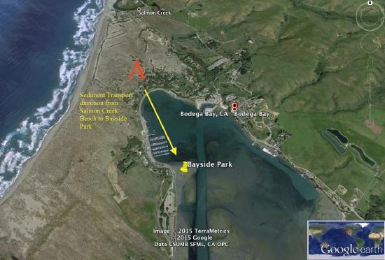
This is an aerial view(right) of Salmon Creek beach and Bayside Park. The yellow arrow represents 950 meters. It is important to note the relationship between the two areas. Sediments in bay side Park range from silt size to fine-grained sand sized grains. This indicates that one of the sources of the sediments must have been Salmon Creek Beach, in which sediments of similar size and composition were transferred by aeolian processes to Bayside Park.
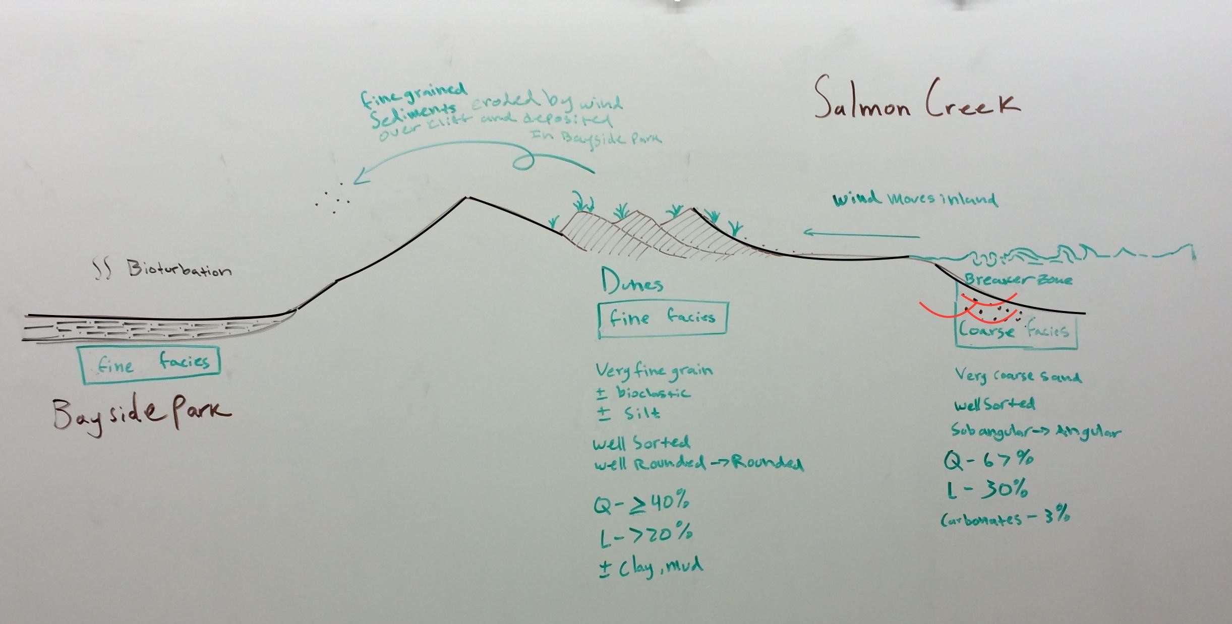
Schematic picture (left) of relationship between Salmon Creek beach and Bayside park.
Different energy levels and erosional forces contribute to the different facies found at bodega bay. In Salmon Creek, we see that the coarsest grains are found in the breaker zone where there is a moderate amount of energy. the constant breaking of the waves provide enough energy to erode and further weather coarse grains. the sedimentary structure that appears when the grains are deposited are called ‘trough cross bedding.’ The facies we expect to see are very coarse grains that is well sorted subangular to angular and consist of mostly quartz.
As the wind moves inland, the low energy provided by gusts of air erode finer sediments. The fine sediments travel inland until the wind is broken up by local grass. This causes sand dunes to form (dune ripples). the facies we expect to see are well sorted, well rounded, very fine grained sands plus or minus bioclastic sediments and silt, consisting of mostly quartz and lithics plus or minus clay and mud.
As wind travels further inland, those grains that are eroded from the sand dunes or did not become deposited are then moved to bayside park. Bayside Park is a low energy lagoon and receives the bulk of its sediments from wind erosion although the occasional runoff and high tide may create altering layers of sand and muddy sand. the facies we expect to see here is the fine facies last observed in the dune area of Bodega Bay.
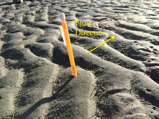
This is an image of current ripples found at Bay Side Park. The flow direction is indicated. Do you see any reactivation surfaces?
Module 2: Current ripples
Current ripples are the separation of sand within the viscous sublayer. The sand grains saltate to the crest, accumulating grains on the stoss side of the ripple. At the separation point, the grains flow down to the lee side of the ripple. As the grains deposit between the separation point and the attachment point, it creates a planar cross lamination (Bass 1994). This can be seen at Bayside Park. It shows the flow direction of wind and accumulation of grains.

Baas, J.H. (1994) A flume study on the development and equilibrium morphology of small-scale bedforms in very fine sand. Sedimentology, 41, 185–209.
The flow is parallel to a flat bed, which there is a boundary layer separation between the separation point and attachment point. At the bottom of the boundary layer, there is a viscous sublayer. It has a laminar flow, which the grains barely move with the flow of wind or water. Above the laminar layer has a turbulent flow that allows the particles to become suspended. Some particles do not stay suspended due to the change in pressure around the grain (Bass 1999).

Baas, J.H. (1999) An empirical model for the development and equilibrium morphology of current ripples in fine sand. Sedimentology, 46, 123–138.
Fluid flow and Sediment transport
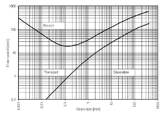
Below is a Hjulström diagram which demonstrates the interaction between grain sizes and flow speed and how this relates to deposition erosion and transport of sediments. These processes are predicted with help from the Reynolds number Re = (I*u*rho)/mu, where I is the flow depth, u is the flow velocity, rho is the density of the flowing material (100kg/m3 for water), and mu is the viscosity of the material flowing. The Reynolds number is a balance of inertial forces over the viscous forces and is unit-less. Laminar flow, Re<50, and turbulent flow, Re>2000, are the two main states . One phenomena that takes place is that, as you get closer to the floor of a flow, the interactions between that floor of the flow and the fluid is friction, which slows the fluid down until the velocity=0. As you move up in the fluid column, speed increases and the frictional forces decrease. The differences in flow causes a pressure difference that can transport, erode, or deposit grains, which is what the diagram below is describing.
For further explanation please check out the Aeolian Processes page.
Sample
BP – 1
Bayside Park
Wind transport sediments from Salmon Creek Beach
- Collected: Backshore of the bay
- Grain size: silt/clay – very fine sand
- Sorting: Well sorted
- Interpreted energy: Very low
- Composition: 60% - Quartz, 40% - Lithics
-Facies- Fine grain
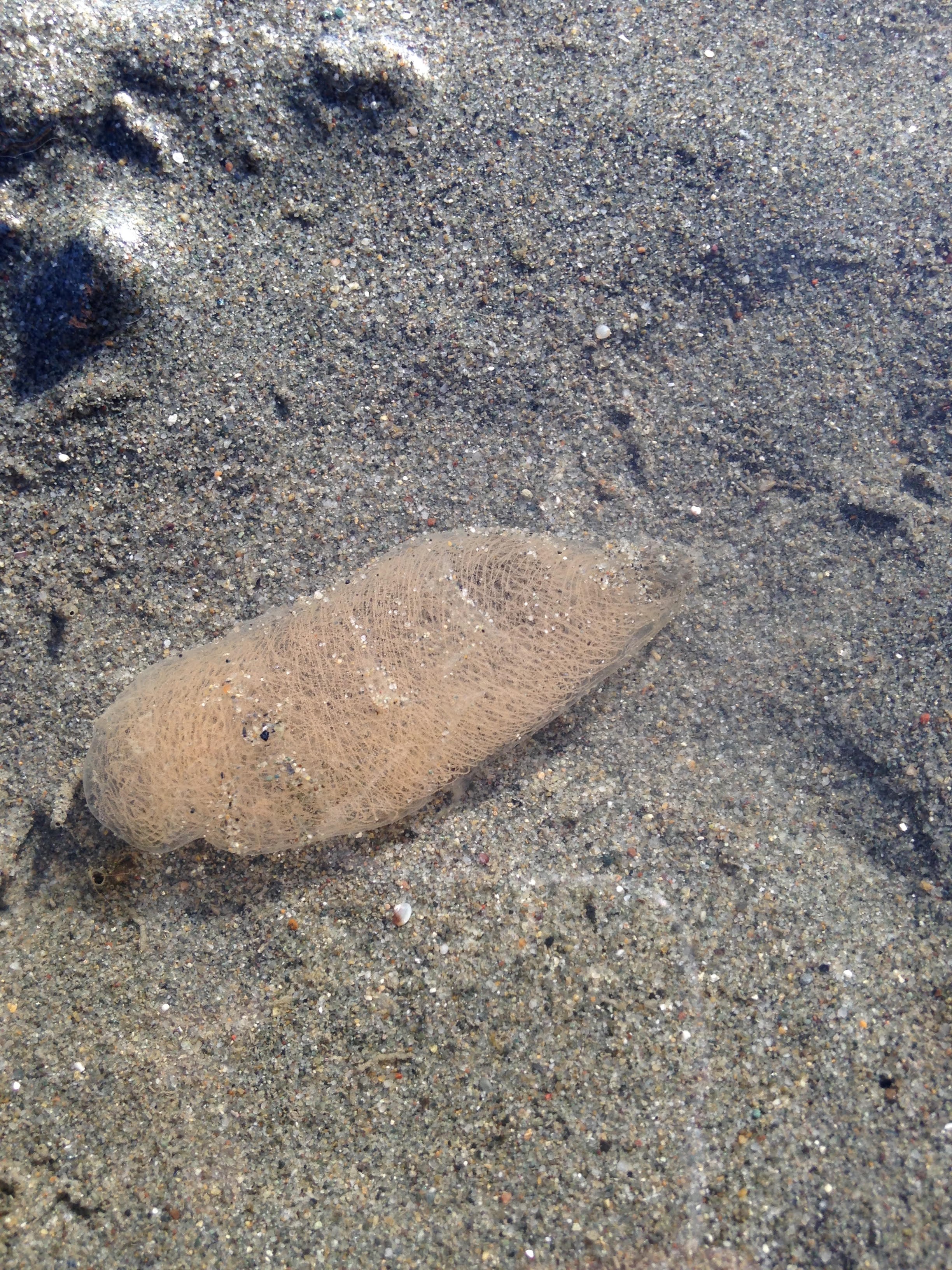
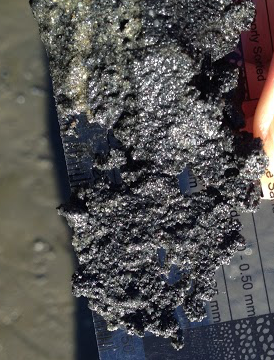
Module 1: Urechis caupo (Echiura) worms found in Bayside Park.
Echiura worms are native to the mud flat areas of Bodega Bay found specifically at Bayside Park. These worms create U-shaped burrows that are used for respiration and food collection. A mucus net attached to one end of the burrow filters plankton and seston out of the water. I have attached a video showing the process by which a worm uses a burrow to collect nutrients from the water (Suer, 1984).
Suer, A. L. (1984). Growth and spawning of urechis caupo (echiura) in bodega harbor, california. Marine Biology.Berlin, Heidelberg, 78(3), 275-284. Retrieved from http://search.proquest.com/docview/1...ccountid=14505
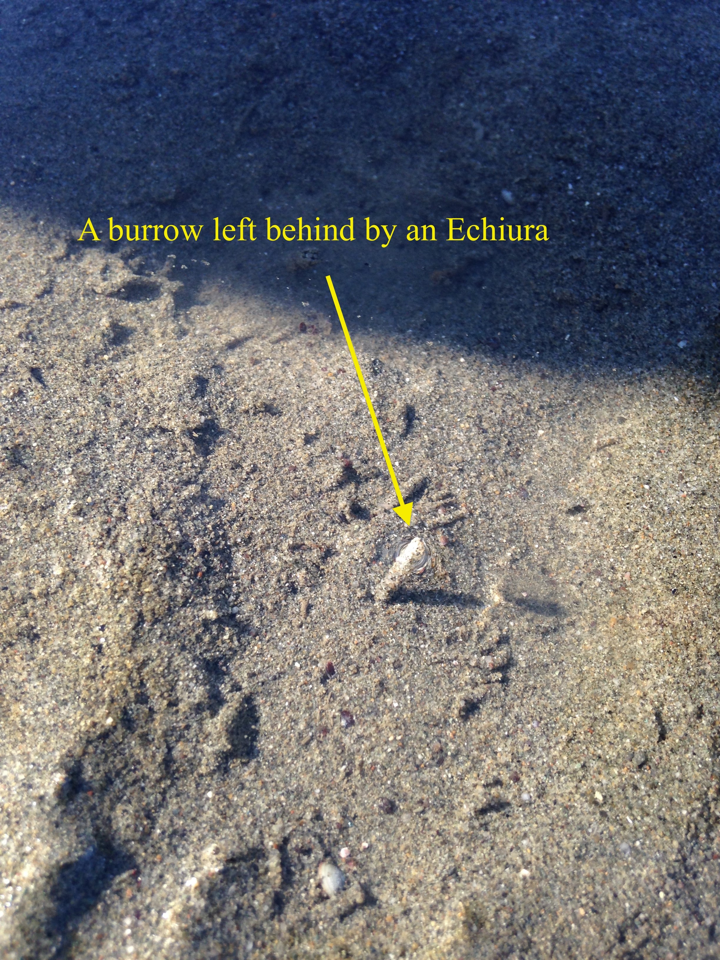
This is an image of an abandoned burrow. This one in particular stood about a centimeter and a half above the ground.