
5.6.1: Introduction
- Page ID
- 5970

Overview
We have heard the bad news regarding the next great subduction-zone earthquake, but there is one small bit of good news. Based on the edge of the ETS zone, west of which the subduction zone is currently locked, the epicenter is likely to be offshore or close to the coast: more than 50 miles from Portland, one hundred miles from Seattle, and a bit farther from Vancouver (Figure 4-25). This means that due to attenuation, seismic waves will be smaller when they reach the major population centers than when they strike the coast.
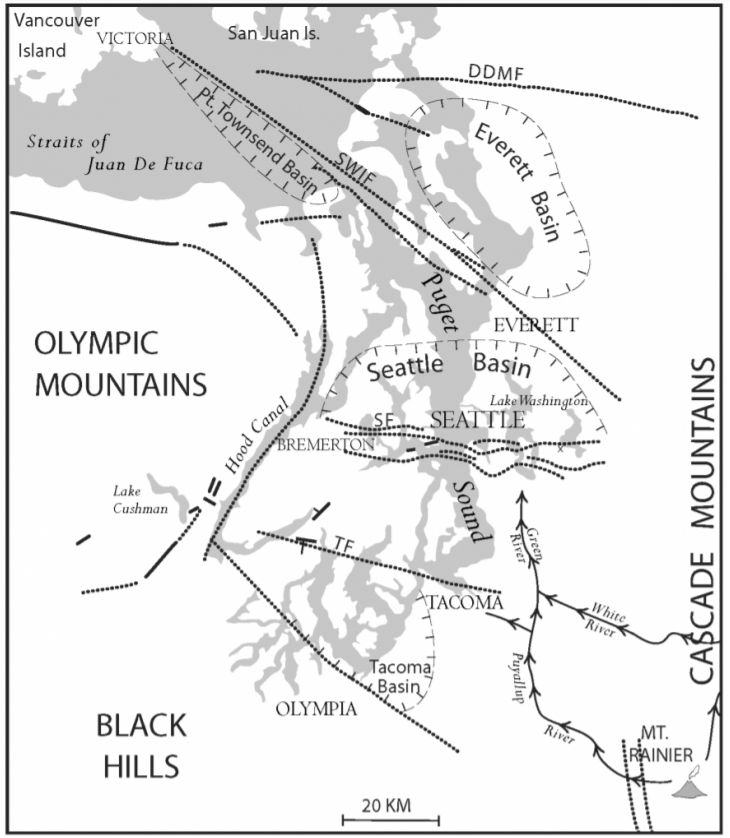
But there is still more bad news. The continental crust directly beneath Seattle, Tacoma, and Portland has its own earthquake problem. Figure 6-1 shows potentially active faults in the Puget Sound region. Earthquakes within the crust would be a lot smaller, to be sure. The largest historical crustal earthquake, of magnitude 7.3, struck a thinly populated area on central Vancouver Island in 1946. Three earthquakes in Oregon in 1993 served as wake-up calls: the Scotts Mills “Spring Break Quake” of M 5.6 near Salem, and two earthquakes west of Klamath Falls of M 5.9 and 6.0. The Scotts Mills Earthquake resulted in more than $28 million in losses, including damage to the rotunda at the State Capitol in Salem
Figure 6-2 shows the large earthquakes in the Pacific Northwest from 1833 through 2001, all of which ruptured either the continental crust, the oceanic crust of the Juan de Fuca Plate or Gorda Plate offshore, or the oceanic crust of the Juan de Fuca Plate beneath the continent in western Washington.
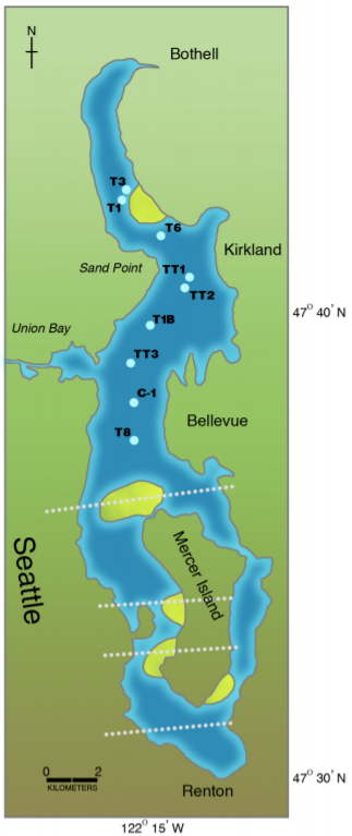
Our historical earthquakes have been troublesome, particularly for the communities affected, but they have not been major disasters like the Northridge or Kobe earthquakes. But evidence has been found for other, more ominous, prehistoric earthquakes that, if they happened today, would result in catastrophic losses to the Puget Sound region. Our story begins in Seattle and an earthquake that took place eleven hundred years ago, shortly before the time of the Norman Conquest of Britain. The detectives uncovering evidence of this earthquake are paleoseismologists, practicing their new field of identifying earthquakes by their geologic signature. The fault they discovered extends east-west through downtown Seattle, beneath the most expensive real estate in the Pacific Northwest.