
2.7.2: Ternary diagrams for progradation and transgression
- Page ID
- 16285

Boyd et al. (1992) used the classification in prograding and transgressive coasts as a starting point and added the effect of domination by waves or tides. In prograding situations, the landside is on the winning hand, either because of a falling sea level rel- ative to the land, or because of an excessive sediment supply. Transgression takes place either because of a rise in sea level, or because of insufficient sediment supply. Note again that the change in sea level is relative; subsidence of the land with a constant sea level has the same effect. Since Boyd et al. (1992) only take depositional environments into account, the distinction between prograding and transgressive boils down to the distinction between shoreline advance and shoreline retreat (see Fig. 2.23).
In the progressive case, deposition of river sediment leads to delta formation. When wave power and tidal power are low, the sediment of the river will build up long nar- row banks on both sides of its course. Due to the gradient of the river flow, water levels at a fixed point along the river will gradually rise since the distance of this point from the actual river mouth is increasing. At a certain moment, most likely when the river discharge is high, the river starts overflowing the bank and it will erode a new shorter channel towards the sea. The same process is continuously repeated, which leads to an ‘elongate’ or ‘bird foot’ delta (see also Sect. 2.7.3). Strong waves with longshore cur- rents tend to stretch the delta coast parallel to the general orientation of the shoreline, while strong tidal action usually creates patterns perpendicular to the shoreline. Out- side the influence of the river, a strand plain develops when wave action is dominant and tidal flats develop when tidal action is the strongest.
In the transgressive case, an estuary is the equivalent of a delta in the prograding case, but now, the sediment supply is not enough to keep pace with the relative sea-level rise. The sediment is no longer merely fluvial, but also has a marine source, since the flood tide or waves bring in sediment from the sea. A lagoon has a marine sediment source only, as no river is flowing into it.
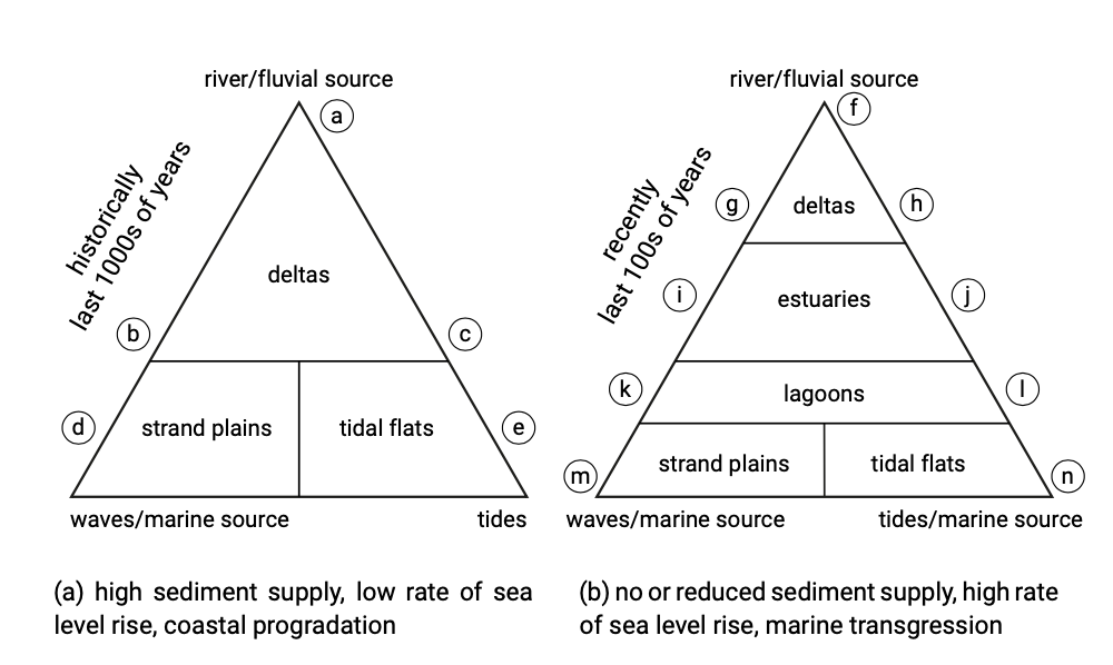
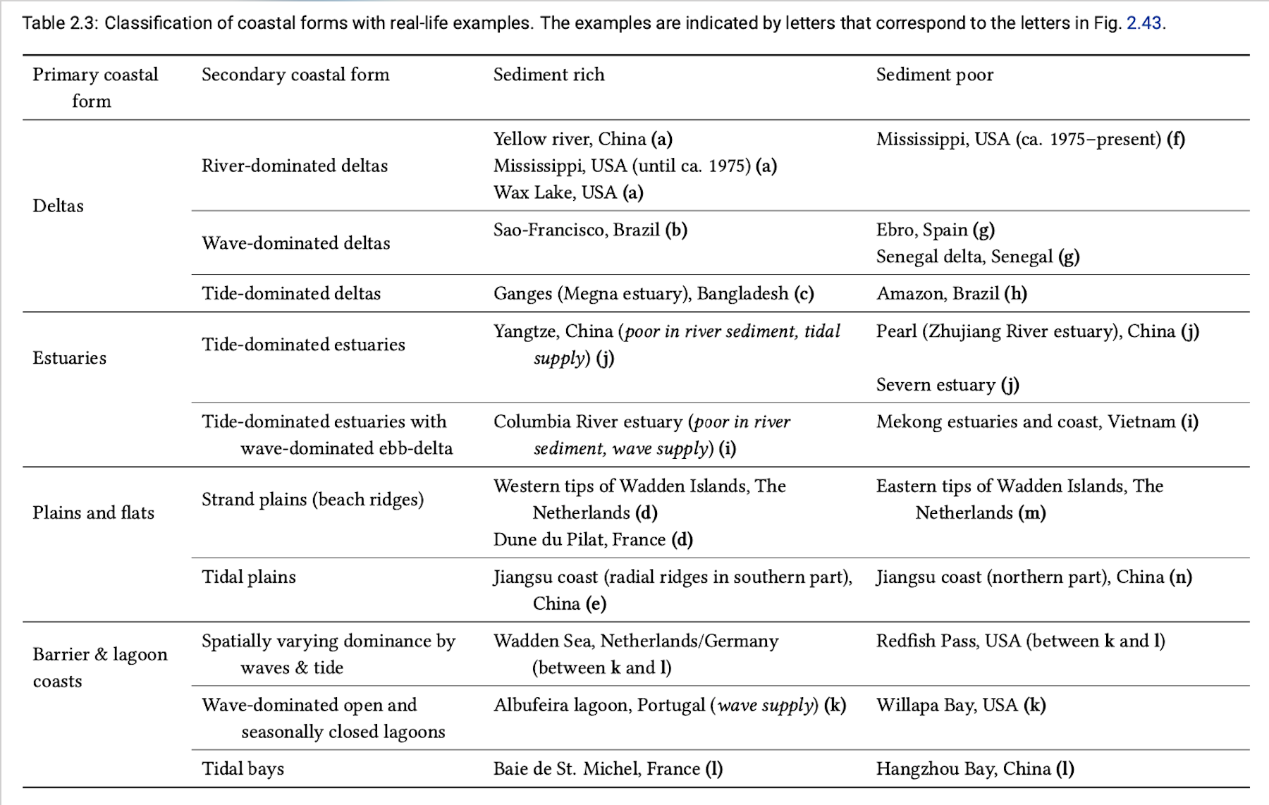
The two diagrams together give an idea of the evolution of coastal systems in time, relative to the change in sea level and sediment supply. For instance, with a rising sea level, deltas change into estuaries (transgression). Strand plains and tidal flats vanish and become shelf when the sea level rises.
It is interesting to note that the triangles in Fig. 2.43 depicting deltas has been separately described by Galloway. Section 2.7.3 describes in detail how the various delta shapes are influenced by the dominance of fluvial, wave or tidal processes.