
1.5.1: Definition of the coast
- Page ID
- 16246

So far we have assumed that it was clear what we meant by ‘coast’. The definition of coast however depends on the objective and the timescale under consideration. Coasts are the transition zones between oceans and continents. The coastal zone is made up of:
- the part of the land that is affected by being near to the oceans (coastlands); and
- the part of the oceans that is affected by being near to the land (coastal waters).
The coastlands encompass all terrain features that are influenced by coastal processes like dunes, cliffs and low-lying areas (coastal plains). In a practical situation, the inland extent depends on the timescale under consideration. A coastal engineer, who is mostly concerned about timescales of years, would say that the coast extends inland as far as the influence of the tides and storm waves reaches. Although for a large estuary the limit of inland tidal propagation can be up to hundreds of kilometres, this definition of the landward extent is relatively narrow in the eyes of a geologist. A geologist would be aware of the fact that in former times the sea has reached higher levels than the present levels and might find evidence of that in the form of coastal deposits far from the present influence of the sea. Therefore, a geologist would include all these areas in a definition of the coast. Half of the Netherlands consisting of polders below sea level would then belong to the coast.
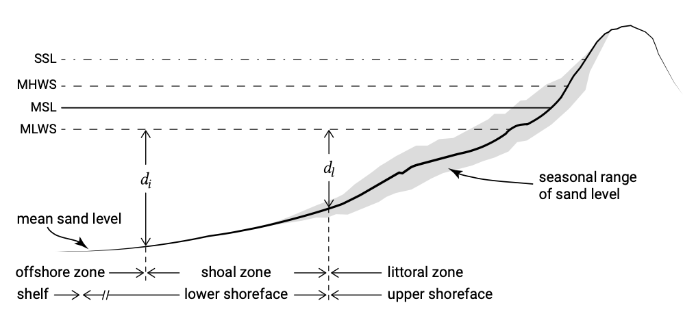
Similarly, the seaward limit of the coast is dependent on the timescale under consideration. Engineers have introduced the so-called depth of closure as the most seaward point of interest. The depth of the beach profile closure is the depth beyond which repeated field observations of the bed height over a certain period of time show no significant changes. It can be empirically determined by examining a series of profile measurements over a period of months to years so that both calm periods and storm conditions are included (Fig. 1.14).
The beach profile envelope in Fig. 1.14 includes typical accretional profiles built up during months of moderate wave conditions and typical erosional profiles under the influence of large storm waves. It shows that the profile is divided into an inactive offshore and a more active nearshore zone called shoreface. The shoreface is the part of the sandy profile affected by wave action and typically extends to water depths of 10 m to 20 m. The shoreface can further be separated into the shoal zone (or shoaling zone or lower shoreface) where waves gain amplitude up to the point of breaking and the most active zone where waves are breaking and the majority of the changes take place (breaker or surf zone, littoral zone or upper shoreface).
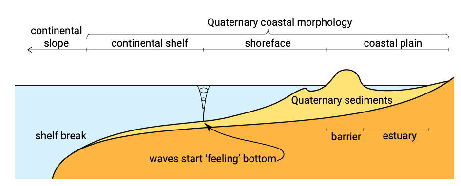
When considering larger timescales we have to take into account that coastal processes have reached up to the continental shelf (Fig. 1.15) when sea levels were lower than present. The continental shelf is the edge of a continent and is covered with relatively shallow seas up to 100 m to 200 m water depth (up to the shelf break).
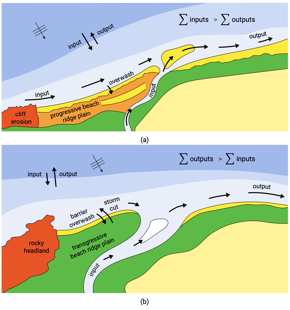
In the broadest sense of the word, we can now characterise coastal systems as relative shallow areas (i.e. depths less than order 100 m) bordered by or partly enclosed by land that are influenced by the sea and connected to the oceans, and in which ocean disturbances propagate. Due to the intensive interaction between land and water at the interfaces of the two, a large variety of coastal ocean systems has developed. The landward side includes the partially enclosed basins (such as the estuaries of Fig. 1.16b).