
5.5: Geologic Map
- Page ID
- 11138

\( \newcommand{\vecs}[1]{\overset { \scriptstyle \rightharpoonup} {\mathbf{#1}} } \) \( \newcommand{\vecd}[1]{\overset{-\!-\!\rightharpoonup}{\vphantom{a}\smash {#1}}} \)\(\newcommand{\id}{\mathrm{id}}\) \( \newcommand{\Span}{\mathrm{span}}\) \( \newcommand{\kernel}{\mathrm{null}\,}\) \( \newcommand{\range}{\mathrm{range}\,}\) \( \newcommand{\RealPart}{\mathrm{Re}}\) \( \newcommand{\ImaginaryPart}{\mathrm{Im}}\) \( \newcommand{\Argument}{\mathrm{Arg}}\) \( \newcommand{\norm}[1]{\| #1 \|}\) \( \newcommand{\inner}[2]{\langle #1, #2 \rangle}\) \( \newcommand{\Span}{\mathrm{span}}\) \(\newcommand{\id}{\mathrm{id}}\) \( \newcommand{\Span}{\mathrm{span}}\) \( \newcommand{\kernel}{\mathrm{null}\,}\) \( \newcommand{\range}{\mathrm{range}\,}\) \( \newcommand{\RealPart}{\mathrm{Re}}\) \( \newcommand{\ImaginaryPart}{\mathrm{Im}}\) \( \newcommand{\Argument}{\mathrm{Arg}}\) \( \newcommand{\norm}[1]{\| #1 \|}\) \( \newcommand{\inner}[2]{\langle #1, #2 \rangle}\) \( \newcommand{\Span}{\mathrm{span}}\)\(\newcommand{\AA}{\unicode[.8,0]{x212B}}\)
Map
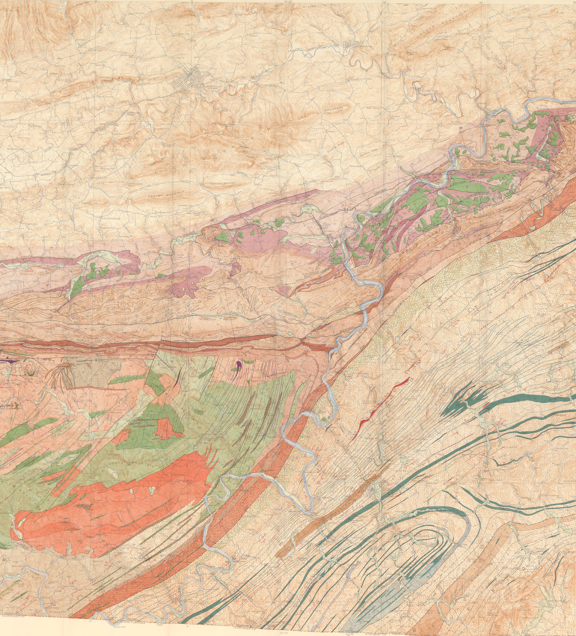
This is the map of the area (without annotations):
Here is an annotated map of the area, showing approximate sample locations and towns, as well as the Fries Fault and major structural units:

Rock Units
| Formation | Age | Sample # | Rock Type | Protolith |
| Ashe Formation | Protolith Age: 600 Ma (Late Proterozoic). Age of metamorphism: 450-430 Ma. | A1 B2, A3 schist | Staurolite Schist (Pelite) | Fine-grained mudstone |
| A1 amph, A3 Amph | Amphibolite | Basalt or Gabbro | ||
| UM1 | Soapstone / serpentinite | Ultramafic (peridotite) | ||
| Fries Fault Zone | Fault Age To Be Determined | A4 Mylonite 1 | Mylonite | Cranberry Gneiss |
| A4 Mylonite 2 | Mylonite | Ultramafic or mafic protolith | ||
| Cranberry Gneiss | Protolith Age: ~1.1 Ga (billion years) Age of metamorphism: gneissic fabric – 900 Ma? faulting age is unknown. | Cranberry | Orthogneiss | Granite |
| S5 Cranberry | Paragneiss | Sedimentary | ||
| Striped Rock Granite | Crystallization age ~690 Ma. Perhaps associated with Mt Rogers volcanics (~750 Ma)? | S6 Striped Rock | Granite | Not applicable |
| Unicoi Formation | Early Cambrian (like the Chilhowee Group near JMU) | Unicoi 1 | Shale / mudstone | Not applicable |
| Unicoi 2 | Greenstone | Basalt | ||
| Unicoi 3 | Conglomerate | Not applicable |
Field Bulletin
The map and field descriptions of this area (by Stose and Stose) are available here: https://www.dmme.virginia.gov/commercedocs/BUL_72.pdf
And from this page (it is free to download, even though it is the DMME “store”): https://www.dmme.virginia.gov/commerce/ProductDetails.aspx?productID=2272
Like most map bulletins, the text is first, and the maps are at the very end of the .pdf document.