
12.1: Introduction
- Page ID
- 5672

Overview
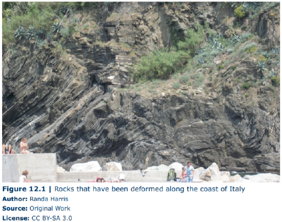
The Earth is an active planet shaped by dynamic forces. Such forces can build mountains and crumple and fold rocks. As rocks respond to these forces, they undergo deformation, which results in changes in shape and/or volume of the rocks. The resulting features are termed geologic structures. This deformation can produce dramatic and beautiful scenery, as evidenced in Figure 12.1, which shows the deformation of originally flat (horizontal) rock layers.
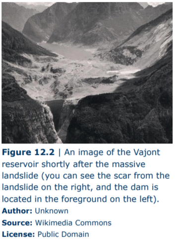
Why is it important to study deformation within the crust? Such studies can provide us with a record of the past and the forces that operated then. The correct interpretation of features created during deformation is critical in the petroleum and mining industry. It is also essential for engineering. Understanding the behavior of deformed rocks is necessary to create and maintain safe engineering structures. When proper geological planning is not considered in engineering, disasters can strike. For example, the Vajont Dam was constructed at Monte Toc, Italy in the early 1960s. The place was a poor choice for a dam, as the valley was narrow, thorough geological tests were not performed, and the area surrounding the dam was prone to large landslides. The steep canyon walls were composed of limestone with solution cavities, not known for its stability, and shifting and fracturing of rock that occurred during the filling of the reservoir went unheeded. In 1963, a massive landslide in the area displaced much of the water in the dam, causing it to override the top of the dam and flood the many villages downstream, resulting in the deaths of almost 2,000 people (Figure 12.2).
Key Terms
- Anticline
- Basin
- Compressional forces
- Contact
- Dip
- Dip-slip fault
- Dome
- Geologic cross-section
- Geologic map
- Horst & graben
- Monocline
- Normal fault
- Reverse fault
- Shear forces
- Strain
- Stress
- Strike
- Strike-slip fault
- Syncline
- Tensional forces
- Thrust fault